- McKenzie River
-
For rivers named "Mackenzie", see Mackenzie River (disambiguation).
McKenzie River  An island in the upper McKenzie
Country United States State Oregon Counties Lane, Linn Source Clear Lake - location Cascade Range - elevation 3,570 ft (1,088 m) [1] - coordinates 44°21′37″N 121°59′39″W / 44.36028°N 121.99417°W [2] Mouth Willamette River - elevation 371 ft (113 m) [2] - coordinates 44°7′32″N 123°6′20″W / 44.12556°N 123.10556°W [2] Length 90 mi (145 km) [3] Basin 1,300 sq mi (3,367 km2) [4] Discharge for river mile 27.7 near Walterville - average 2,897 cu ft/s (82 m3/s) [5] - max 56,100 cu ft/s (1,589 m3/s) - min 420 cu ft/s (12 m3/s) 
 Location of the mouth of the McKenzie River in Oregon
The McKenzie River is a 90-mile (145 km) tributary of the Willamette River in western Oregon in the United States. It drains part of the Cascade Range east of Eugene and flows into the southernmost end of the Willamette Valley. It is named for Donald MacKenzie, a Scottish Canadian fur trader.[6] There are six large dams on the McKenzie and its tributaries.[7]
Contents
Course
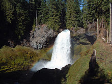 Sahalie Falls on the McKenzie River
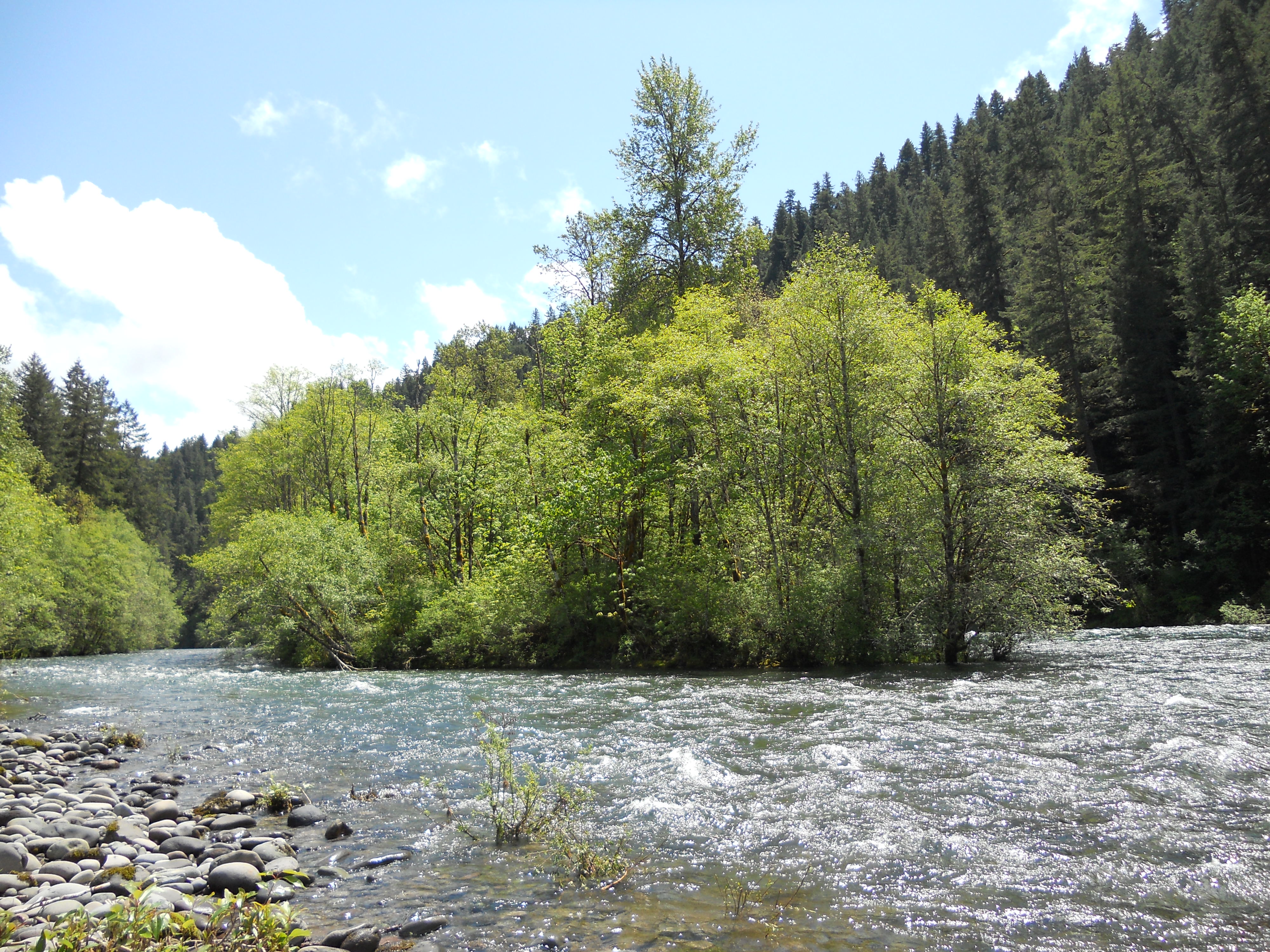
The McKenzie River originates as the outflow of Clear Lake in the high Cascades of eastern Linn County in the Willamette National Forest. Clear Lake is fed by Ikenick Creek and Fish Lake Creek, the latter of which flows from Fish Lake (a few miles north of Clear Lake, in Marion County). Fish Lake's main tributary is Hackieman Creek, which drains the north side of Browder Ridge east of Tombstone Pass. U.S. Route 20 crosses the pass and follows Hackieman Creek. The McKenzie River flows south from Clear Lake, paralleled by Oregon Route 126. It enters Lane County and flows west past McKenzie Bridge. It receives the South Fork McKenzie River approximately 3 miles (4.8 km) east of Blue River. The South Fork rises near the Pacific Crest Trail in the Three Sisters Wilderness Area and flows north-northwest approximately 30 miles (48 km) through Cougar Reservoir and Cougar Dam.
After the South Fork confluence, the main stem McKenzie River flows west through a narrow valley in the mountains, past Vida and Walterville. As it emerges from the mountains it passes along the north side of Springfield and joins the Willamette from the east 5 miles (8.0 km) north of Eugene.[8]
History
The McKenzie has been home to Native Americans for over 8,000 years.[9] Soon after he had arrived to establish a fur trading post at the mouth of the Columbia River, Donald Mackenzie and others explored the McKenzie and Willamette Rivers in April 1812 as part of an expedition in the Willamette Valley.[10]
Watershed
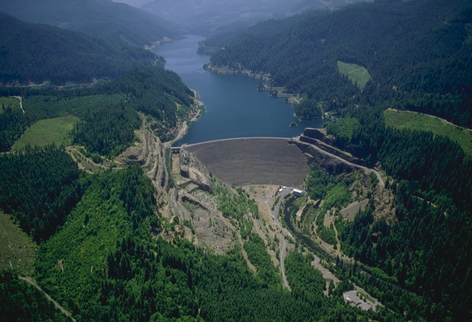
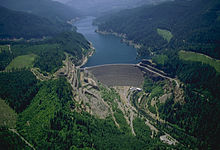 Cougar Dam and reservoir on the South Fork of the McKenzie River
Fed by numerous other creeks in the Oregon Cascades, the McKenzie Watershed includes the summit of South Sister, at 10,358 feet (3,157 m), as well as the McKenzie's confluence with the Willamette, at 375 feet (114 m) above sea level.[7] The McKenzie is the sole source of municipal drinking water for Eugene.[11]
Drift boat
The McKenzie River is also home of the McKenzie River Drift Boat. This flat-bottomed boat with a high bow is used throughout the world for fishing in fast moving rivers.
Communities in the McKenzie River Valley
The eastern portion of Oregon Route 126 passes through the valley of the McKenzie River, closely following the river for much of its route. The 60-mile stretch of the river from the edge of the Springfield metro area east to the Cascades is known as the McKenzie Valley.[12] The following communities are located on or near the river and/or the highway in the valley (west to east):
- Cedar Flat
- Walterville
- Deerhorn
- Leaburg
- Vida
- Nimrod
- Finn Rock
- Blue River
- Rainbow
- McKenzie Bridge
- Belknap Springs
See also
- List of rivers of Oregon
- List of longest streams of Oregon
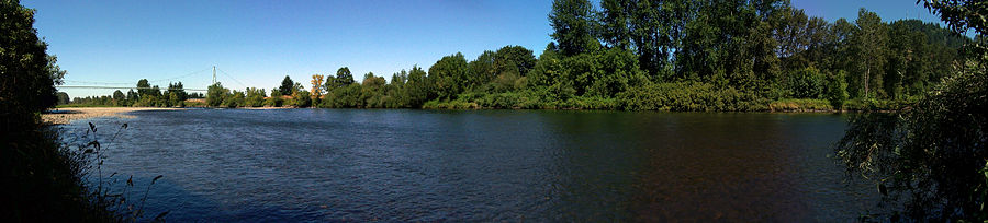

The McKenzie at Armitage County Park south of Coburg, near its mouth on the Willamette River References
- ^ Derived from Google Earth search using Geographic Names Information Service (GNIS) source coordinates.
- ^ a b c "McKenzie River". Geographic Names Information System (GNIS). United States Geological Survey. November 28, 1980. http://geonames.usgs.gov/pls/gnispublic/f?p=gnispq:3:::NO::P3_FID:1136527. Retrieved August 7, 2010.
- ^ "The River". Willamette Riverkeeper. http://www.willamette-riverkeeper.org/nww1.htm. Retrieved August 6, 2010.
- ^ "Watershed Facts". McKenzie Watershed Council. http://www.mckenziewc.org/facts.htm. Retrieved 29 September 2009.
- ^ "Water Resources Data for Oregon, Water Year 2005; McKenzie River Basin including and below the Blue River". United States Geological Survey. http://pubs.usgs.gov/wdr/2005/wdr-or-05/pdf/mckenzie_2.pdf. Retrieved 29 September 2009.
- ^ McArthur, Lewis (2003). Oregon Geographic Names. Portland: Oregon Historical Society Press. pp. 628–629. ISBN 0875952771.
- ^ a b "About the McKenzie Watershed". McKenzie Watershed Council. Retrieved January 9, 2010.
- ^ General course info from USGS topographic maps accessed via the "GNIS in Google Map" feature of the USGS Geographic Names Information System website; and Oregon Road & Recreation Atlas (Second ed.). Benchmark Maps. 2002. ISBN 0-929591-50-X.
- ^ Williams, Gerald W. "McKenzie River". The Oregon Encyclopedia. Retrieved January 11, 2011.
- ^ Munford, Kenneth. "The McKenzie River trails". Benton County Historical Society & Museum. Retrieved January 11, 2011.
- ^ Eugene Water & Electric Board: McKenzie Water Quality.org
- ^ McKenzie River Communities
External links
 Media related to McKenzie River at Wikimedia Commons
- McKenzie Watershed Council
Coordinates: 44°7′32″N 123°6′20″W / 44.12556°N 123.10556°W
Categories:- Wild and Scenic Rivers of the United States
- Tributaries of the Willamette River
- Landforms of Lane County, Oregon
- Rivers of Oregon


Wikimedia Foundation. 2010.