- Mado Gashi
-
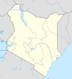
Mado Gashi Location of Mado Gashi Coordinates: 0°44′N 39°11′E / 0.73°N 39.18°E Country Kenya Province Eastern Province Time zone EAT (UTC+3) Mado Gashi (also Modogashe) is a small remote town in the Eastern Province and North Eastern Province of Kenya. Mado Gashi is not near any large cities. It is connected by to road to Isiolo (175 km west), Wajir (155 km northwest) and Garissa (155 km south). Mado Gashi has an unpaved airstrip. The village of Garba Tula is located 75 km west of Mado Gashi [1].
Administratively there are is divided into two adjacent locations named Modogashe, one in Modogashe division Garissa District, Northeastern Province the other in Sericho Division of Isiolo District, Eastern Province [2]. These locations are part of the Lagdera Constituency and Isiolo North Constituency, respectively.
References
- ^ Kenya - The Rough Guide Map
- ^ UN Office for the Coordination of Humanitarian Affairs (OCHA): Kenya_AdminLevels_1-4
Coordinates: 0°44′N 39°11′E / 0.733°N 39.183°E
Categories:- Isiolo District
- Populated places in the Eastern Province of Kenya
- Populated places in the North Eastern Province of Kenya
- Garissa District
- Eastern Province, Kenya geography stubs
Wikimedia Foundation. 2010.

