- Durrington Walls
-
Stonehenge, Avebury and Associated Sites * UNESCO World Heritage Site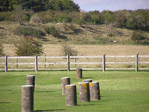
Durrington Walls, seen from Woodhenge.Country  United Kingdom of Great Britain and Northern Ireland
Type Cultural Criteria i, ii, iii Reference 373 Region ** Europe and North America Inscription history Inscription 1986 (10th Session) * Name as inscribed on World Heritage List
** Region as classified by UNESCODurrington Walls is the site of a large Neolithic settlement and later henge enclosure located in the Stonehenge World Heritage Site. It is 2 miles north-east of Stonehenge in the parish of Durrington, just north of Amesbury. Excavations on the site by a team led by the University of Sheffield, support an estimate of a community of several thousand, thought to be the largest one of its age in north-west Europe.[1][2] At 500m in diameter, the henge is the largest in Britain and recent evidence suggests that it was a complementary monument to Stonehenge.[3]
Contents
Etymology
The name comes from the civil parish in which the site is located – Durrington, meaning “the farm of doers people” (doer-deer, ing-people/tribe, tun-farm/settlement), and the large henge banks that surround it.
Context
What visibly remains of Durrington Walls today is the ‘walls’ of the henge monument – in fact the eroded remains of the inner slope of the bank and the outer slope of the internal ditch. This now appears as a ridge surrounding a central basin. On the eastern side the separate ditch and bank are much more discernible although badly eroded by ploughing. Originally the ditch was some 5.5m deep, 7m wide at its bottom and 18m wide at the top. The bank was in some areas 30m wide. There were two entrances through the bank and ditch – at the north western and south eastern ends. There may also have been an entrance to the south and the north east, although these may have been deliberately blocked. The henge enclosed several timber circles and smaller enclosures – not all of which have been excavated. Several Neolithic house floors have been found next to and under the eastern bank of the henge. Their density suggests that there was a very large village on the sloping river bank on this side.
The henge sits on high ground that slopes south east toward a bend in the River Avon, and is thus considerably higher at its north western side than at its south eastern edge. The south eastern entrance is roughly 60m from the riverbank.
The henge has two roads passing through it – an old toll road, and a modern banked road constructed in 1967. In the past military barracks were constructed at the north eastern end of the henge, and some houses are constructed on the western bank. The land on the western side of the toll road is owned by the National Trust, forming part of its Stonehenge Landscape property. It has free entry.
History
 Durrington Walls seen from Woodhenge
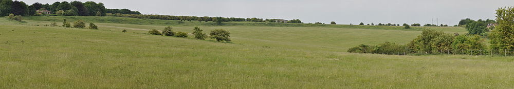
 Durrington Walls, as seen from the south of the monument. It is bisected here to the left by one of the two roads that now cross the prehistoric site.
Although there is evidence of some early Neolithic activity at the site, most of the structures seem to have been built in the late Neolithic/early Bronze Age. At some point around approximately 2600BC, a large timber circle was constructed. It is now known as the Southern Circle. The circle was oriented southeast towards the sunrise on the midwinter solstice and consisted of four large concentric circles of postholes, which would have held extremely large standing timbers. A metalled avenue was also constructed on a slightly different alignment – towards the sunset on the summer solstice – that led to the River Avon. This feature is similar to the Stonehenge Avenue. A large timber post lay on this orientation, about as far away from the circle as the Heelstone is from Stonehenge.
At a similar time, but likely after the circle and avenue were constructed, a village began to develop around the site. Excavations have revealed seven Neolithic house floors on the eastern side of the bank. Some of these floors were located underneath the henge bank, suggesting that settlement came first. The density of some of the houses suggests that there are many more house floors under the field east of the henge, along the banks of the River Avon. One of the homes excavated showed evidence of a cobb wall and its own ancillary building, and was remarkably similar in layout to a house at Skara Brae in Orkney. The other houses seem to have had simple wattle and daub walls. Evidence also suggests that the houses continued to the north of the site.
It is probable that the village surrounded a large, circular, open area that contained the Southern Circle and several smaller enclosures, including two houses set within timber palisades and ditched enclosures that appear to have been kept clean.
Sometime later, perhaps 200 hundred years after the circle was first constructed, another two concentric rings were added, and the henge enclosure was constructed. A ditch some 5.5m deep was dug, and the earth used to create a large outer bank some 30m wide and presumably several metres high. Several features of the village, including houses and midden pits, were built over. The henge seems to have been built in one continuous operation, not in phases, as there is no evidence of soil or turf developing in the bank. The ditch also seems to have been dug in sections, perhaps by different groups of labourers. Estimates of the number of people required to create the henge vary from 4000 – 6000. At a similar time, another large timber circle and henge were created immediately south at Woodhenge.
It is unknown when the site fell out of use. It was re-occupied during the Iron Age, when a settlement and field system was established inside the henge. A large drainage ditch was also dug above the north eastern entrance, possibly to complement the field system.
Excavations and theories
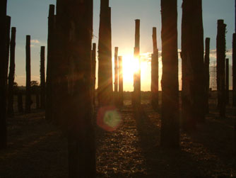
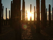 Sunrise at the Durrington Walls reconstruction, which was produced for a special episode of Time Team that first aired in 2005.
Richard Colt Hoare noted Durrington Walls in 1810, and observed that centuries of agriculture had left “its form much mutilated”.[4] Geoffrey Wainwright excavated the route of the new A345 in 1966. He discovered the southern timber circle as well as a smaller one slightly north of it. Since 2003 the Stonehenge Riverside Project, led by Mike Parker Pearson, has carried out annual excavations at Durrington Walls. It identified the Neolithic village and avenue to the river.
Radiocarbon dates of approximately 2600 BC are roughly contemporary with the earliest stone phase at Stonehenge. It is likely that the builders of the stone monument lived here. Mike Parker Pearson believes that Durrington Walls was a complementary structure to Stonehenge, as evidenced by the similar solstice alignments. He suggests that the timber circle at Durrington Walls represented life and a land of the living, whilst Stonehenge and the down around it, encircled by burial mounds, represented a land of the dead. The two were connected by the River Avon and their respective avenues. A ceremonial procession route from one to the other represented the transition from life to death.
Geoff Wainwright and Timothy Darvill have contested Parker Pearson’s theories, however; they suggest that Stonehenge was a monument to healing and that connections between the two monuments were unlikely.
See also
Bibliography
- M. Parker Pearson. Bronze Age Britain. 2005. ISBN 0713488492
- C. Chippindale. Stonehenge Complete. ISBN 0500284679
- R. Legg. Stonehenge and Avebury: The World Heritage Site. 2004. ISBN 184114360X
- D. Souden. Stonehenge: Mysteries of the Stones and Landscape. 1997. ISBN 1855852918
- M. Parker Pearson et al. The Age of Stonehenge. 2007. Antiquity, 81(313) pp 617–639
- M. Parker Pearson et al. The Stonehenge Riverside Project 2004 Interim Report
- M. Parker Pearson et al. The Stonehenge Riverside Project 2005 Interim Report
- M. Parker Pearson et al. The Stonehenge Riverside Project 2006 Summary Interim Report
References
- ^ Price, Siân (5 November 2007). "Stonehenge's huge support settlement". BBC. http://news.bbc.co.uk/1/hi/sci/tech/7078578.stm. Retrieved 25 March 2010.
- ^ "Huge Settlement Unearthed Near Stonehenge World Heritage Site". World Heritage. UNESCO. 13 February 2007. http://whc.unesco.org/en/news/310/. Retrieved 25 March 2010.
- ^ The New York Times 30 January 2007
- ^ Stonehenge and Avebury: The World Heritage Site. Rodney Legg. 2004.
External links
- Sheffield University: The Stonehenge Riverside Project
- Intute interviews with Professor Parker-Pearson and Dr. Umberto Albarella about the excavations at Durrington Walls
- Channel 4: Time Team Durrington Walls Special
- National Geographic: 'Stonehenge Decoded' exploring Parker Pearson's theories and the excavations of Durrington Walls
Categories:- 24th-century BC architecture
- History of Wiltshire
- Stone Age sites in England
- Archaeological sites in Wiltshire
- Henges
- Former populated places in England


Wikimedia Foundation. 2010.