- Georgia State Route 180
Infobox road
state=GA
type=
route=180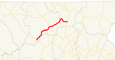
length_mi=26
length_ref= [http://www.dot.state.ga.us/DOT/plan-prog/transportation_data/400reports/2002/dpp444_2002.pdf]
length_round=0
established=
direction_a=East
direction_b=West
starting_terminus=
junction=
ending_terminus=
previous_route=179
next_route=181State Route 180 runs for about 26 miles from S.R. 60 in Suches to S.R. 17/75 halfway between Hiawassee and Helen in Union County. S.R. 180 traverses some of the most difficult terrain in Georgia, traveling the gaps of the highest mountains in the state. The route has two sections known as Bald Mountain Road and Wolfpen Gap Road, which are joined by a 2.3 mile overlap with
U.S. 19 /129 in the north ofVogel State Park . Much of the highway is in theChattahoochee National Forest .Bald Mountain Road, named for the state's highest peak (
Brasstown Bald ), is the eastern section of the highway and has been designated aNational Scenic Byway and aGeorgia Scenic Byway . Included in this section is a junction with theRichard B. Russell Scenic Highway and part of S.R. 180 is included in theRussell-Brasstown Scenic Byway . Bald Mountain Road crosses theNottely River shortly before the overlap with U.S. 19/129.Wolfpen Gap Road (11.8-mile western section of the highway) is known to be the curviest road in the state. Sites along this section include various hiking trails and scenery as well as Vogel State Park, access to
Sosebee Cove , an intersection with theCoosa Back Country Trail ,Lake Winfield Scott (Georgia's highest lake) and Suches, “The Valley Above The Clouds.” The highpoint of the highway is 3,260 feet at Wolfpen Gap.ee also
*State Route 180 Spur
Sources
* [http://psr.southeastroads.com/ga180_profile.htm Peach State Roads]
* [http://www.milebymile.com/main/United_States/Georgia/State_180_1/United_States_Georgia_road_map_travel_guides.html MilebyMile.com]
Wikimedia Foundation. 2010.