- Nová Baňa
-
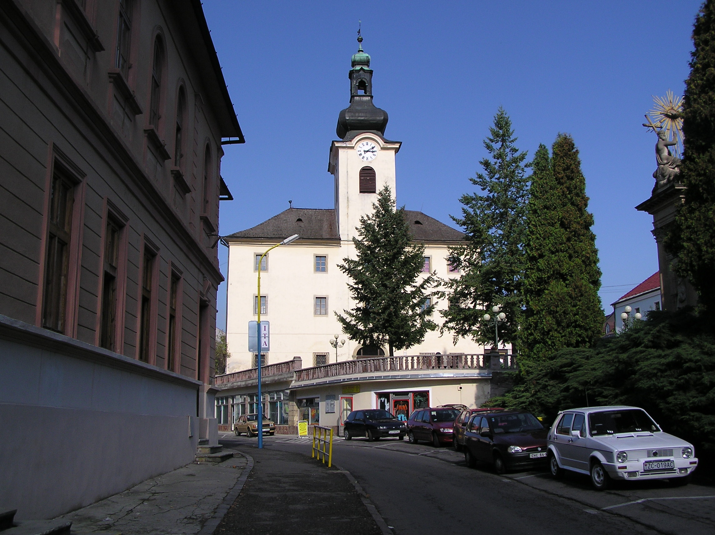
Nová Baňa Town  Town Hall in Nová Baňa
Country Slovakia Region Banská Bystrica District Žarnovica Tourism region Tekov River Hron Elevation 221 m (725 ft) Coordinates 48°25′28″N 18°38′21″E / 48.42444°N 18.63917°E Area 61.25 km2 (23.65 sq mi) Population 7,334 (2005) Density 120 / km2 (311 / sq mi) First mentioned 1337 Mayor Jan Havran Timezone CET (UTC+1) - summer (DST) CEST (UTC+2) Postal code 96801 Area code +421-45 Car plate ZC 

 Location of Nová Baňa in Slovakia
 Location of Nová Baňa in the Banská Bystrica Region
Wikimedia Commons: Nová Baňa Statistics: MOŠ/MIS Website: www.novabana.sk Nová Baňa (German: Königsberg; Hungarian: Újbánya) is a small town in the west of central Slovakia and the largest town of the Žarnovica District, located in the Banská Bystrica Region.
Contents
Geography
Nová Baňa lies in right bank of Hron river. Nová Baňa region is surrounded by a ring of volcanic mountains (Štiavnica Mountains on the east, Pohronský Inovec on the south-west and Vtáčnik on the north-west). Seven kilometers from Nová Baňa, close by the village Tekovská Breznica, is the youngest volcano in Central Europe called Putnikov vŕšok.
History
Mining in this area started as early as in the 13th century. In 1337 it was first mentioned under the names Nove Montanie (hence the name Nová Baňa - "new mine") and Seunych. In that year, (probably German) burghers from Kremnica and Pukanec settled here, because gold was discovered in the area. In 1345 Nová Baňa became a "free royal mining town". The mines were closed down in 1887.
Demographics
According to the 2001 census, the town had 7,505 inhabitants. 97.51% of inhabitants were Slovaks, 0.85 Ukrainians and 0.48% Czechs.[1] The religious makeup was 82.53% Roman Catholics, 11.50% people with no religious affiliation and 1.00% Orthodox.[1]
References
- ^ a b "Municipal Statistics". Statistical Office of the Slovak republic. Archived from the original on 2007-11-16. http://web.archive.org/web/20071116010355/http://www.statistics.sk/mosmis/eng/run.html. Retrieved 2007-12-15.
External links
Nová Baňa · Žarnovica
Brehy · Hodruša-Hámre · Horné Hámre · Hrabičov · Hronský Beňadik · Kľak · Malá Lehota · Orovnica · Ostrý Grúň · Píla · Rudno nad Hronom · Tekovská Breznica · Veľká Lehota · Veľké Pole · Voznica · Župkov Categories:
- Cities and towns in Slovakia
- Villages and municipalities in Žarnovica District


Wikimedia Foundation. 2010.