- Vtáčnik
Geobox | Mountain Range
name = Vtáčnik
native_name =
other_name =
category =
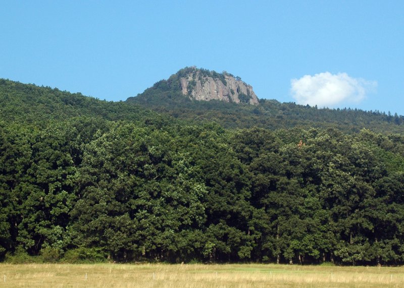
image_caption = Mount Žarnov
etymology =
nickname =
country = Slovakia
country_
state =
region = Žilina
region1 = Banská Bystrica
district =
district1 = Ružomberok
district2 = Turčianske Teplice
district3 = Banská Bystrica
commune =
municipality =
parent = Nitra basin
border = Strážov Mountains
border1 = Žiar
border2 = Kremnica Mountains
border3 = Tribeč
border4 = Štiavnica Mountains
part = Vysoký Vtáčnik
part1 = Nízky Vtáčnik
part2 = Župkovská brázda
part3 = Raj
part4 =
city =
landmark =
river =
highest = Vtáčnik (1,346 m)
highest_elevation =
highest_lat_d =
highest_lat_m =
highest_lat_s =
highest_lat_NS =
highest_long_d =
highest_long_m =
highest_long_s =
highest_long_EW =
length =
length_orientation =
width =
width_orientation =
free =
map_background =
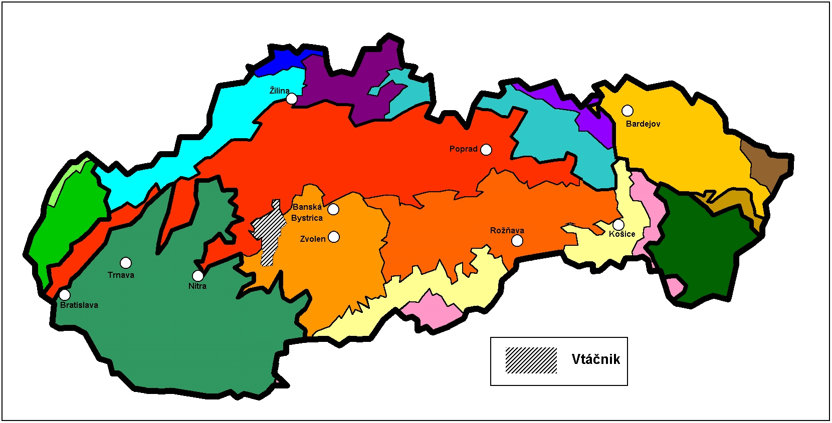
map_caption = Vtáčnik in Slovakia (gray)
map1 =
map1_background =
map1_caption =
commons = Vtáčnik
statistics =
website =
footnotes =Vtáčnik is a mountain range in central
Slovakia , which is part of theSlovenské stredohorie Mountains and part of the InnerWestern Carpathians .It is bordered in the west, north and northeast by the upper Nitra basin,
Strážov Mountains and Žiar, in the east by theKremnica Mountains and Žiar basin, and in the south byTribeč and theŠtiavnica Mountains .It is divided further into these geomorphological units:
# "Vysoký Vtáčnik"
# "Nízky Vtáčnik"
# "Župkovská brázda"
# "Raj"The four highest mountains are: Vtáčnik (also named Hrádok) (1,346 m), Biela skala (1,136 m), Buchlov (1,040 m), and Žiar (845 m).
Some of the towns or villages around or in Vtáčnik include:
Prievidza ,Nováky ,Handlová ,Prochot ,Lehota pod Vtáčnikom , andVeľké Pole .

Wikimedia Foundation. 2010.