- Ossuccio
-
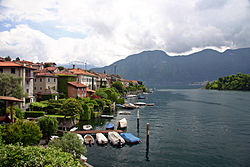
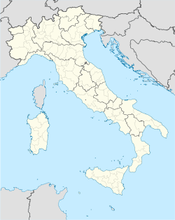
Ossuccio — Comune — Comune di Ossuccio Ossuccio Location of Ossuccio in Italy Coordinates: 45°58′N 9°11′E / 45.967°N 9.183°ECoordinates: 45°58′N 9°11′E / 45.967°N 9.183°E Country Italy Region Lombardy Province Como (CO) Government - Mayor Giorgio Cantoni Area - Total 8.0 km2 (3.1 sq mi) Population (Dec. 2004) - Total 975 - Density 121.9/km2 (315.7/sq mi) Time zone CET (UTC+1) - Summer (DST) CEST (UTC+2) Postal code 22010 Dialing code 0344 Ossuccio is a comune (municipality) in the Province of Como in the Italian region Lombardy. It is located on the western shore of Lake Como some 20 km northeast of Como. As of 31 December 2004, it had a population of 975 and an area of 8.0 km².[1]
It is known for the Sacro Monte, a site of pilgrimage and worship close to it, for the late 16th century Villa del Balbiano[1], the mid-20th century Villa Leoni[2], and for the island of Comacina which falls within its territory.
Ossuccio borders the following municipalities: Colonno, Lenno, Lezzeno, Ponna, Porlezza, Sala Comacina.
Demographic evolution

References
Settlements Abbadia Lariana · Argegno · Bellagio · Bellano · Blevio · Brienno · Carate Urio · Cernobbio · Colico · Colonno · Como · Consiglio di Rumo · Cremia · Dervio · Domaso · Dongo · Dorio · Faggeto Lario · Gera Lario · Giulino · Gravedona · Griante · Laglio · Lecco · Lenno · Lezzeno · Lierna · Malgrate · Mandello del Lario · Menaggio · Mezzegra · Moltrasio · Musso · Nesso · Oliveto Lario · Ossuccio · Perledo · Pianello del Lario · Pognana Lario · Sala Comacina · San Siro · Sant'Abbondio · Santa Maria Rezzonico · Sorico · Torno · Tremezzo · Valbrona · Valmadrera · Varenna · Vercana

Islands Rivers Valleys Mountains Landmarks Villa del Balbianello · Villa Carlotta · Villa d'Este · Priorato di Piona · Castello di Vezio · Sacro Monte di OssuccioFilms People Categories:- Cities and towns in Lombardy
- Communes of the Province of Como
- Province of Como geography stubs
Wikimedia Foundation. 2010.


