- Dervio
-
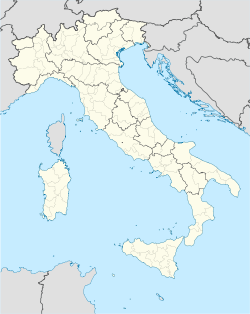
Dervio — Comune — Comune di Dervio Location of Dervio in Italy Coordinates: 46°5′N 9°18′E / 46.083°N 9.3°ECoordinates: 46°5′N 9°18′E / 46.083°N 9.3°E Country Italy Region Lombardy Province Province of Lecco (LC) Frazioni Corenno Plinio Area – Total 11.7 km2 (4.5 sq mi) Elevation 220 m (722 ft) Population (Dec. 2004) – Total 2,743 – Density 234.4/km2 (607.2/sq mi) Demonym Derviesi Time zone CET (UTC+1) – Summer (DST) CEST (UTC+2) Postal code 23824 Dialing code 0341 Website Official website Dervio is a comune (municipality) in the Province of Lecco in the Italian region Lombardy, located on the eastern shore of Lake Como, about 70 kilometres (43 mi) north of Milan and about 25 kilometres (16 mi) northwest of Lecco. As of 31 December 2004, it had a population of 2,743 and an area of 11.7 km².[1]
The municipality of Dervio contains the frazione (subdivision) Corenno Plinio.
Dervio borders the following municipalities: Bellano, Cremia, Dorio, Introzzo, Pianello del Lario, San Siro, Sueglio, Tremenico, Vendrogno, Vestreno.
Demographic evolution

References
External links
Settlements Abbadia Lariana · Argegno · Bellagio · Bellano · Blevio · Brienno · Carate Urio · Cernobbio · Colico · Colonno · Como · Consiglio di Rumo · Cremia · Dervio · Domaso · Dongo · Dorio · Faggeto Lario · Gera Lario · Giulino · Gravedona · Griante · Laglio · Lecco · Lenno · Lezzeno · Lierna · Malgrate · Mandello del Lario · Menaggio · Mezzegra · Moltrasio · Musso · Nesso · Oliveto Lario · Ossuccio · Perledo · Pianello del Lario · Pognana Lario · Sala Comacina · San Siro · Sant'Abbondio · Santa Maria Rezzonico · Sorico · Torno · Tremezzo · Valbrona · Valmadrera · Varenna · Vercana

Islands Rivers Valleys Mountains Landmarks Villa del Balbianello · Villa Carlotta · Villa d'Este · Priorato di Piona · Castello di Vezio · Sacro Monte di OssuccioFilms People Categories:- Cities and towns in Lombardy
- Communes of the Province of Lecco
- Province of Lecco geography stubs
Wikimedia Foundation. 2010.


