- New Brunswick Route 114
-
Route 114
Route information Maintained by New Brunswick Department of Transportation Length: 137.63 km[1] (85.5 mi) Existed: 1965 – present Major junctions West end:  Route 1 in Sussex Corner
East end:  Route 106 in Moncton
Location Major cities: Alma, Riverside-Albert, Hillsborough, Riverview Highway system Provincial highways in New Brunswick
Former routes←  Route 113
Route 115  →
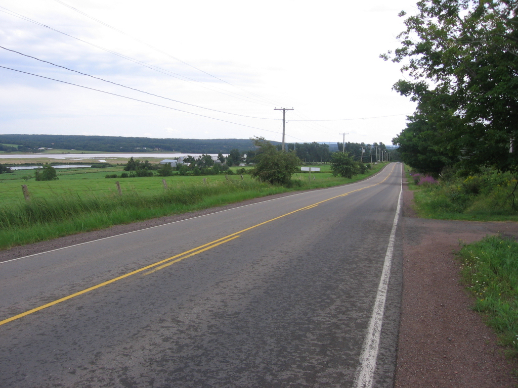
→ Route 114 passes through Lower Coverdale on the eastern edge of the town of Riverview. The road parallels the south and east bank of the Petitcodiac River from Riverview to Riverside-Albert.
Route 114 is a 137.6 km (85.5 mi) Canadian secondary highway in southeastern New Brunswick.
The route is the primary road serving the eastern part of Albert County and Fundy National Park.
Route 114's western terminus is at Route 1 exit 198 near Sussex Corner. From there, the route follows the former Trans-Canada Highway to Penobsquis, where it turns southeast to Fundy National Park. At the park's headquarters, Route 114 descends a hill to the village of Alma.
The route continues east to Riverside-Albert, then runs along the western coast of Shepody Bay to the shire town of Hopewell Cape. Following the west bank of the Petitcodiac River, Route 114 turns north through Hillsborough to the Moncton suburb of Riverview. Route 114 crosses the Petitcodiac River Causeway to Moncton, where it ends at a traffic circle.
See also
References
- ^ New Brunswick Department of Transportation: Designated Provincial Highways, 2003
Categories:- New Brunswick provincial highways
- Roads in Kings County, New Brunswick
- Roads in Albert County, New Brunswick
- Roads in Westmorland County, New Brunswick
- Canada road stubs
- New Brunswick stubs
Wikimedia Foundation. 2010.