- Western Bug
Infobox River | river_name = Bug

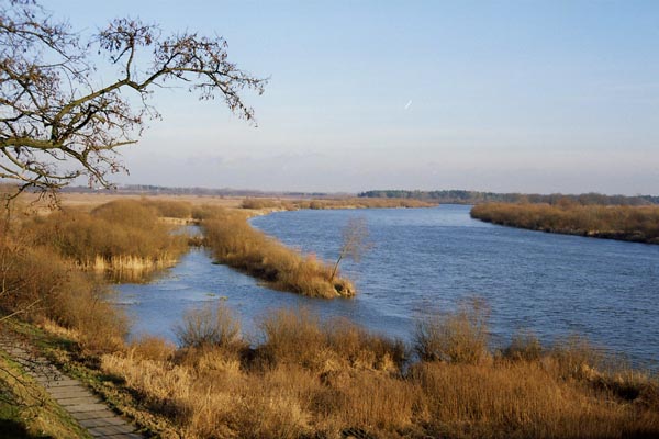
caption = Bug River in the vicinity of Wyszków
origin =Ukraine
mouth =Zegrze Lake on theNarew
basin_countries =Ukraine ,Poland ,Belarus
length = 772 km (480 mi)
elevation =
discharge =
watershed = 39,420 km² (15,220 mi²)The Bug or Buh River ( _pl. Bug Audio-IPA-pl|Bog.ogg|b|u|k; _uk. Західний Буг, "Zakhidnyy Buh"; _be. Захо́дні Буг, "Zakhodni Buh"; _ru. Западный Буг, "Zapadnyy Bug"), sometimes called the Western Bug to distinguish it from the
Southern Bug , flows from centralUkraine to the west, forming part of the boundary between Ukraine andPoland , passes along the Polish-Belarus ian border and intoPoland , and empties into theNarew river nearSerock (actually to the artificialZegrze Lake ). The part between the lake and theVistula River is sometimes referred to asBugo-Narew . The Vistula River drains into theBaltic Sea .The Bug is 772 km long (587 km in Poland) and is the 4th longest Polish river. The basin area is 39,420 km² (19,284 km² in Poland). It is connected with the
Dnieper river by theDnieper-Bug Canal .Traditionally the Bug was also often considered the ethnographical border between Orthodox and Catholic peoples. The Bug was the dividing line between German and Russian forces following the invasion of Poland in the
Second World War .Tributaries
Poltva,
Sołokija ,Bukowa ,Huczwa ,Uherka ,Włodawka ,Krzna ,Liwiec ,Ług , Mukhavets,Leśna ,Nurzec , Brok,Warenzhanka *Left bank
**Pełtew
**Bukowa
**Huczwa
**Uherka
**Włodawka
**Krzna
**Toczna
**Liwiec
**Kałamanka *Right bank
**Sołokija
**Ług
**Mukhavets
**Leśna (Leśna Prawa ,Leśna Lewa )
**Nurzec
**BrokSee also
*
Southern Bug
*Bug Landscape Park
*Rivers of Poland
*Rivers of Ukraine
*Geography of Poland
*Geography of Ukraine Photo Gallery
Wikimedia Foundation. 2010.
