Millbourne (SEPTA station)

Millbourne (SEPTA station)
Millbourne
SEPTA rapid transit station
Markfrnkline1.jpg
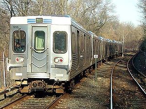
The Market-Frankford Line near Millbourne Station
Station statistics
Address Wister Drive & Millbourne Avenue
Millbourne, Pennsylvania
Coordinates 39°57′52″N 75°15′08″W / 39.9644°N 75.2523°W / 39.9644; -75.2523Coordinates: 39°57′52″N 75°15′08″W / 39.9644°N 75.2523°W / 39.9644; -75.2523
Lines
Platforms 2 side platforms
Tracks 2
Other information
Rebuilt 2008
Electrified 700 volts DC
Accessible Handicapped/disabled access
Owned by SEPTA
Formerly 66th Street
Services
Preceding station   SEPTA   Following station
Terminus
Market–Frankford Line
toward Frankford

Millbourne Station is a ground-level stop on the Market-Frankford Line, near the intersection of Millbourne Avenue and Market Street in Millbourne, Pennsylvania.

The station was formerly called 66th Street, as it is half way in between 63rd Street in Philadelphia and 69th Street in Upper Darby. It was reopened on June 16, 2008 following a total reconstruction.

Before reconstruction, only "B" trains stopped at Millbourne. However, during the reconstruction both "A" and "B" trains stopped here, effectively ending skip-stop operation west of Center City on the Market-Frankford Line. With the completion of construction of the west end operations, "A" and "B" stops have resumed at Millbourne with only "B" trains making stops during peak hours.

As far as the SEPTA heavy rail system is concerned, the Millbourne station (alongside the 69th Street Terminal) is one of two stations located outside Philadelphia proper.

External links


Wikimedia Foundation. 2010.

Игры ⚽ Поможем сделать НИР

Look at other dictionaries:

  • Millbourne Mills (Pennsylvania) — Millbourne Mills was a flour mill owned by the Sellers family in Upper Darby Township, Pennsylvania, U.S.A., as well as the name of a former railroad station located there. The Pennsylvania Railroad s Cardington Branch ended there, where… …   Wikipedia

  • Millbourne, Pennsylvania — Coordinates: 39°57′48″N 75°15′14″W / 39.96333°N 75.25389°W / 39.96333; 75.25389 …   Wikipedia

  • Market–Frankford Line —      Market–Frankford Line Market–Frankford Line train departing 52nd Street stati …   Wikipedia

  • Market-Frankford Line — Market–Frankford Subway Elevated Line Market–Frankford Line, Bahnhof 52nd Street Streckenlänge: 20,76 km km Spurweite: 1581 mm Breitspur …   Deutsch Wikipedia

  • Market-Frankford Subway-Elevated Line — Market–Frankford Subway Elevated Line Market–Frankford Line, Bahnhof 52nd Street Streckenlänge: 20,76 km km Spurweite: 1581 mm Breitspur …   Deutsch Wikipedia

  • Market–Frankford Line — Market–Frankford Subway Elevated Line Market–Frankford Line, Bahnhof 52nd Street Streckenlänge: 20,76 km km Spurweite: 1581 mm Breitspur …   Deutsch Wikipedia

  • Market–Frankford Subway-Elevated Line — Market–Frankford Line, Bahnhof 52nd Street Streckenlänge: 20,76 km Spurweite: 1581 mm Stromsystem …   Deutsch Wikipedia

  • West Philadelphia — is a section of the City of Philadelphia, Pennsylvania, United States. Though there is no official definition of its boundaries, West Philly is generally considered to reach from the western shore of the Schuylkill River, to City Line Avenue to… …   Wikipedia

  • 69th Street Terminal — Infobox Station name=69th Street Terminal type=SEPTA rapid transit and trolley station image size= image caption=69th Street Terminal at 69th and Market Streets address=69th and Market Streets Upper Darby, Pennsylvania line=rail color… …   Wikipedia

  • Chester, Pennsylvania — Coordinates: 39°50′50″N 75°22′22″W / 39.84722°N 75.37278°W / 39.84722; 75.37278 …   Wikipedia

Share the article and excerpts

Direct link
Do a right-click on the link above
and select “Copy Link”