- Kyustendil Province
Infobox Province of Bulgaria
Cyrillic = Област Кюстендил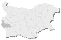
Capital =Kyustendil
Municipalities = 9
Area = 3,084.30 km²
Population = 163,889 GRAO
LicensePlate = KH
Governor = Lyubomir Dermanski
Website = http://www.kn.government.bg/Kyustendil Province (Област Кюстендил, "Oblast Kyustendil") is a province in western
Bulgaria , neighbouring toRepublic of Macedonia andSerbia . Its main city isKyustendil , and other municipalities are:*
Boboshevo
*Bobov Dol
*Dupnitsa
*Kocherinovo
*Nevestino
*Rila
*Sapareva Banya
*Treklyano The Region of Kyustendil is situated in the South-Western part of
Bulgaria , extends over an area of 3084,30 km². (constituting 2,7% of the total territory of the Republic of Bulgaria), and has a population of 173 889. It borders upon the Regions of Sofia, Pernik and Blagoevgrad, while to the west, its limits coincide with the state borders betweenBulgaria and theRepublic of Macedonia , andBulgaria and theRepublic of Serbia . The administrative center of the Province isKyustendil and the commercial and cultural center of it isDupnitsa . The region features diverse surface relief - fertilevalley s andcanyon s, separated by hillocks and mountains. The northern and western parts of the territory form the so-called "Kyustendilsko kraishte" (Kyustendil Cornerland), and include parts of the cross-border Milevska, Chudinska, Zemenska and - to the east - Konyavska mountains. To the south, the Kyustendilsko kraishte reaches as far as the valleys of theDragovishtitsa andBistritsa river s, as well as the Lisets mountain. The southern part of the region includes massifs of theOsogovo ,Vlahina and North-WesternRila mountains, embracing the Kamenitsa, Kyustendil and Dupnitsa lowerlands.The region is divided in two under-districts - Kyustendil in west and Dupnitsa in east.InDupnitsa region there are the geographic areas: Gorno pole (Upper field), Dolno pole (Lower field)and the area Razmetanitsa where the EmperorSamuil of Bulgaria killed his brotherAaron and his family.The region abounds with
granite s,clay s,fossil s, andore s. Polymetal ores are excavated inOsogovo ; brown coals in theBobov dol mines. Clays deposits are located at the villages of Chetirtsi, Yahinovo andDragovishtitsa . The region, however, is most famous for its numerousmineral water springs: hot mineral water springs inKyustendil ,Sapareva banya , the villages of Nevestino and Chetirtsi. A marvel of nature, found in the region are the Stobski piramidi (Stob pyramids ).For the most part, the
climate is trans-continental, but at higher altitudes it ismountainous . The main drainage river isStruma whose subsidiaries are the Treklyanska,Dragovishtitsa ,Bistritsa , Slokoshtitsa, Novoselska,Dzherman andRila rivers. Subterranean water levels are relatively high. Near the village of Kamenichka Skakavitsa, the Golemi dol river forms a 70-meter-high waterfall. The Dyakovo, Bersin, Drenov dol and Bagrentsi artificial lakes (dams) are chiefly used for irrigation purposes. Soil composition is most favorable for the traditionally-developed fruit-growing.Forest vegetation is mostly deciduous, although coniferous forests are also present. In the Gabra natural reservation (area: 89,5 metric hektars) houses the last remaining black-pine trees.
The Region of Kyustendil includes 9 municipalities:
Kyustendil ,Dupnitsa ,Bobov dol ,Sapareva banya ,Rila , Kocherinovo, Nevestino,Boboshevo , Treklyano with a total of 182 settlements. The regional administrative center is the town of Kyustendil situated in its Southwestern part: the Kyustendil lowerland. The town also serves as the administrative center of the municipality of Kyustendil (with an area of 923 km²., this Municipality represents 30,2% of the total territory of the Region), with a population of 73 346, of whom 51 300 are residents of the town area. Four main transport routes pass throughKyustendil : fromRepublic of Macedonia on theSkopie -Sofia high-way; fromSerbia on theNish -Bosilegrad -Kyustendil high-way; throughDupnitsa andKyustendil passes the oldest commercial road that for centuries has linkedConstantinople and theAdriatic Sea . Kyustendil has managed to preserve is historical, ecological and cultural heritage. It is a contemporary Bulgarian administrative center, whose future is mostly seen in the development of cultural tourism, and modern rehabilitation resort centers by the hot mineral water springs.The surrounding region is like an untapped National Park. Wander through green lanes past medieval houses and barns and discover stunning landscapes. Plenty of fishing, walking, treking, 4*4 country, hunting, with clear air and a fantastic climate.
Wikimedia Foundation. 2010.