- Tightsqueeze, Virginia
-
Tightsqueeze is an unincorporated community in the center of Pittsylvania County, Virginia, United States. It is included in the Danville, Virginia Metropolitan Statistical Area.
Contents
History
The community of Tightsqueeze got its name due to the construction of two buildings close to a road that connected Chatham and Danville during the 19th century. In 1870, W. H. Colbert built his general store close enough to the road that women could go straight from their carriages to the store without getting muddy or dusty. [1]
Soon, another merchant, Isaiah Giles, built a blacksmith-wheelwright shop directly across the road from the general store. It, too, was on the road's edge. Due to the closeness of the two buildings, buggies and wagons had to slow down as they passed between the two buildings. Thus, individuals were told to slow down for the "tight squeeze" where the two stores were located.
Tightsqueeze noted by media
As related by Virginia journalist Guy Friddell in his book What Is It About Virginia?, at one point, the Pittsylania County Board of Supervisors changed the name of Tightsqueeze to "Fairview." However, after public protest, the name of Tightsqueeze was restored.
Time magazine ran a feature story about Tightsqueeze and the name controversy. [2] Next American City magazine named it to a List of U.S. Cities with names that make 13-year-olds laugh. [3]
Modern times
The community in recent years has seen significant growth coming from businesses that would otherwise have located themselves within the nearby Chatham. For many years, Virginia Department of Transportation signs with the community's name on them were frequently stolen by pranksters.
See also
- Lost counties, cities and towns of Virginia
Notes
- ^ ([1])Preston B. Moses, from The Pittsylvania Packet, Pittsylvania Historical Society, Chatham, Virginia, Spring 1995, pp. 14-15.
- ^ http://www.victorianvilla.com/sims-mitchell/local/tightsq/
- ^ http://americancity.org/daily/entry/197/
External links
- Historic Tightsqueeze, Virginia
- How Tightsqueeze Really Got Its Name
- More Tales of Tightsqueeze, Virginia
Municipalities and communities of Pittsylvania County, Virginia Towns 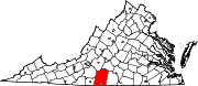
CDPs Blairs | Motley | Mount Hermon
Unincorporated
communitiesAjax | Andersons Mill | Bachelors Hall | Banister | Berry Hill | Beverly Heights | Birnam Wood | Brights | Brosville | Brutus | Buford | Callahans Hills | Callands | Cartersville | Cascade | Cedar Forest | Cedar Hill | Chalk Level | Climax | Coles Hill | Dry Fork | Dundee | Ebenezer | Eldon Knolls | Fairfield Park | Farmers | Flint Hill | Fox Hollow | Galveston | Gilmer Terrace | Glenland | Glenwood | Grady | Green Acres | Green Pond | Greenfield | Grit | Halifax Hills | Henrys Mill | Hermosa | Hill Grove | Hinesville | Hollys Mill | Hollywood | Hopewell | Java | Jones Mill | Keeling | Kentuck | Lakewood | Laniers Mill | Laurel Grove | Leaksville Junction | Level Run | Lucks | Lumpkin Forest | Markham | Motleys Mill | Mt. Airy | Mount Cross | Mountain Hill | Museville | Natal | New Mount Cross | Oak Hill | Oak Hills | Oak Ridge | Oakland | Olde Hunting Hills | Peytonsburg | Pickaway | Pickerel | Pine Ridge | Pittsville | Pleasant Gap | Pleasant Grove | Pullens | Ray | Red Oak Hollow | Redeye | Renan | Riceville | Ridgecrest | Ridgeway | Ringgold | Rondo | Sandy River | Sharon | Sheva | Shockoe | Smothers | Soapstone | Sonans | Spring Garden | Stony Mill | Straightstone | Surry Hills | Sutherlin | Swansons Mill | Swansonville | Sycamore | Tightsqueeze | Toshes | Transco Village | Turkey Fork | Vadens Mill | Vance | Vandola | Weal | West Fork | Whitfield | Whitmell | Whittles | Whittletown | Witt | Woodlake Park | Woodlawn | Woodlawn Heights | Worlds | Wyndover Woods
Categories:- Pittsylvania County, Virginia geography stubs
- Unincorporated communities in Virginia
- Populated places in Pittsylvania County, Virginia
- Danville, Virginia metropolitan area

Wikimedia Foundation. 2010.