- Muotathal
-
Muotathal 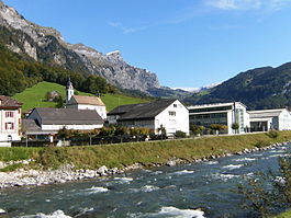
Country Switzerland 
Canton Schwyz District Schwyz 46°58′N 8°45′E / 46.967°N 8.75°ECoordinates: 46°58′N 8°45′E / 46.967°N 8.75°E Population 3,538 (Dec 2009)[1] - Density 21 /km2 (53 /sq mi) Area 172.16 km2 (66.47 sq mi)[2] Elevation 606 m (1,988 ft) Postal code 6436 SFOS number 1367 Surrounded by Braunwald (GL), Bürglen (UR), Glarus (GL), Illgau, Innerthal, Linthal (GL), Luchsingen (GL), Morschach, Oberiberg, Riemenstalden, Spiringen (UR), Schwyz, Unteriberg, Unterschächen (UR) Website www.muotathal.ch
SFSO statistics
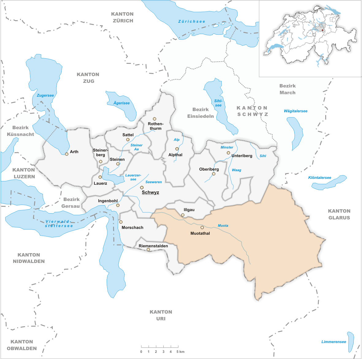
 MuotathalMap of Muotathal

Muotathal is a municipality in Schwyz District in the canton of Schwyz in Switzerland. The eponymous valley is formed by the Muota river, which joins Lake Lucerne at Brunnen.
Contents
History
Muotathal is first mentioned in 1246 as Muthathal and Mutetal.[3]
Geography
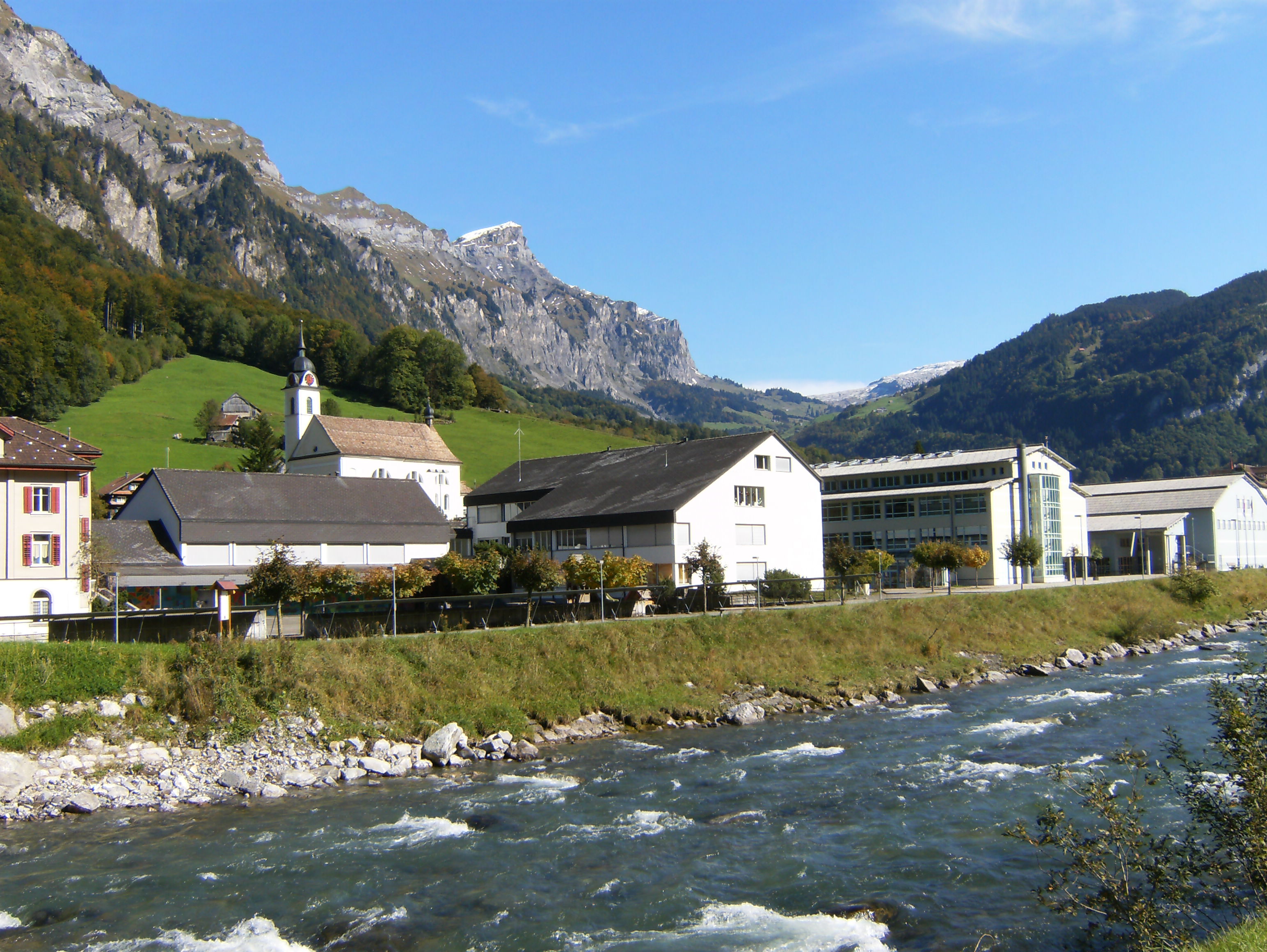
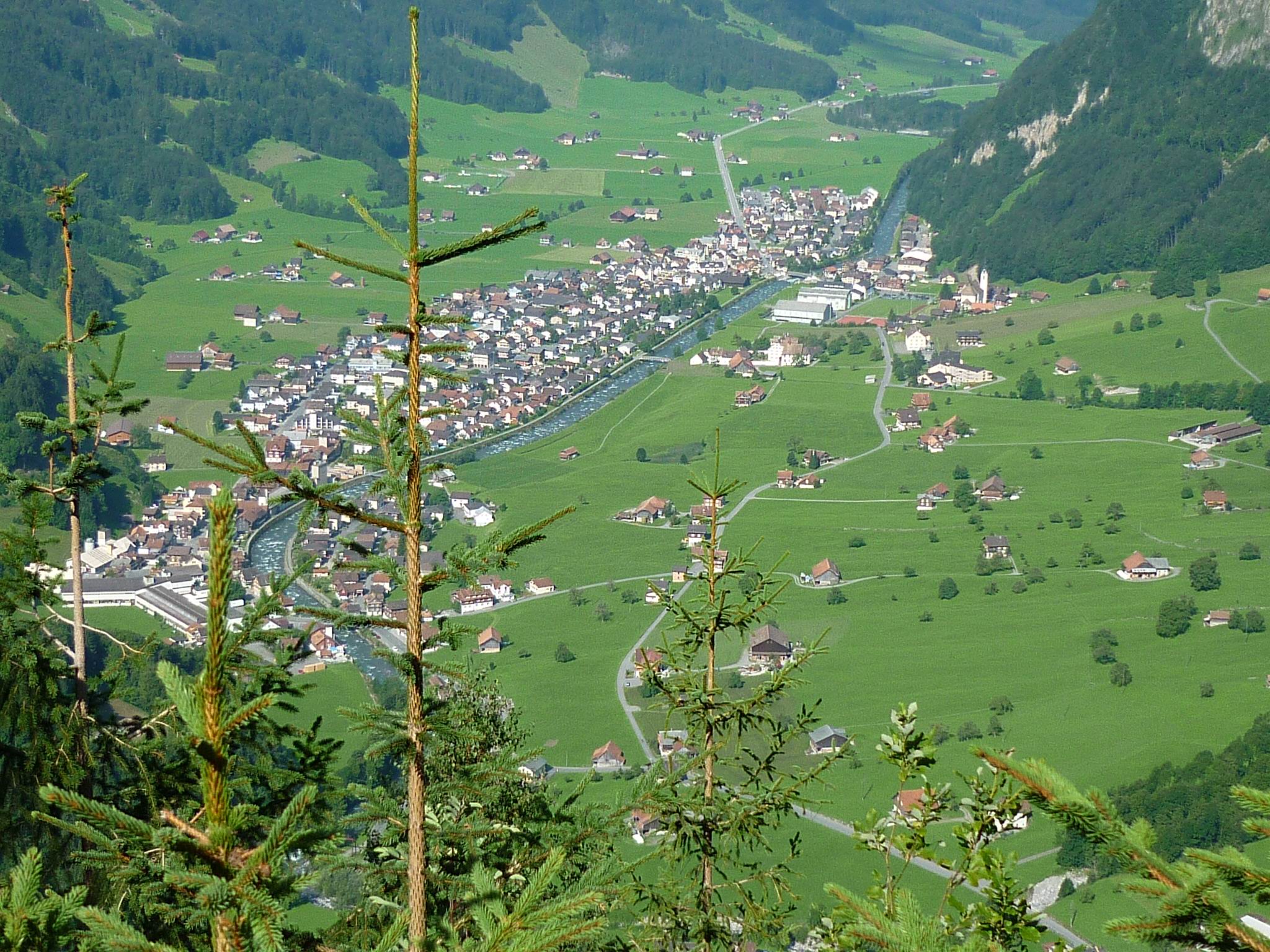
 Muotathal village the Muota river
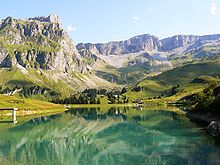 Lake north of the Glatten mountain
Muotathal has an area, as of 2006[update], of 172.2 km2 (66.5 sq mi). Of this area, 32.8% is used for agricultural purposes, while 22% is forested. Of the rest of the land, 1% is settled (buildings or roads) and the remainder (44.2%) is non-productive (rivers, glaciers or mountains).[4]
The municipality is located in the Muota river valley (Muotatal or Muotathal), with which it shares the name. It is located in a series of valleys on the eastern edge of the canton, on the borders with the cantons of Uri and Glarus. It is the 10th largest municipality in Switzerland.[3] It consists of the village sections of Schachen, Wil, Hinterthal (had its own post office since 1896, though it has now grown together with Schachen), Bisisthal and Ried. It also includes a number of alpine pasture settlements including Glatt-, Tor-, Charetalp and Goldplangg.
Demographics
Muotathal has a population (as of 31 December 2009) of 3,538.[1] As of 2007[update], 5.2% of the population was made up of foreign nationals.[5] Over the last 10 years the population has grown at a rate of 0.3%. Most of the population (as of 2000[update]) speaks German (96.5%), with Albanian being second most common ( 2.5%) and Macedonian being third ( 0.3%).[4]
As of 2000[update] the gender distribution of the population was 52.3% male and 47.7% female. The age distribution, as of 2008[update], in Muotathal is; 1,069 people or 30.5% of the population is between 0 and 19. 1,017 people or 29.0% are 20 to 39, and 972 people or 27.7% are 40 to 64. The senior population distribution is 251 people or 7.2% are 65 to 74. There are 148 people or 4.2% who are 70 to 79 and 50 people or 1.43% of the population who are over 80.[5]
As of 2000[update] there are 1,154 households, of which 246 households (or about 21.3%) contain only a single individual. 154 or about 13.3% are large households, with at least five members.[5]
In the 2007 election the most popular party was the SVP which received 67.4% of the vote. The next three most popular parties were the CVP (22%), the SPS (5.1%) and the FDP (4.5%).[4]
In Muotathal about 46.9% of the population (between age 25-64) have completed either non-mandatory upper secondary education or additional higher education (either university or a Fachhochschule).[4]
Muotathal has an unemployment rate of 0.67%. As of 2005[update], there were 303 people employed in the primary economic sector and about 119 businesses involved in this sector. 512 people are employed in the secondary sector and there are 51 businesses in this sector. 414 people are employed in the tertiary sector, with 82 businesses in this sector.[4]
From the 2000 census[update], 3,197 or 91.2% are Roman Catholic, while 47 or 1.3% belonged to the Swiss Reformed Church. Of the rest of the population, there are 14 individuals (or about 0.40% of the population) who belong to the Orthodox Church. There are 133 (or about 3.79% of the population) who are Islamic. There are less than 5 individuals who belong to another church (not listed on the census), 34 (or about 0.97% of the population) belong to no church, are agnostic or atheist, and 81 individuals (or about 2.31% of the population) did not answer the question.[5]
The historical population is given in the following table:[3]
year population 1850 1,680 1900 2,221 1950 2,475 1970 2,763 1980 3,056 1985 3,147 1990 3,152 2000 3,556 2005 3,543 2007 3,556 Weather
Muotathal has an average of 157.8 days of rain per year and on average receives 2,040 mm (80 in) of precipitation. The wettest month is June during which time Muotathal receives an average of 232 mm (9.1 in) of precipitation. During this month there is precipitation for an average of 15.9 days. The driest month of the year is October with an average of 126 mm (5.0 in) of precipitation over 15.9 days.[6]
References
- ^ a b Swiss Federal Statistical Office, MS Excel document – Bilanz der ständigen Wohnbevölkerung nach Kantonen, Bezirken und Gemeinden (German) accessed 25 August 2010
- ^ Arealstatistik Standard - Gemeindedaten nach 4 Hauptbereichen
- ^ a b c Muotathal in German, French and Italian in the online Historical Dictionary of Switzerland.
- ^ a b c d e Swiss Federal Statistical Office accessed 31-Aug-2009
- ^ a b c d Canton Schwyz Statistics (German) accessed 27 August 2009
- ^ "Temperature and Precipitation Average Values-Table, 1961-1990" (in German, French, Italian). Federal Office of Meteorology and Climatology - MeteoSwiss. http://www.meteoswiss.admin.ch/web/de/klima/klima_schweiz/tabellen.html. Retrieved 8 May 2009., the weather station elevation is 620 meters above sea level.
External links
- Muotathal in German, French and Italian in the online Historical Dictionary of Switzerland.
Municipalities in the district of Schwyz, Switzerland Alpthal | Arth | Illgau | Ingenbohl | Lauerz | Morschach | Muotathal | Oberiberg | Riemenstalden | Rothenthurm | Sattel | Schwyz | Steinen | Steinerberg | Unteriberg
Canton of Schwyz | Districts of Canton Schwyz | Municipalities of the canton of Schwyz
 Categories:
- Municipalities of the canton of Schwyz
- Municipalities of Switzerland
- Reuss drainage basin


Wikimedia Foundation. 2010.