- Därstetten
-
Därstetten The Moos hamlet in Därstetten.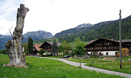
Country Switzerland 
Canton Bern District Frutigen-Niedersimmental 46°39′N 7°29′E / 46.65°N 7.483°ECoordinates: 46°39′N 7°29′E / 46.65°N 7.483°E Population 849 (Dec 2010)[1] - Density 26 /km2 (67 /sq mi) Area 32.79 km2 (12.66 sq mi)[2] Elevation 757 m (2,484 ft) Postal code 3763 SFOS number 0761 Surrounded by Blumenstein, Diemtigen, Erlenbach im Simmental, Oberstocken, Oberwil im Simmental, Pohlern, Rüeggisberg, Rüschegg Website Därstetten.ch
SFSO statistics
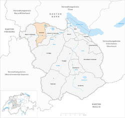
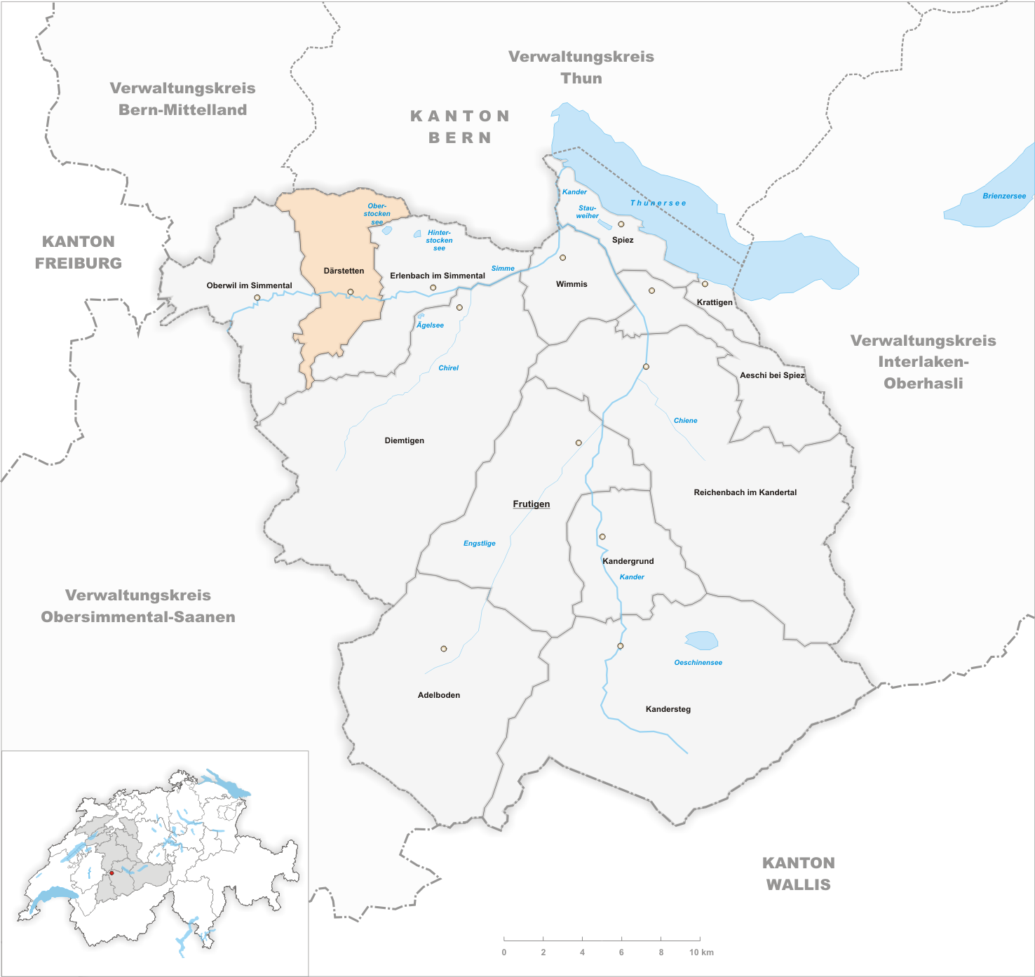
 DärstettenMap of Därstetten
Därstetten is a municipality in the Frutigen-Niedersimmental administrative district in the canton of Bern in Switzerland.
Contents
History
Därstetten is first mentioned in 1228 as Tarenchat.[3]
Geography
Därstetten has an area, as of 2009[update], of 32.79 km2 (12.66 sq mi). Of this area, 15.16 km2 (5.85 sq mi) or 46.2% is used for agricultural purposes, while 13.07 km2 (5.05 sq mi) or 39.9% is forested. Of the rest of the land, 0.88 km2 (0.34 sq mi) or 2.7% is settled (buildings or roads), 0.36 km2 (0.14 sq mi) or 1.1% is either rivers or lakes and 3.32 km2 (1.28 sq mi) or 10.1% is unproductive land.[4]
Of the built up area, housing and buildings made up 1.3% and transportation infrastructure made up 1.2%. 32.8% of the total land area is heavily forested and 5.7% is covered with orchards or small clusters of trees. Of the agricultural land, 0.2% is used for growing crops and 15.9% is pastures and 29.9% is used for alpine pastures. All the water in the municipality is in rivers and streams. Of the unproductive areas, 6.9% is unproductive vegatation and 3.2% is too rocky for vegatation.[4]
The municipality is located on the valley floor and hills around the Stockhorn and Turnen mountains. The landscape includes a valley floor, forests and alps. It includes the farming cooperatives (Bäuerten) of Weissenburg, Reichenbach and Wiler.
Demographics
Därstetten has a population (as of 31 December 2010) of 849.[1] As of 2007[update], 2.6% of the population was made up of foreign nationals. Over the last 10 years the population has decreased at a rate of -0.1%. Most of the population (as of 2000[update]) speaks German (96.9%), with French being second most common ( 0.9%) and Albanian being third ( 0.7%).
In the 2007 election the most popular party was the SVP which received 69.1% of the vote. The next three most popular parties were the local small left-wing parties (10.1%), the FDP (6.2%) and the SPS (4.7%).
The age distribution of the population (as of 2000[update]) is children and teenagers (0–19 years old) make up 31.3% of the population, while adults (20–64 years old) make up 52.9% and seniors (over 64 years old) make up 15.8%. The entire Swiss population is generally well educated. In Därstetten about 62.3% of the population (between age 25-64) have completed either non-mandatory upper secondary education or additional higher education (either University or a Fachhochschule).
Därstetten has an unemployment rate of 0.98%. As of 2005[update], there were 170 people employed in the primary economic sector and about 57 businesses involved in this sector. 77 people are employed in the secondary sector and there are 19 businesses in this sector. 133 people are employed in the tertiary sector, with 25 businesses in this sector.[5] The historical population is given in the following table:[3]
year population 1764 535 1850 104 1900 897 1950 885 1980 759 2000 879 References
- ^ a b Swiss Federal Statistical Office - STAT-TAB, online database – Datenwürfel für Thema 01.2 - Bevölkerungsstand und -bewegung (German) accessed 29 September
- ^ Arealstatistik Standard - Gemeindedaten nach 4 Hauptbereichen
- ^ a b Därstetten in German, French and Italian in the online Historical Dictionary of Switzerland.
- ^ a b Swiss Federal Statistical Office-Land Use Statistics 2009 data (German) accessed 25 March 2010
- ^ Swiss Federal Statistical Office accessed 10-Jul-2009
External links
- Därstetten in German, French and Italian in the online Historical Dictionary of Switzerland.
Adelboden | Aeschi bei Spiez | Därstetten | Diemtigen | Erlenbach im Simmental | Frutigen | Kandergrund | Kandersteg | Krattigen | Oberwil im Simmental | Reichenbach im Kandertal | Spiez | Wimmis
Canton of Bern | Districts of Canton Bern | Municipalities of the canton of Bern
 Categories:
- Municipalities of Bern
- Municipalities of Switzerland


Wikimedia Foundation. 2010.