- Maps of Cornwall
-
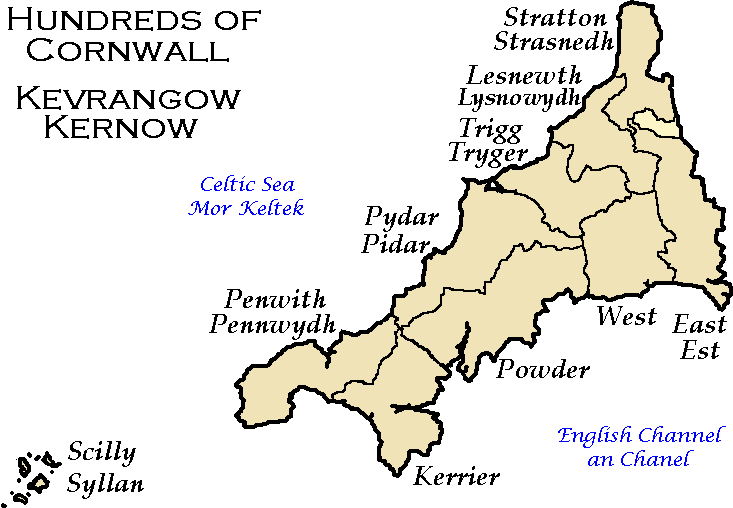
 Map showing the Hundreds of Cornwall in the early 19th century, (formerly known as Cornish Shires)
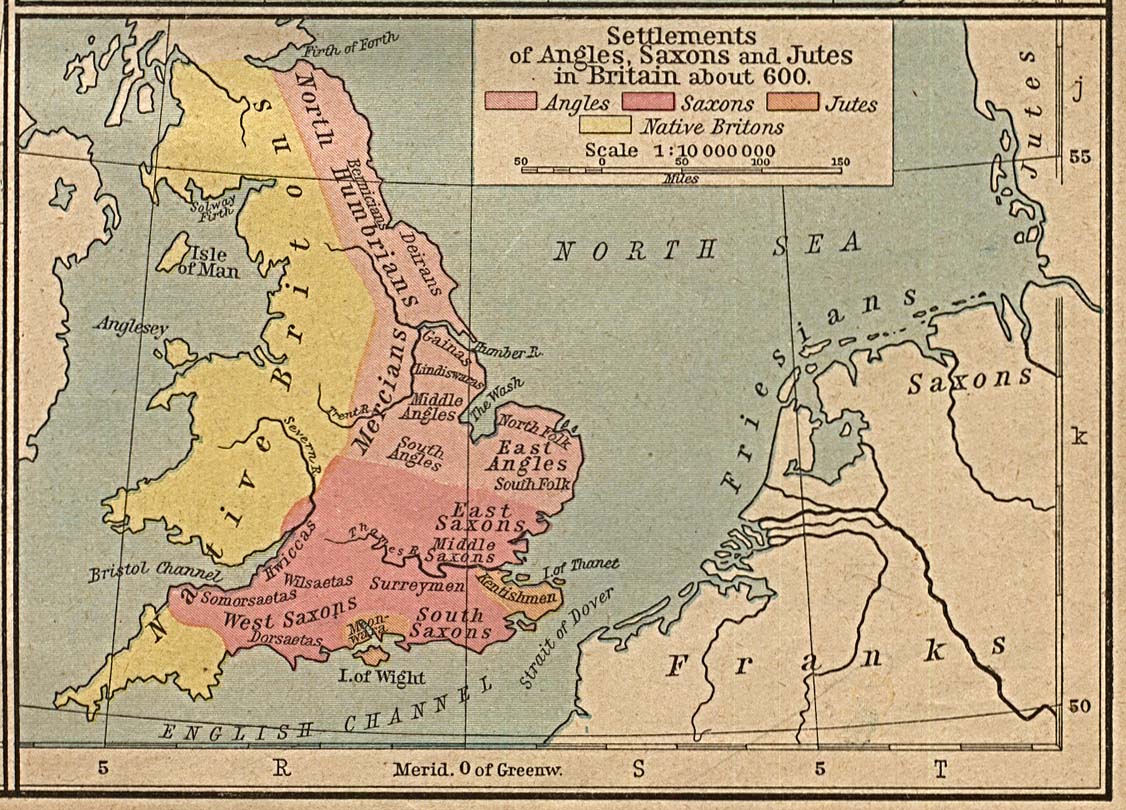
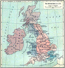 West Wales and Wessex in a map of the British Isles, 936
Cornwall was originally known as Kernow and this name applied to the Kingdom of Cornwall during the period of the Heptarchy (which referred to the separate kingdoms which made up Anglo-Saxon Ængla Land or England). To the Anglo-Saxons it was known as West Wales. (The Old English word Wealas, meaning "foreigners" in the sense of Britons, gave its name to Wales, and was also applied to Cornwall, as "West Wealas" meaning Western foreigners.) One of the oldest maps still in existence depicting Cornwall is the 1290 Hereford Mappa Mundi currently on display in Hereford Cathedral in the United Kingdom. Many maps of the British Isles prior to the 17th century showed Cornwall (Cornubia/Cornwallia/Kernow) as a nation on a par with Wales and examples include the maps of Sebastian Münster, Abraham Ortelius, and Girolamo Ruscelli. After the 17th century, maps of Cornwall tended to no longer make the distinction between Anglia and Cornubia, the British Sea was renamed the English Channel and Cornwall was no longer shown as a separate entity from England on maps of the British Isles.
Further reading
- The Old Series Ordnance Survey Maps of England and Wales (scale: 1 inch to 1 mile): a reproduction of the 110 sheets of the survey in early state ... Volume II; Devon, Cornwall & West Somerset; introduction by J. B. Harley and Yolande O'Donoghue. Lympne Castle, Kent: Harry Margary, 1977
See also
- Hundreds of Cornwall
- Cornish people
- List of topics related to Cornwall
- History of Cornwall
- The Wikipedia Cornwall Portal
- Maps of the UK and Ireland
External links
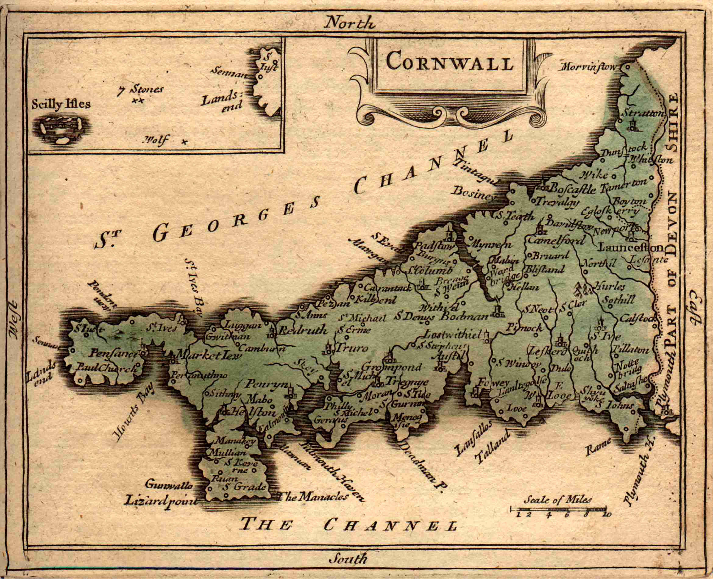
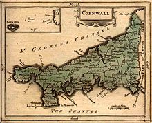 1783 map of CornwallCategories:
- History of Cornwall
- Maps of Cornwall
- Old maps of Cornwall
- Cornwall stubs
Wikimedia Foundation. 2010.