- Vargas (state)
-
Vargas State
Estado Vargas— State — 
Flag
Coat of armsMotto: Igualdad, Libertad, Propiedad y Seguridad.
(English: Equality, Liberty, Property and Security)Anthem: Vargas State Anthem Location within Venezuela Country  Venezuela
Created 1998 Capital La Guaira Government – Governor Jorge Luis García Carneiro (2008–2012) Area – Total 1,496 km2 (577.6 sq mi) Area rank 22nd 0.16% of Venezuela Population (2007 est.) – Total 332,900 – Rank 21st 1.29% of Venezuela Time zone UTC-04:30 ISO 3166 code VE-X Emblematic tree Uva de Playa (Coccoloba uvífera) Website www.estadovargas.gob.ve Vargas State (Spanish: Estado Vargas, IPA: [esˈtaðo ˈβarɣas]) is one of the 23 states of Venezuela. Named after Venezuela's first non-military president, José María Vargas, Vargas comprises a coastal region in the north of Venezuela, bordering Aragua to the west, Miranda to the east, the Caribbean Sea to the north and the Capital District to the south. It is home to both the country's largest seaport and airport. The state capital is La Guaira.
In 1999, the geographic center of Vargas state suffered major floods and landslides, known as La Tragedia de Vargas (the Vargas Tragedy), causing major losses of life and property, and resulting in forced population movements including the virtual disappearance of some small towns. Thousands died, and many more fled the area to other states.
Contents
History
This region of Venezuela has undergone important changes over the years, and while the geographical borders have remained, the territorial delineation has varied. The area was previously one of the departments of the Venezuela's Federal District (the other being the Libertador department, now Libertador Municipality), and the governor of this region was chosen by the national government. The area later evolved into a municipality, but was still dependent on the governor of the Federal District. In the 1990s there were increased calls for Vargas to become a separate entity, distinct from Caracas. In 1998 the government of Rafael Caldera decreed Vargas as an independent municipality, separate from the Federal District, with the statute of Federal Territory. Shortly after it became the 23rd state of Venezuela.
In mid-December 1999, after several days of ever-increasing rains pouring over the Central Mountain Range and the piedmont within the span of 24 hours along the coastline for about 45 km., the state suffered from massive floods which resulted in severe losses of life and property. In its wake as of December 16, the surviving population witnessed the massive destruction of most of the state infrastructure, including the collapse of most roads, bridges, housings, public and private buildings, and of basic services as electricity and communications; in which thousands were killed or missing. Official estimates some 50,000 dead or missing, but the real figure may be much higher. In the following weeks nearly the entire state's population was displaced. Locals refer to the Dec. 1999 disaster as "La Tragedia de Vargas" (the Vargas' Tragedy). Such climatic phenomenon (of extraordinarily high rainfall levels) appears to be periodical, having a cycle of about 70 years, and probably has occurred hundreds, perhaps thousands of times since a distant past.
Geography
Geology
The geology of the state corresponds with the Coast Mountain range. It has as geologic limit, the fault of La Victoria, where the rocks of the Gran Caracas group arise, on the igneous-Metamorphico plinth of the Sebastopol Complex of the inferior Paleozoic. Also they are located the formation: Peña de Mora of the Mesozoic, the Migmático Complex of Todasana of the superior Cretaceous, the formation of Las Pailas del plioceno tardío, and the Abisina formation composed by sea sediments.
Relief
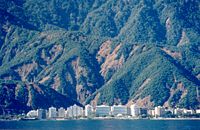
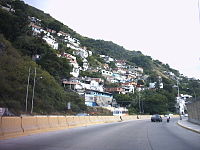
It is formed by one narrow coastal area on the Caribbean Sea, of about 160 km of length, that falls steeply to the sea. It compares to this line rises the mountainous area of the Coast, that reaches heights superior to the 2000 ms, being the hills, Agustín Codazzi (2 425m.s.n.m), and Naiguatá (2 765 m.s.n.m) as well as the Row of Avila.
 La Guaira from El Cerro el Ávila
Climate
The climate is classified as tropical and warm. The annual average temperature oscillates between 25,6º and 27º Celsius. According to the climatic classification of Koeppen, the climate is of steppe characterized by dryness, because the evaporation surpasses precipitations. Annual precipitation varies from 1530 to 900 mm.
Hydrography
The water obstacles that end to the sea are of low volume, short passage and torrential behavior. Between the rivers, they emphasize: Chuspa, Caruao, Todasana, San José de Macuto, Mamo, Los Caracas, Osma, La Sabana, Maya, Chichiriviche, Oricao, Limón, Naiguatá and San Julián.
Vegetation
The dry-tropical forest forms a parallel strip to the coast, with species like: cují, dividivi, araguaney, indio desnudo, ceiba, caro-caro, almendron, mango, and jabillo, among many others.
Geopolitical division
 Guipuzcoana House seat of the state government
In 1825, La Guaira conforms the Province of Caracas. In 1850, Maiquetía is created. In 1864, La Guaira and Maiquetía form a District. In 1872 is created the Federal District and in 1904 is divided in two parts, one of them of the Vargas Department. In 1986 Vargas is declared independent municipality, but part of the Federal District. In 1998 the state is created. At the moment it divides in one municipality and eleven parishes.
- Vargas State covers a total surface area of 1,497 km².
Municipality
- Vargas (La Guaira)
Parishes
- Caraballeda
- Carayaca
- Carlos Soublette (Maiquetía)
- Caruao (La Sabana)
- Catia La Mar
- El Junco
- La Guaira
- Macuto
- Maiquetía
- Naiguatá
- Raul Leoni (Catia La Mar)
Law and government
- State government: The constitution of Venezuela specifies that the state government is divided into executive and legislative branches. The executive government is directed by the governor, while the legislative government is managed by the Legislative council. The Governor of Vargas is the head of the executive power of the state. According to the 160 article of the Constitution of Venezuela, the governor must be Venezuelan, greater of twenty-five years and Secularity state, is chosen by a four years term, by simple majority, and can be reelected by another period.
- Municipal government: The constitution of Venezuela specifies that municipal governments be divided into executive and legislative branches. The executive government of the municipality is governed by the mayor, while the legislative government is managed by the Municipal council.
Economy
The main economic activity of the state has turned around the Harbor and the Airport. Additionally to these primary activities, before the 1999 Tragedy, the state had an intense local and foreign visitor activity, with growing investment in residential areas, social clubs, Hotels, Restaurants and other facilities.
- Since the 1999 tragedy, many of these investments have come down, the value of the property and land has lowered, and many hotels, restaurants, and tourist facilities have disappeared.
- The slow recovery and/or rebuilding of destroyed roada and services, the enormous difficulties of transportation of people and goods, and the overall status of insecurity that ensued after the tragedy greatly affected many industries, many shops, stores, offices and social clubs disappeared or were closed, the major hotels closed down, and hundreds of thousands of jobs were lost. As a consequence, the tourism industry has all but disappeared.
La Guaira Harbor: is the second port of Venezuela, in order of traffic and payload volumes, and constitutes the front door of consumer goods, destined to the metropolitan area of Caracas and the states: Vargas, Miranda and Aragua.
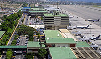
Simon Bolivar International Airport, Maiquetia: is located in Maiquetía, Venezuela, about 13 miles from Downtown Caracas, the capital of Venezuela. Simply called 'Maiquetia' by the local population, this is the most important airport of the twelve international airports in Venezuela, it handles flights to & from many important cities in the Americas, the Caribbean and Europe.
Sites of interest
Beaches
- Aeropuerto
- Caruao
- La Punta
- Marina Grande
- Punta Care
- Anare
- Catia La Mar
- La Sabana
- Naiguatá
- Quebrada Seca
- Arrecífe
- Chichiriviche
- La Salina
- Oricao
- San Luis
- Bahía Marina
- Chuspa
- La Zorra
- Oritapo
- Sheraton
- Bikini
- Círculo Militar
- Larga
- Osma
- Taguao
- Buchón
- El Burro
- Los ángeles
- Pantaleta
- Tarma
- Camurí Chico
- El Chorrito
- Los Caracas
- Paraíso
- Todasana
- Candileja
- El Farallón
- Los Cocos
- Puerto Carayaca
- Urama
- Caribito
- Escondida
- Macuto
- Puerto Cruz
- Verde
Culture
Folklore
The Afro-Venezuelan music is the representation par excellence of all this region, the main folkloric celebrations where the drums and the joy of the population present, are:
- Biblical Magi (January 6). Christianity in the Vargas state celebrates the Magi on the day of Epiphany, January 6, the last of the twelve days of Christmas, with the name of the three kings ("Los Tres Reyes Magos"), receive wish letters from children and magically bring them gifts on the night before Epiphany.
- Virgin of La Candelaria day (February 2). The Celebrations of th Virgin of La Candelaria, is conformed by the conducts of popular faith, dances and cultural manifestations, disguises, masks and bands who lead expressions festive sensitivity.
- The Burial of the Sardine (From February 7 to February 12). Like all festive period, the Carnival has a beginning and an end, before the Lent, the citizens burns a symbolic doll.
- Saint Joseph day (March 19). As so many other traditions in the Vargas state, the celebration of Saint Joseph day is commemorated on March 19.
- Virgin of El Carmen day (July 16). Masses, processions, and celebrations, unites the devotee people of the Virgin of El Carmen, each July 16.
- Our Lady of Coromoto (celebrated three times in the year, February 2, February 8 and September 11). The Venezuelan people celebrate to their spiritual pattern in three occasions every year, February 2, February 8 and September 11. The National Sanctuary of the Virgin of Coromoto, place of encounter of great peregrinations, was declared Basilic by the Pope Pius XII, on May 24, 1949.
- Feast of the Holy Innocents (December 28). The Catholic Church commemorates the eighth day of the birth of Jesus, with the death of the Holy Innocents, in honor to the children assassinated by order of the King Herod. In Venezuela and the Vargas state, December 28 is a day for pranks, equivalent to April Fool's Day in many countries. Prank victims are called innocentes.
- Saint John the Baptist day (June 24). In Venezuela, the celebartions in honor to Saint John the Baptist have singular importance from the colonial time to the present, mainly in those Afro-Venezuelan populations.
Historical seats
- Guipuzcoana house: This imposing colonial construction, was constructed between 1734 and 1736 by instructions of the King Felipe V, the specific function of the Guipuzcoana Company consisted in the defense of the coasts and commerce of Venezuela. It is now the current seat of the Vargas state government.
- San Carlos Fort: Its construction dates from 1769, according to the project of the Miguel Roncalí, the Count of Roncalí. Nevertheless, for its construction were used the foundations and some parts of another fort that according to Enrique Rivodo existed from 1604. The fort is designed in star form, was designated National Historical Monument in 1876.
- El Vigía Fort: Was constructed at the beginning of the 18th century, by Don Francisco Alberreo. Thence they announced with the sound of bells and hoisting flags, the arrival of the ships to the port, its view is impressive.
- Colonial zone of La Guaira: On June 29, 1589, Don Diego de Osorio y Villegas found the population of San Pedro de la Guaira, nowadays this colonial constructions, with their facades and ample windows can be appreciated in this beautiful parish.
Vargas Coast and its beaches
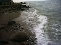
From the heights of El Ávila we can contemplate the winding coastline of the Caribbean fringed by royal palm trees. A few kilometres out of Caracas are the extensive beaches of the central coastline: Playa Grande, Catia La Mar, Macuto, Caraballeda, El Palmar, Naiguatá and Anare, however a walk around the central coast must begin at La Guaira, which since its foundation has been the port of Caracas.
La Guaira, together with its varied maritime and commercial activities has preserved the atmosphere of the colonial period. The forts of El Vigía and La Pólvora remind us the time when the city had to defense itself against the attacks of pirates and buccaneers. It could be said that history always came to La Guaira, for better or for worse, via the sea. The wealth that reached it through its port also attracted pirates who devastated it, sacking the town on many occasions.
Among the remains of the colonial period, La Guaira has preserved the following noteworthy monuments: Guipuzcoana house, Bolívar street, the San Carlos fort, the Guamacho and Muchinga gangways, the Pasaje Urrutia, and the Puente Jesús.
This state and its capital, are land of sailors, where the women tell of loneliness and where the men tell of sea-fairing and storms.
Reference: The coast and its beaches, by Maurice Wiesenthal, article appeared in the book Caracas, published in 1981.
Gallery
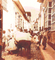
Old photos of Vargas state
See also
- Venezuela
- States of Venezuela
- 1999 Vargas mudslide catastrophe
References
- History
- Geography
- Geopolitical division
- Law and government— State government
- Law and government— Municipal government
- Economy
- Sites of interest
- Folklore
- Historical seats
Capital District 
States Dependencies Regions Claimed Categories:- Vargas (state)
- States of Venezuela
- States and territories established in 1998
Wikimedia Foundation. 2010.

