- Haut-Intyamon
-
Haut-Intyamon Country Switzerland 
Canton Fribourg District Gruyère 46°0′N 7°3′E / 46°N 7.05°ECoordinates: 46°0′N 7°3′E / 46°N 7.05°E Population 1,433 (Dec 2009)[1] - Density 24 /km2 (61 /sq mi) Area 60.44 km2 (23.34 sq mi) Elevation 763 m (2,503 ft) Postal code 1669 SFOS number 2121 Localities Albeuve, Lessoc, Montbovon, Neirivue Surrounded by Bas-Intyamon, Blonay (VD), Château-d'Œx (VD), Châtel-Saint-Denis, Grandvillard, Gruyères, Montreux (VD), Rossinière (VD), Semsales, Veytaux (VD) Website www.haut-intyamon.ch
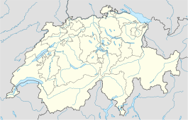
SFSO statisticsView map of Haut-Intyamon High-Intyamon is a municipality in the district of Gruyère in the Canton of Fribourg in Switzerland. The municipalities of Albeuve, Lessoc, Montbovon and Neirivue formed it on January 1, 2002.
The Lake Lessoc tank on the Saan river is located in the municipality.
References
- ^ Swiss Federal Statistical Office, MS Excel document – Bilanz der ständigen Wohnbevölkerung nach Kantonen, Bezirken und Gemeinden (German) accessed 25 August 2010
Bas-Intyamon | Botterens-Villarbeney | Broc | Bulle | Cerniat | Charmey | Châtel-sur-Montsalvens | Corbières | Crésuz | Echarlens | Grandvillard | Gruyères | Haut-Intyamon | Hauteville | Jaun | Marsens | Morlon | Le Pâquier | Pont-en-Ogoz | Pont-la-Ville | Riaz | La Roche | Sâles | Sorens | Vaulruz | Vuadens
Fribourg | Districts of Canton Fribourg | Municipalities of the canton of Fribourg
 Categories:
- Municipalities of the canton of Fribourg
- Municipalities of Switzerland
- Freiburg region geography stubs
Wikimedia Foundation. 2010.

