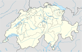
- Charmey
-
Charmey Country Switzerland 
Canton Fribourg District Gruyère 46°37′N 7°10′E / 46.617°N 7.167°ECoordinates: 46°37′N 7°10′E / 46.617°N 7.167°E Population 1,829 (Dec 2009)[1] - Density 23 /km2 (60 /sq mi) Area 78.44 km2 (30.29 sq mi) Elevation 887 m (2,910 ft) - Highest 2389 m - - Lowest 800 m - Postal code 1637 SFOS number 2127 Surrounded by Bas-Intyamon, Broc, Cerniat, Château-d'Œx (VD), Crésuz, Grandvillard, Gruyères, Jaun, Plaffeien, Rougemont (VD), Saanen (BE) Twin towns Orphin (France) Website www.charmey.ch
SFSO statisticsView map of Charmey Charmey is a municipality in the district of Gruyère in the canton of Fribourg in Switzerland.
The lake Schwarzsee/Lac Noir is located partially in the municipality.
References
- ^ Swiss Federal Statistical Office, MS Excel document – Bilanz der ständigen Wohnbevölkerung nach Kantonen, Bezirken und Gemeinden (German) accessed 25 August 2010
Bas-Intyamon | Botterens-Villarbeney | Broc | Bulle | Cerniat | Charmey | Châtel-sur-Montsalvens | Corbières | Crésuz | Echarlens | Grandvillard | Gruyères | Haut-Intyamon | Hauteville | Jaun | Marsens | Morlon | Le Pâquier | Pont-en-Ogoz | Pont-la-Ville | Riaz | La Roche | Sâles | Sorens | Vaulruz | Vuadens
Fribourg | Districts of Canton Fribourg | Municipalities of the canton of Fribourg
 Categories:
- Municipalities of the canton of Fribourg
- Municipalities of Switzerland
- Spa towns in Switzerland
- Canton of Fribourg geography stubs
Wikimedia Foundation. 2010.


