- Rabah Bitat Airport
-
Rabah Bitat Airport
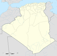
El Mellah AirportIATA: AAE – ICAO: DABB Location of airport in Algeria Summary Airport type Public Operator EGSA-Constantine Serves Annaba, Algeria Elevation AMSL 5 m / 16 ft Coordinates 36°49′45.7″N 007°48′50.2″E / 36.829361°N 7.813944°E Runways Direction Length Surface m ft 01/19 3,000 9,843 Asphalt 05/23 2,290 7,513 Asphalt Sources: AIP [1] and DAFIF [2][3] Rabah Bitat Airport (IATA: AAE, ICAO: DABB), formerly known as Les Salines Airport, and popularly as El Mellah Airport is an international airport located 9 km south of Annaba, a city in Algeria.[1] It is named after Rabah Bitat, a president of Algeria (1978-1979).
Contents
Facilities
Terminal
The terminal has an annual capacity of 500,000 passengers.
A project to build a new international terminal has been awarded to the Egyptian company Arab Contractor. The terminal should be completed in 2007, leaving the existing one for hajj flights and peak season charters to Europe.
Statistics
2001 2002 2003 2004 2005 Passengers Total 416,022 435,451 349,008 348,503 360,121 Domestic 316,751 331,580 239,114 247,855 250,285 International 99,271 103,871 109,894 100,648 109,836 Freight Total 302.750 357.270 329.148 328.180 359.217 Domestic 185.532 180.773 147.519 215.883 237.124 International 117.218 176.497 181.629 112.297 122.093 Aircraft movements Total 9,060 6,468 6,071 5,995 6,203 Domestic 8,089 5,439 4,849 4,893 5,041 International 971 1,029 1,177 1,102 1,162 Airlines and destinations
Airlines Destinations Aigle Azur Marseille, Paris-Charles de Gaulle, Paris-Orly Air Algérie[4] Algiers, Djeddah, In Amenas, Lyon, Madinah, Marseille, Nice, Oran, Paris-Charles-de-Gaulle, Paris-Orly Saudi Arabian Airlines Seasonal: Djeddah, Madinah Tassili Airlines Alger, El Oued, Hassi Messaoud, In Salah, Tamanrasset World War II
During World War II the airport was known as Bone Airfield, and was used by the German Luftwaffe. Later captured by the United States Army, the USAAF Twelfth Air Force in the Western Desert Campaign in 1942-1943.
References
- ^ a b AIP and Chart from Service d'Information Aéronautique - Algerie (French)
- ^ Airport information for DABB at World Aero Data. Data current as of October 2006.Source: DAFIF. Retrieved 2007-09-24.
- ^ Airport information for AAE / DABB at Great Circle Mapper. Source: DAFIF (effective Oct. 2006). Retrieved 2007-11-26.
- ^ "Air Algérie Route Map". http://www.airalgerie.dz/routemap.jsp?lang=. Retrieved January 22, 2011.
External links
Categories:- Airports in Algeria
- Proposed airport expansion
Wikimedia Foundation. 2010.

