- Kentucky Route 676
[
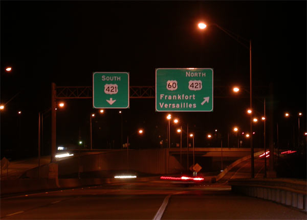
left|280px|thumb
Eastbound terminus view at the US 60SPUI interchange. The road continues as US 421.] Infobox road
state=KY
type=KY
route=676
alternate_name=East-West Connector
maint=KYTC
maint_abbrev=KYTC
length_mi=5.287
length_round=3
length_ref= [cite web|url=http://transportation.ky.gov/planning/reports/SPRS_listings/listings/franklin.pdf |title=State Primary Road System in Franklin County |format=PDF |publisher=Kentucky Transportation Cabinet |date=December 2 ,2004 |accessmonthday=March 9 |accessyear=2007 ]
established=
direction_a=West
starting_terminus=
junction=
direction_b=East
ending_terminus=
counties=Franklin
cities=Frankfort
previous_type=KY
previous_route=674
next_type=KY
next_route=677Kentucky Route 676 (KY 676) is a
Kentucky State Highway located almost entirely within the city limits of Frankfort. The four-lane divided highway is locally known as the East-West Connector.Because Frankfort is bisected by the steep gorge of the
Kentucky River , east-west transportation through the city was historically a challenge. The road was built mainly to divert local traffic between the two sides of Frankfort from congested and sometimes hazardous local streets. Its western terminus is at US 127 on the west side of Frankfort, just north of that road's interchange withInterstate 64 . The road steeply descends to the river, briefly exiting the city limits just before it crosses the river in unincorporated Franklin County. Immediately after crossing the river, the road reenters Frankfort and ascends toward Its eastern terminus at asingle-point urban interchange with US 60 and US 421.References
External links
*
Wikimedia Foundation. 2010.