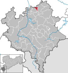
- Mylau
-
Mylau 
Coordinates 50°37′0″N 12°16′0″E / 50.616667°N 12.266667°ECoordinates: 50°37′0″N 12°16′0″E / 50.616667°N 12.266667°E Administration Country Germany State Saxony Admin. region Chemnitz District Vogtlandkreis Mayor Christoph Schneider (CDU) Basic statistics Area 4.73 km2 (1.83 sq mi) Elevation 305 m (1001 ft) Population 2,818 (31 December 2010)[1] - Density 596 /km2 (1,543 /sq mi) Other information Time zone CET/CEST (UTC+1/+2) Licence plate V Postal code 08499 Area code 03765 Website www.mylau.de Mylau is a town in the Vogtlandkreis district, in the Free State of Saxony, Germany with 2912 citizens. It is situated in the valleys of the Göltzsch river and the Raumbach, a stream flowing from Reichenbach im Vogtland that is locally known as the Soap Stream (German: Seifenbach) because of the textile painting factories that had been built by its banks. The town lies 6 km southeast of Greiz, and 20 km southwest of Zwickau.
Contents
History
In the 14th century, a settlement was built at the foot of Mylau Castle (1180). Emperor Charles IV granted town privileges in 1376. Until late in the 17th century, the town was reasonably insignificant; in 1650 it was composed of only 24 houses. It then grew rapidly because of a rise of manual weaving craftsmanship in the area, which facilitated the rapid development of the textile industry in the 19th century.
Population growth (as of 1960, the poll date is December 31):
- 1706: 900
- 1834: 2393
- 1871: 4449
- 1890: 6353
- 1910: 7957
- 1925: 7166
- 1933: 7375
- 1939: 6986
- 1946: 7562
- 1950: 7234
- 1960: 6668
- 1964: 6393
- 1971: 6087
- 1990: 3658
- 1998: 3364
- 1999: 3328
- 2000: 3316
- 2001: 3202
- 2002: 3119
- 2003: 3080
- 2004: 3013
- 2005: 2979
- 2007: 2889
- 2008: 2878
- 2009: 2858
- Data before 1998: Digitales Historisches Ortsverzeichnis von Sachsen
Data since 1998: Statistisches Landesamt Sachsen
Sites of interest
Mylau Castle was built in 1180 at the place where the Raumbach flows into the Göltzsch river, and is still intact. One kilometer to the northwest of the town the world-famous Göltzsch Viaduct crosses the Göltzsch valley. Also worth visiting is the city church St. Wenzel established in 1890, which includes a Gottfried Silbermann organ built in 1730/1731).
See also
 Media related to Mylau at Wikimedia Commons
- Municipal Web site (German)
- City information (German)
- Digitales Historisches Ortsverzeichnis von Sachsen (Digital Historic City Directory of Saxony) (German)
References
- ^ "Bevölkerung des Freistaates Sachsen jeweils am Monatsende ausgewählter Berichtsmonate nach Gemeinden" (in German). Statistisches Landesamt des Freistaates Sachsen. 31 December 2010. http://www.statistik.sachsen.de/download/010_GB-Bev/Bev_Gemeinde.pdf.
Adorf | Auerbach | Bad Brambach | Bad Elster | Bergen | Bösenbrunn | Eichigt | Ellefeld | Elsterberg | Erlbach | Falkenstein | Grünbach | Heinsdorfergrund | Klingenthal | Lengenfeld | Limbach | Markneukirchen | Mühlental | Mühltroff | Muldenhammer | Mylau | Netzschkau | Neuensalz | Neumark | Neustadt | Oelsnitz | Pausa | Plauen | Pöhl | Reichenbach im Vogtland | Reuth | Rodewisch | Rosenbach | Schöneck | Steinberg | Theuma | Tirpersdorf | Treuen | Triebel | Weischlitz | Werda | Zwota Categories:
- Towns in Saxony
- Saxony geography stubs
Wikimedia Foundation. 2010.


