- Mount Makaturing
-
Makaturing Location of Makaturing volcano in the Philippines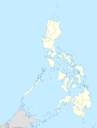

Elevation 1,940 m (6,365 ft) Location Location  Philippines
Coordinates 7°39′N 124°19′E / 7.65°N 124.317°ECoordinates: 7°39′N 124°19′E / 7.65°N 124.317°E Geology Type Stratovolcano Last eruption 1882
Makaturing, is a stratovolcano on Mindanao island in the Philippines. It is found in the province of Lanao del Sur (particularly in the town of Butig) in the Autonomous Region in Muslim Mindanao. Makaturing has an elevation of 1,940 metres (6,365 ft) and a base diameter of 29 km (18 mi). It is part of a string of volcanos called the Central Mindanao Arc.Contents
Eruptions
There is still some controversy on the number of times Makaturing erupted. The Philippine Institute of Volcanology and Seismology lists 10 eruptions with the last one occurring on March 18, 1882. But the Smithsonian Institution's Global Volcanology Program, citing the Catalog of Active Volcanoes of the World (Neumann van Padang, 1953), suggests that some eruptions were actually those of neighboring Ragang volcano.
Makaturing is one of the active volcanos in the Philippines. All are part of the Pacific Ring of Fire.
Trivia
On May 18, 1947, Philippine Air Force (PAF) commander Gen. Edwin Andrews died with 16 others when the C-47 transport plane carrying them crashed in Makaturing. Nine years later, the PAF established an air base in Zamboanga City and is now named the Edwin Andrews Air Base from where the Philippine military launches air support operations in the ongoing campaign against separatists.
See also
- Active volcanos in the Philippines
- Potentially active volcanos in the Philippines
- Inactive volcanos in the Philippines
- Philippine Institute of Volcanology and Seismology
- Volcano
References
Categories:- Stratovolcanoes
- Subduction volcanoes
- Volcanoes of Mindanao
- Mountains of the Philippines
- Active volcanoes
- Autonomous Region in Muslim Mindanao
- Lanao del Sur
- Active volcanoes of the Philippines

Wikimedia Foundation. 2010.