- Congrove Field and The Tumps
-
Congrove Field and The Tumps Site of Special Scientific Interest 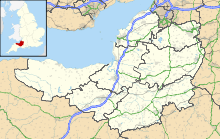
 Shown within Somerset
Area of Search Avon Grid reference ST713698 Coordinates 51°25′35″N 2°24′51″W / 51.42647°N 2.41418°WCoordinates: 51°25′35″N 2°24′51″W / 51.42647°N 2.41418°W Interest Biological Area 30.8 acres (0.125 km2; 0.0481 sq mi) Notification 1991 Natural England website Congrove Field and The Tumps is a (grid reference ST713698) is an 12.5 hectare biological Site of Special Scientific Interest (SSSI) on Lansdown Hill, north of Bath in Bath and North East Somerset, notified in 1991.
It is an area of calcareous grassland lying over Oolitic (Jurassic) Limestone covered by shallow, well-drained soils. The Tumps is above Congrove Field, and is believed to be the site of mining activities in the past. The grassland communities present are of the Tor-grass (Brachypodium pinnatum) type showing elements of both the Meadow Oat-grass-wild thyme (Avenula pratensis)–(Thymus praecox) and the Knapweed-Rough Hawkbit (Centaurea nigra)–(Leontodon hispidus) variants.[1]
References
- ^ "Congrove Field and the Tumps, Lansdown". SSSI citation sheet. English Nature. http://www.english-nature.org.uk/citation/citation_photo/1006283.pdf. Retrieved 2008-10-22.

This article about a Site of Special Scientific Interest is a stub. You can help Wikipedia by expanding it.
