- Noccundra, Queensland
-
Noccundra
Queensland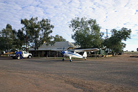
Noccundra Hotel, July 2010
 Noccundra
Population: 4 Established: 1882 Postcode: 4492 Location: - 1146 km (712 mi) W of Brisbane
- 339 km (211 mi) W of Cunnamulla
- 143 km (89 mi) W of Thargomindah
- 217 km (135 mi) E of Innamincka
LGA: Shire of Bulloo Federal Division: Maranoa Noccundra is a township in south western Queensland, Australia. It is on the banks of the Wilson River 145 kilometres from and 80 kilometres west of Thargomindah[1][2] and contained within the pastoral holding of Nockatunga Station.[3] The town was established in 1882 with the construction of the Noccundra Hotel which is also known as the Noccundra Pub.[4][2]
The hotel is Noccundra's only occupied building, housing a permanent population of four.[4] The stone hotel building is heritage listed. An airstrip is behind the hotel.[1][2]
Andrew Hume's ill fated expedition, to rescue long term survivors of Leichhardt's 1848 expedition, perished of thirst to the west of Noccundra.[4][5] Today a memorial to Hume is on the western side of the hotel.[2]
References
- ^ a b Noccundra Hotel. Environmental Protection Agency. Retrieved on 13 August 2011
- ^ a b c d Noccundra, Bulloo Shire (accessed 7th July 2006)
- ^ "Noccundra Hotel lease up for sale". Australian Broadcasting Corporation. 2006-06-20. http://www.abc.net.au/news/items/200606/1666904.htm?westqld. Retrieved 2006-07-07.
- ^ a b c Noccundra, Outback Queensland Tourism Authority (accessed 7th July 2006)
- ^ Wright, John, The Cork VC, Emigrant Online: News for the Global Irish Community
- Noccundra, Queensland is at coordinates 27°49′03″S 142°35′21″E / 27.817614°S 142.589085°ECoordinates: 27°49′03″S 142°35′21″E / 27.817614°S 142.589085°E
Categories:- Towns in Queensland
- Queensland geography stubs


Wikimedia Foundation. 2010.