- Thousand Islands Bridge
Infobox Bridge
bridge_name = Thousand Islands Bridge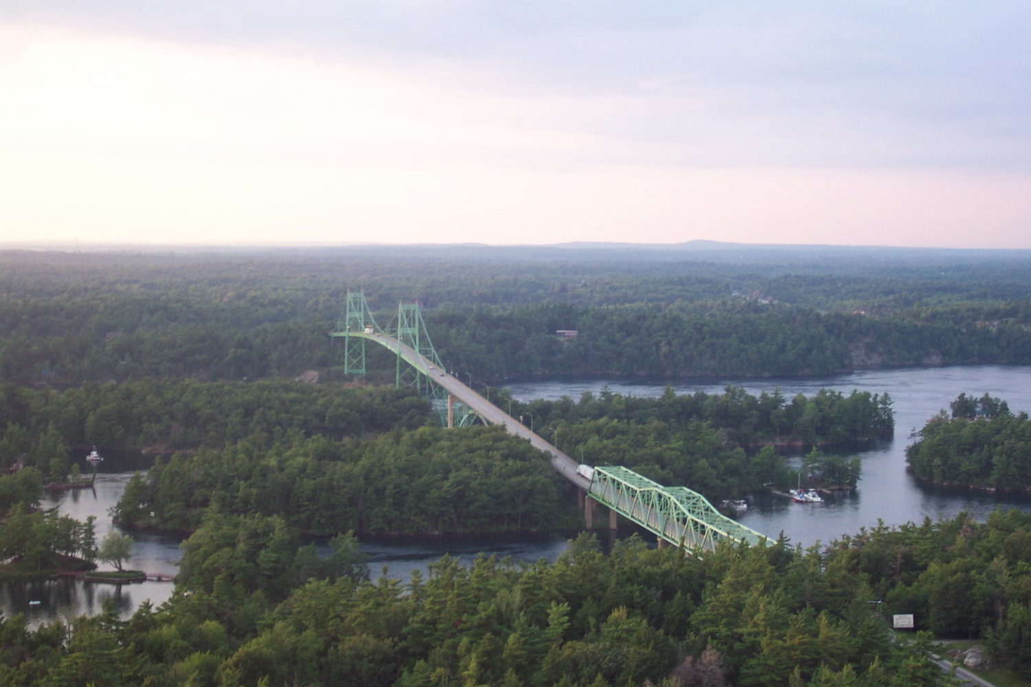
caption = A view of the Canadian side of the bridge system from an observation tower just before the border crossing.
official_name = The Thousand Islands Bridge system
carries = Automotive traffic
crosses =Saint Lawrence River
locale =Wellesley Island ,New York ,United States toHill Island ,Ontario ,Canada
maint = Thousand Island Bridge Authority
id =
design = suspension & truss bridge [cite web |url=http://www.tibridge.com/facts.htm |title=Thousand Islands Bridge Facts |accessdate=2008-05-29]
mainspan = American suspension: convert|800|ft|m|abbr=on
Canadian suspension: convert|750|ft|m|abbr=on
Canadian truss: convert|600|ft|m|abbr=on
length = Total: convert|8.5|mi|km|abbr=on
width =
height =
load =
clearance =
below =U.S.: convert|150|ft|m|abbr=on
Canada: convert|120|ft|m|abbr=on
traffic =
begin = April 30, 1937
complete =
open = 1937
closed =
toll = Varies $2.50–$13.50 (USD or CAD) [cite paper | first = Robert | last = G. Horr the Third | author = Robert G. Horr, III | title = Thousand Islands Bridge Authority Toll Rate Classification Schedule | date =1 November 2007 | url = http://www.tibridge.com/rate%20sheet.pdf | format =PDF | accessdate = ]
map_cue =
map_
map_text = Map of Thousand Island bridge and surrounding area
map_width = 250px
coordinates = coord|44|20|50.71|N|75|59|0.6|W|display=inline,title|name=Thousand Islands Bridge
lat =
long = The Thousand Islands Bridge is an international bridge over theSaint Lawrence River connecting northernNew York in theUnited States with southeasternOntario inCanada . Constructed in 1937, with additions in 1959, the bridge spans theUnited States-Canada border in the middle of theThousand Islands region, from which it derives its name. The bridge is administered by the Thousand Islands Bridge Authority, an international agency.The actual international border bridge crossing is between
Wellesley Island in the United States and Hill Island in Canada.Structure
The bridge is actually not a single bridge but rather a series of bridges that span parts of the St. Lawrence River, ultimately connecting both banks. The southern end of the bridge connects with
Interstate 81 and the northern end of the bridge connects to Highway 401 via Highway 137. There is also an interchange with theThousand Islands Parkway on the Ontario side.Future
Thousand Island Bridge Authority is conducting a study among other things, determine when the bridge will reach its operational limits and how to reduce delay on the bridge. [cite web |url=http://www.tibridge.com/study/index.htm |title=Thousand Island Bridge Study |accessdate=2008-05-29]
Gallery
Footnotes
ee also
*
List of crossings of the Saint Lawrence River *
Dewolf Point State Park External links
* [http://www.tibridge.com/ Thousand Islands Bridge Authority]
* [http://www.empirestateroads.com/week/week65.html Aerial photos of the Thousand Island Bridge System]
* [http://www.1000islandsphotoart.com/Albums/tabid/55/AlbumId/37/Default.aspx/ Ian Coristine's Thousand Islands Canadian Span & Area Gallery]Crossings navbox
structure = Bridges
place =St. Lawrence River
bridge = Thousand Islands Bridge
bridge signs =
upstream =Lake Ontario
upstream signs =
downstream =Ogdensburg-Prescott International Bridge
downstream signs =
Wikimedia Foundation. 2010.