- Itajaí
Infobox City
official_name = Itajaí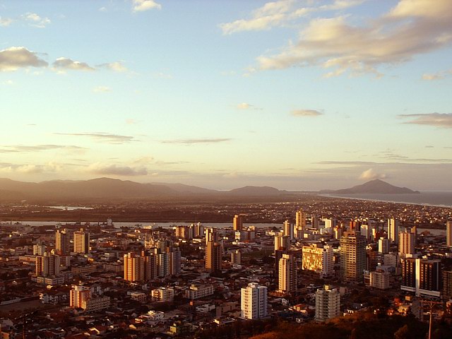
image_caption = Partial view of Itajaí
image_
mapsize = 250px
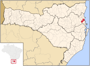
map_caption = Location of Itajaí
pushpin_
subdivision_type = Country
subdivision_type1 = Region
subdivision_type2 = State
subdivision_name = flagicon|BRABrazil
subdivision_name1 = Southern
subdivision_name2 = flagicon|Santa Catarina Santa Catarina
leader_title =Mayor
leader_name = Volnei Morastoni
leader_party = PT
area_note =
area_total_km2 = 289.255
area_total_sq_mi = 112.11
data_pop = est. 2007
population_total = 160,639
population_density_km2 = 581.1
population_density_sq_mi = 1432.8
timezone = UTC-3
utc_offset = -3
timezone_DST = UTC-2
utc_offset_DST = -2
elevation_m = 2
latd = 26
latm = 54
lats =
latNS = S
longd = 48
longm = 40
longs =
longEW = W
longs=
established_title = Incorporated
established_date =June 15 , 1860
footnotes =|Itajaí is a
Brazil iancity in the state of Santa Catarina.History
The city was founded on June 15, 1860, but the colonization of Itajaí started in 1658, when the Paulista João Dias D’Arzão arrived in the region. In 1750, Portuguese colonists coming from
Madeira and theAzores made this region their home. By 1823 it became a prominent region for Portuguese settlers and, at the end of theXIX century , received a great number of Germanimmigrants .Geography
Itajaí is located on the Northern coast of the state, specifically on the banks of the river
Rio Itajaí-Açu ("where the origin of the name comes from"). Itajaí borders neighboring citiesBalneário Camboriú ,Camboriú ,Brusque ,Gaspar ,Ilhota andNavegantes . It is also home to the biggest fishing port in the country (second biggest port in the nation) and the second biggest university in the state, the Univali.Itajaí is located on the base
Baixo Vale do Itajaí , and to its coast, theAtlantic Ocean . It is also situated at the opening to the Itajaí-Açu, making the existence of the port possible.The city is basically a plain — being at sea-level — and a great deal of the native vegetation has been removed for commercial activities and urban expansion. Itajaí is an incorporated
city of the Metropolitan Region of the Itajaí River, as well as its neighboring cities.Itajaí is also home to one of the biggest popular Brazilian music festivals in the nation. The festival happens every September and reunites musicians and artists from around the country. These encounters are a display of the rich culture of Itajaí.
Highway
BR-101 is the main highway that passes by the city, and highways SC-100, SC-486, SC-470, andBR-470 , connect Itajaí to the rest of the state.Ethnic Groups
The majority of the population are descendants of
Azoreans andGermans . A cultural mix of Germans and Portuguese is also a mark of the city.Port of Itajaí
The port of Itajaí is the main port of Santa Catarina and the second largest of the country, exports almost all of the products of the state.
Tourism
Itajaí has many beautiful
beaches , among them are the Molhes, Atalaia, Jeremias, Cabeçudas, Morcego, Praia Brava and Solidão. The city also has ample rural areas and a beautiful natural landscape, with a rich heritage of Portuguese and German immigrants.Itajaí has a píer for passenger vessels that serves to assist the coast of Santa Catarina and for customs, that returns the ships by laser. TheMarejada , a Portuguese festival of fishing and seafood, is the principal festival of the city, showcasing attractions relative to the ocean and the Azores. Itajaí is also the hub of Nautical Club Marcílio Dias, a sport association for bothsoccer /football and competitive rowing.ister Cities
Itajaí has the following
Sister Cities :External links
* [http://www.itajai.com.br/ The City of Itajaí Website]
* [http://www.portoitajai.com.br/ The Port of Itajaí Website]


Wikimedia Foundation. 2010.