- Bert T. Combs Mountain Parkway
-
Bert T. Combs Mountain Parkway
Route information Length: 75.627 mi[1] (121.710 km) Major junctions West end:  I-64 near Winchester
East end:  US 460 near Salyersville
Location Counties: Clark, Powell, Wolfe, Morgan, Magoffin Highway system The Bert T. Combs Mountain Parkway, commonly known as the Mountain Parkway, is a freeway in eastern Kentucky. It was built in the early 1960s and opened in January 1963 as Kentucky's second toll road running from Interstate 64 just east of Winchester southeast for 75.627 miles (121.710 km) to a junction with U.S. Route 460 near Salyersville. The first 43 miles (69 km), beginning at the western terminus in Winchester is a four-lane limited access highway with only minor design standard differences from an Interstate Highway, while the remainder is a limited access Super 2 highway.
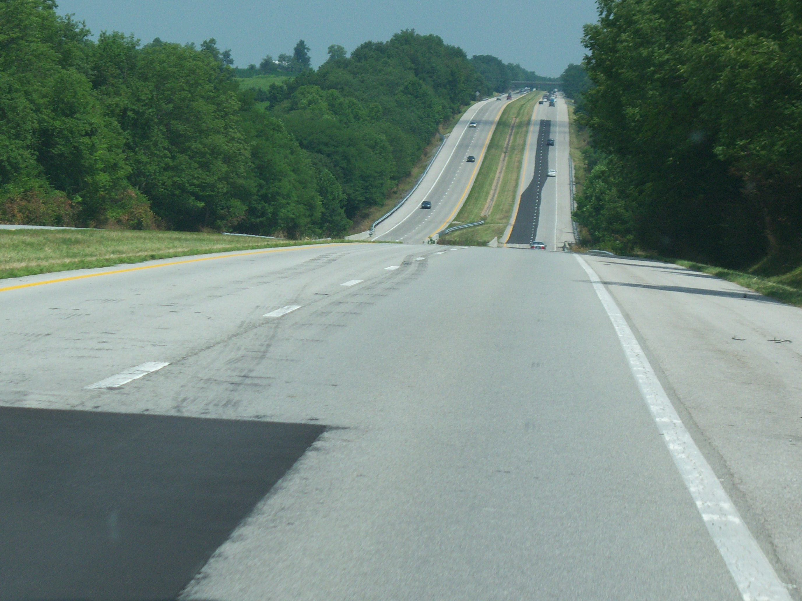
 A large portion of the parkway is four lanes wide
The route was originally signed only as the 'Mountain Parkway'. In the late 1970s, the "Bert T. Combs" name was added to honor the governor from the mountains who spearheaded construction of the highway. Auxiliary plates were added above the circular Mountain Parkway signs to mark the designation.
As with all of Kentucky's toll roads, the tolls were removed as the construction bonds were paid off. Tolls were removed from the four-lane section in 1985, and the road became a freeway in 1986 when the remaining tolls were removed from the two-lane section.
The route was designated Kentucky Route 114 in April 1985. In August, the road was redesignated Kentucky Route 402. Later, in February 1990, the parkway was designated Kentucky Route 9000 from its western terminus to Kentucky Route 15 Spur near Campton and Kentucky Route 9009 from KY 15 Spur to the parkway's eastern terminus. Both designations are unsigned.[1][2]
Exit list
County Location Mile[1] # Destinations Notes Clark Winchester 0.000 I-64 west - Lexington, WinchesterWestbound only. Powell Clay City 16.412 16 
 KY 15/KY 82 - Clay City, Irvine
Northern terminus of KY 82. 18.471 18  KY 1057 - Clay City
Westbound exit, eastbound entrance. Stanton 22.307 22  KY 213 - Stanton, Irvine
Slade 32.802 33  KY 11 - Beattyville, Slade
To Natural Bridge State Resort Park. Wolfe Pine Ridge 40.468 40  KY 15/KY 715 - Beattyville, Pine Ridge, Rogers
Campton 42.105 42  KY 1653 (Quillins Chapel Road)
Westbound exit and entrance, eastbound entrance. 42.759 43 
KY 15 Spur to KY 15 - Campton, Jackson, Hazard, WhitesburgEastbound exit, westbound entrance.
To Buckhorn Lake State Resort Park
To Hal Rogers Parkway.43.104 Eastern terminus of Mountain Parkway (KY 9000).
Western terminus of Mountain Parkway Extension (KY 9009).46.223 46  KY 191 - Campton
Westbound exit, eastbound entrance. 53.284 53  KY 1010 - Hazel Green
57.188 57  KY 191/KY 205 - Lee City, West Liberty
Morgan 60.402 60  KY 134
Westbound exit only. Magoffin 71.740 72  KY 30
KY 30Salyersville 74.772 75  KY 7 - Salyersville
75.627 US 460At-grade intersection. References
- ^ a b c "Kentucky Transportation Cabinet - Division of Planning - Highway Information System Official Milepoint Route Log Extract". http://www.planning.kytc.ky.gov/data_reports.asp. Retrieved 2007-04-08.
- ^ "KentuckyRoads.com - Bert T. Combs Mountain Parkway". http://www.kentuckyroads.com/mountain_parkway/. Retrieved 2007-03-19.
External links
Categories:- State highways in Kentucky
- Two-lane freeways in the United States
- Kentucky parkway system
Wikimedia Foundation. 2010.