- Civic Center, San Francisco, California
Infobox_nrhp2 | name =San Francisco Civic Center Historic District
nhld=yes
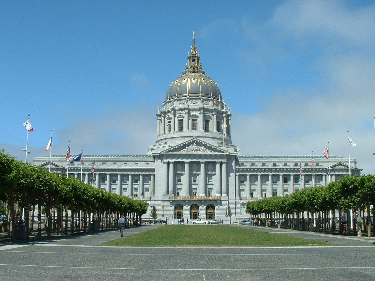
caption = San Francisco City Hall on Civic Center plaza, 2003
location=San Francisco, California
lat_degrees = 37
lat_minutes = 46
lat_seconds = 45
lat_direction = N
long_degrees = 122
long_minutes = 24
long_seconds = 57
long_direction = W
locmapin = California
area =
built =1912 [http://www.nr.nps.gov/writeups/78000757.nl.pdf NHL Writeup] ]
architect=
architecture= Late 19th And 20th Century Revivals,Beaux Arts
added =October 10 ,1978
designated_nhl =February 27 ,1987 [http://tps.cr.nps.gov/nhl/detail.cfm?ResourceID=1748&resourceType=District NHL Summary] ]
governing_body = Local
refnum=78000757cite web|url=http://www.nr.nps.gov/|title=National Register Information System|date=2008-04-15|work=National Register of Historic Places|publisher=National Park Service]
San Francisco's Civic Center is an area of a few blocks north of the intersection of Market Street and Van Ness Avenue that contains many of the city's largest government and cultural institutions. It has two large plazas (Civic Center Plaza and United Nations Plaza) and a number of buildings in classical architectural style. The Exposition Auditorium is the only remaining building from the1915 Panama-Pacific International Exposition . TheUnited Nations Charter was signed in the Herbst Theatre here in 1945, leading to the creation of theUnited Nations . It is also where the post WWII peace treaty withJapan was signed. It is designated aNational Historic Landmark in 1987.Its beauty is marred, however, by a reputation for being one of the more popular parts of the city for the
homeless and the drug addicted. In recent years the homeless have been pushed out of the central part and now congregate mainly at its Market Street edge.Fact|date=February 2007 It is the locale of many rallies, demonstrations, and festivals.The United Nations Plaza was created in 1975, when the
Bay Area Rapid Transit subway was constructed under Market Street. The convert|2.6|acre|m2|sing=on pedestrian mall was designed byLawrence Halprin . [2.6 acres, 1975, part of BART construction, Halprin as designer: [http://www.ci.sf.ca.us/site/mayor_page.asp?id=30529] ]Notable buildings
*City Hall
*Supreme Court of California
*United States Court of Appeals for the Ninth Circuit
*San Francisco Public Library
*Asian Art Museum, opened in 2004 in the former building of the San Francisco Library.
*Bill Graham Civic Auditorium
*War Memorial Opera House, where the U.N. Charter was signed in 1945 and theTreaty of San Francisco was signed in 1951.
*Davies Symphony Hall
*Herbst Theatre
*Phillip Burton Federal Building and United States Courthouse for the United States District Court for the Northern District of California
*California Automobile Association Building
*University of California, Hastings College of the Law
*Fox PlazaTransportation
Civic Center Station is a subway stop for both BART and the
Muni Metro . TheF Market historic streetcar line and many Muni bus lines run nearby.elected photos
ee also
*
49-Mile Scenic Drive
*Bernard J.S. Cahill References
External links
* [http://www.dreamworld.org/sfguide/Neighborhoods/CivicCenter Photo tour of Civic Center] A photo tour of Civic Center complete with narrative text.
Wikimedia Foundation. 2010.