- Myjava
-
Myjava Town 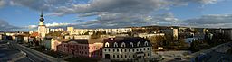
Country Slovakia Region Trenčín District Myjava Tourism region Stredné Považie River Myjava Elevation 325 m (1,066 ft) Coordinates 48°44′57″N 17°33′52″E / 48.74917°N 17.56444°E Area 48.54 km2 (18.74 sq mi) Population 12,811 (2005) Density 264 / km2 (684 / sq mi) Founded 1586 Mayor Pavol Halabrín (HZDS, SMER, ANO) Timezone CET (UTC+1) - summer (DST) CEST (UTC+2) Postal code 907 01 Area code +421-34 Car plate MY 

 Location of Myjava in Slovakia
 Location of Myjava in the Trenčín Region
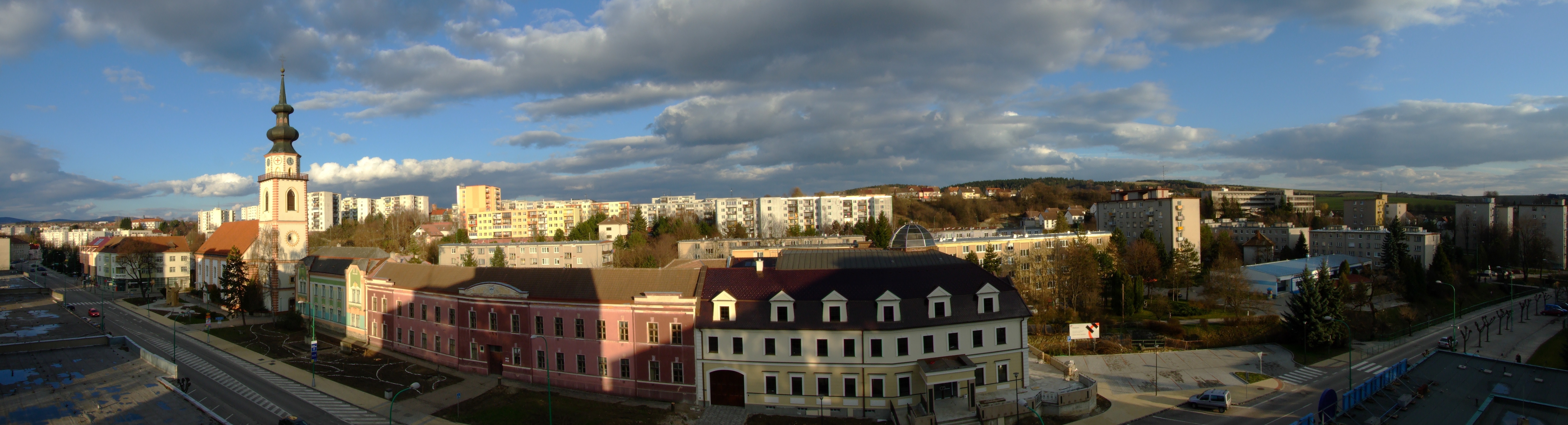
Statistics: MOŠ/MIS Website: www.myjava.sk Myjava (German: Miawa, Hungarian: Miava) is a town in Trenčín Region, Slovakia.
Contents
Geography
It is located in the Myjava Hills at the foothills of the White Carpathians and not far from the Little Carpathians. The river Myjava flows through the town. It is 10 km (6.21 mi) away from the Czech border, 35 km (21.75 mi) from Skalica and 100 km (62.14 mi) from Bratislava.
History
The settlement was established in 1586 and was colonized by two groups of inhabitants: refugees fleeing from the Ottomans in southern Upper Hungary (present Slovakia) and inhabitants from north-western and northern Upper Hungary. During the Revolutions of 1848, the first Slovak National Council met in the town as a result of the Slovak Uprising. Today, the house of their meeting is now part of the Museum of the Slovak National Councils, a part of the Slovak National Museum network.
Demographics
According to the 2001 census, the town had 13,142 inhabitants. 95.5% of inhabitants were Slovaks, 1.5% Czechs and 0.4% Roma.[1] The religious makeup was 51.4% Lutherans, 28.2% people with no religious affiliation and 14.2% Roman Catholics.[1]
References
- ^ a b "Municipal Statistics". Statistical Office of the Slovak republic. http://www.statistics.sk/mosmis/eng/run.html. Retrieved 2007-11-06.
External links
 Categories:
- Cities and towns in Slovakia
- Trenčín geography stubs


Wikimedia Foundation. 2010.