Myjava Hills

Myjava Hills
The village of Podbranč among the Myjava Hills

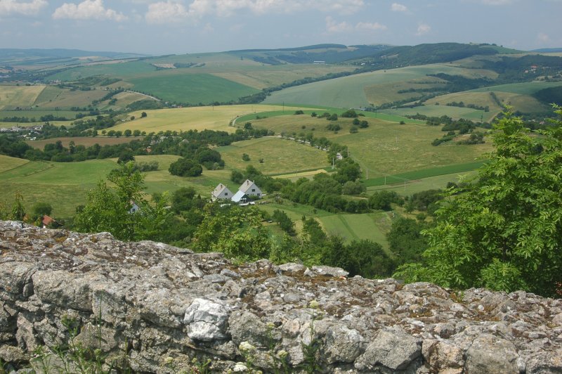
The Myjava Hills (in Slovak, Myjavská pahorkatina) is an area of hills in western Slovakia, rugged highlands along the Myjava River composed of Carpathian flysch. Geologically it's one range of the Slovak-Moravian Carpathians of the Outer Western Carpathians.

The highest peak is Bradlo (543 meters above sea level), site of a monument to General Milan Rastislav Štefánik designed by Slovak architect Dušan Jurkovič. Three villages stand within the borders of the Myjava Hills: Myjava, Stará Turá, and Brezová pod Bradlom.


Wikimedia Foundation. 2010.

Игры ⚽ Нужна курсовая?

Look at other dictionaries:

  • Myjava (river) — Myjava River Myjava in the Záhorie Protected Landscape Area …   Wikipedia

  • Myjava — Coordinates: 48°44′57″N 17°33′52″E / 48.74917°N 17.56444°E / 48.74917; 17.56444 …   Wikipedia

  • Myjava River — Geobox | River name = Myjava other name = category = image caption = Myjava in the Záhorie Protected Landscape Area etymology = nickname = country = Czech Republic country country1 = Slovakia country1 state = region = district = commune =… …   Wikipedia

  • Divisions of the Carpathians — Map of the main divisions of the Carpathians. 1. Outer Western Carpathians 2. Inner Western Carpathians 3. Outer Eastern Carpathians 4. Inner Eastern Carpathians 5. Southern Carpathians 6. Western Romanian Carpathians 7. Transylvanian Plateau 8.… …   Wikipedia

  • Geomorphological division of Slovakia — This page gives an overview of the geomorphological division of Slovakia. It is ordered in a hierarchical form, belonging to the Alps Himalaya System and to the sub systems of the Carpathian Mountains and of the Pannonian Basin. These subsystems… …   Wikipedia

  • Trnava Region — Geobox | Region name = Trnava category = Region image caption = image caption = symbol = symbol type = etymology = official name = motto = nickname = country = Slovakia country state = region = district = commune = municipality = border = part… …   Wikipedia

  • Stará Turá — Geobox | settlement name = Stará Turá native name = other name = category = Town etymology = official name = motto = nickname = image caption = A church in Stará Turá symbol = country = Slovakia country state = region = Trenčín district = Nové… …   Wikipedia

  • History of Slovakia — This article discusses the history of the territory of Slovakia. Prehistory Palaeolithic Radiocarbon dating puts the oldest surviving archaeological artifacts from Slovakia found near Nové Mesto nad Váhom at 270,000 BCE, in the Early Paleolithic… …   Wikipedia

  • Piešťany District —   District   Country Slovakia …   Wikipedia

Share the article and excerpts

Direct link
Do a right-click on the link above
and select “Copy Link”