- New York Passenger Ship Terminal
-
Coordinates: 40°46′05″N 73°59′48″W / 40.767964°N 73.996568°W
The New York Passenger Ship Terminal (also known as the Luxury Liner Row or Manhattan Cruise Terminal or New York Cruise Terminal) is a terminal for ocean-going passenger ships on Manhattan's west side.
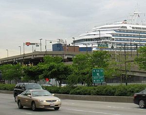
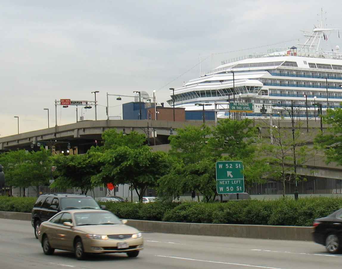
The terminal consists of North River Piers 88, 90, 92 and 94 on the Hudson River between West 46th and West 54th Street. (As a general rule, pier numbers in Manhattan can be determined by adding 40 to the corresponding cross-street.)
Ships now dock at Piers 88, 90 and 92. Pier 94 on the north side is now used for exhibition space. Pier 86, once used by United States Lines, is now home to the USS Intrepid. In 2003, the terminal handled 900,000 passengers. The city is forecasting that 1.5 million will use the terminal by 2017.
The piers are 1,100 feet long and 400 feet apart. They were first completed in 1935 to replace the Chelsea Piers as the city's luxury liner terminal. The new terminal was built to handle bigger ships that had outgrown the Chelsea Piers. The piers were renovated in 1970 and are currently undergoing another $150 million renovation. The renovated plans call for it to handle three large ships at a time. In doing renovations, the city is also considering decommissioning Pier 92.
 Logo of the New York Cruise Terminal.
For decades the terminal was the only ocean-going passenger terminal in New York harbor. With an upsurge in cruise ship traffic and the terminal's ability to handle comfortably only three large ships at a time, two new terminals have opened in the harbor — the Cape Liberty Cruise Port opened in 2004 in Bayonne, New Jersey (used by Royal Caribbean Cruise Line, Celebrity Cruises and Azamara Cruises), and the Brooklyn Cruise Terminal (used by the Queen Mary 2 and other ships of the Carnival Corporation cruise brands) opened in 2006 in Brooklyn, New York.
The West Side Highway takes a small jog east from the piers to below West 42nd Street because when the terminal was built land had to be taken away from Manhattan to allow for longer piers. The US Army Corps of Engineers, who control the waterfront dimension, would not extend the pierhead line farther into the river, so the city extended the pier by cutting away at the land. The city earlier did this for the Chelsea Piers; however in Chelsea only landfill was taken away. At the Passenger Terminal actual Manhattan schist was taken away[1].
 From downstream in the river
Many major passenger ships have docked there, including the RMS Queen Mary 2 and Freedom of the Seas, before the Brooklyn and Bayonne terminals opened. The SS Normandie caught fire and subsequently capsized at its Pier 88 berth during World War II.
Norwegian Cruise Line's soon to be newest ship the Norwegian Breakaway will sail year-round out of New York Passenger Ship Terminal at 143,500-ton she will be the biggest to sail year-round and Mayor Bloomberg said the city will spend $4 million to renovate and upgrade the cruise terminal to accommodate the ship.[2]
See also
- Transportation in New York City
- Cruise ship
- Cape Liberty Cruise Port
- Brooklyn Cruise Terminal
- Port of New York and New Jersey
References
- ^ [1] New York Cruise Terminal: History & Facts
- ^ http://www.cruiseindustrynews.com/cruise-news/6231-norwegian-breakaway-to-sail-from-new-york-year-round.html
External links
Categories:- Water transportation in New York City
- Piers in New York
- Port of New York and New Jersey


Wikimedia Foundation. 2010.