- Münchhausen am Christenberg
-
"Münchhausen" redirects here. For other uses, see Münchhausen (disambiguation).
Münchhausen 

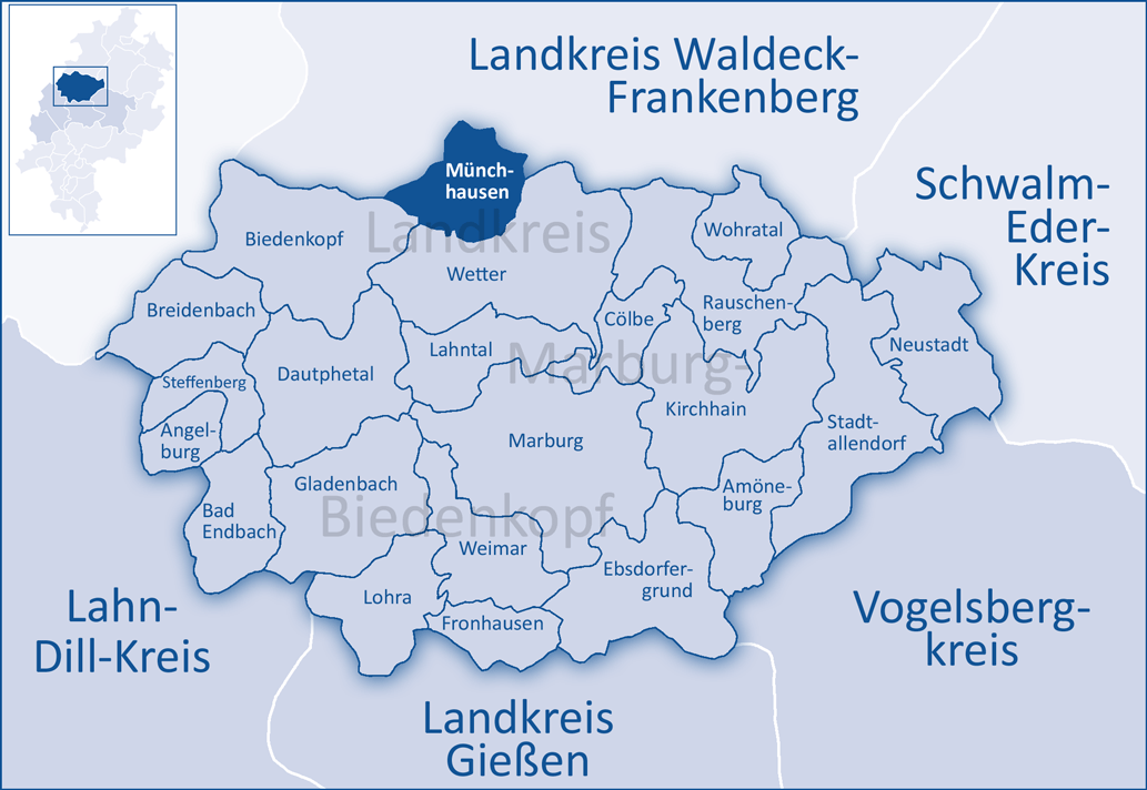
 MünchhausenLocation of Münchhausen within Marburg-Biedenkopf district
Coordinates 50°57′0″N 8°43′0″E / 50.95°N 8.716667°ECoordinates: 50°57′0″N 8°43′0″E / 50.95°N 8.716667°E Administration Country Germany State Hesse Admin. region Gießen District Marburg-Biedenkopf Local subdivisions 5 Ortsteile Mayor Peter Funk (Ind.) Basic statistics Area 41.54 km2 (16.04 sq mi) Elevation 284 m (932 ft) Population 3,477 (31 December 2010)[1] - Density 84 /km2 (217 /sq mi) Other information Time zone CET/CEST (UTC+1/+2) Licence plate MR Postal code 35117 Area codes 06423 06452 06457 Website www.gemeinde-muenchhausen.de The community of Münchhausen is found 20 km (12 mi) north of Marburg on the northern edge of Marburg-Biedenkopf district. It has 3,605 inhabitants and has had its current boundaries since 1974. The community's area is roughly 41 km².
Contents
Geography
Location
West of the community lies the Rothaargebirge, a low mountain range. The municipal area is bounded on the east by the Burgwald, another low mountain range. The constituent communities of Münchhausen and Simtshausen lie in the Wetschaft valley. Wollmar lies on the like-named river Wollmar, which empties into the Wetschaft in Münchhausen. Through the constituent communities of Oberasphe and Niederasphe flows the river Asphe.
Neighbouring communities
Münchhausen's neighbours are Burgwald, Rosenthal, Wetter, Biedenkopf and Battenberg.
Constituent communities
- Münchhausen (1285 inhabitants) (as of January 2004)
- Niederasphe (914 inhabitants)
- Oberasphe (356 inhabitants)
- Simtshausen (495 inhabitants)
- Wollmar (701 inhabitants)
History
Münchhausen am Christenberg officially came into being on 1 July 1974 when the formerly independent places of Münchhausen, Simtshausen, Niederasphe, Oberasphe and Wollm were united.
Politics
Municipal representation
Results of municipal election on 26 March 2006:
Coat of arms
The civic coat of arms might be described thus: Party per chevron; above in gules a cross argent fused with the chevron; below in argent, a five-spoked wheel sable.
The coat of arms symbolizes the nearby mountain, the Christenberg, with its mediaeval church. The wheel with its five spokes stands for Münchhausen's five constituent communities.
Personalities
- Euricius Cordus, German humanist
References
- ^ "Die Bevölkerung der hessischen Gemeinden" (in German). Hessisches Statistisches Landesamt. 31 December 2010. http://www.statistik-hessen.de/static/publikationen/A/AI2_AII_AIII_AV_10-1hj_pdf.zip.
- This article incorporates information from the German Wikipedia.
External links
Towns and municipalities in the district of Marburg-Biedenkopf Amöneburg | Angelburg | Bad Endbach | Biedenkopf | Breidenbach | Cölbe | Dautphetal | Ebsdorfergrund | Fronhausen | Gladenbach | Kirchhain | Lahntal | Lohra | Marburg | Münchhausen | Neustadt | Rauschenberg | Stadtallendorf | Steffenberg | Weimar (Lahn) | Wetter | Wohratal Categories:
- Municipalities in Hesse
- Marburg-Biedenkopf


Wikimedia Foundation. 2010.