- Neshaminy Falls (SEPTA station)
-
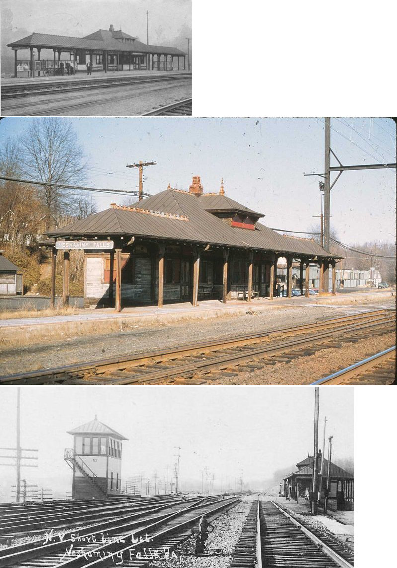
Neshaminy Falls
SEPTA regional rail
Station statistics Address Bristol Road & Linden Street
Bensalem Twp., PACoordinates 40°08′49″N 74°57′44″W / 40.1469°N 74.9622°WCoordinates: 40°08′49″N 74°57′44″W / 40.1469°N 74.9622°W Lines West Trenton LineConnections SEPTA City Bus: 58 Platforms 2 side platforms Tracks 2 Parking 187 Bicycle facilities Yes Other information Opened 1889[1] Electrified 1930 Accessible 
Owned by SEPTA Fare zone 4 Services Preceding station SEPTA Following station toward University CityWest Trenton Line toward West TrentonNeshaminy Falls is a station along the SEPTA West Trenton Line to Ewing, New Jersey. It is located at Bristol Road & Linden Street in Bensalem Township, Pennsylvania. The station has off-street parking and a handicapped-accessible platform.
According to the website Pennsylvania Railroad Stations; Past & Present, Neshaminy Falls Station was originally built in 1889 either by the Bound Brook Railroad or the Philadelphia & Reading Railroad. The station was built for both passenger and freight service. Neshamminy Falls station is also near CSX's Trenton Subdivision that leads to the Fox Chase Line between Ryers and Cheltenham Stations.
References
External links
Categories:- SEPTA Regional Rail stations
- Stations along Reading Company lines
- Pennsylvania railway station stubs
- SEPTA stubs

Wikimedia Foundation. 2010.