- Rhodope Prefecture
Infobox Pref GR
name = Rhodope
name_local = Νομός Ροδόπης
flag_reg =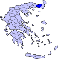
periph =East Macedonia and Thrace
capital =Komotini
population = 112,883
population_as_of = 2005
pop_rank = 31st
pop_dens = 44.4
popdens_rank = 36th
area = 2,543
area_rank = 24th
postal_code = 69x xx
area_code = 255x0
licence = ΚΟ
provinces = 2
municip = 9
commun = 3
ISO = GR-73
website =Rhodope ( _el. Ροδόπη, "Rodópi", IPA-all|ro̞ˈðo̞pi) is one of the
prefectures of Greece . It lies in central Thrace within theEast Macedonia and Thrace periphery. The prefecture is named after theRhodope Mountains , which cover the north and most of the eastern part of its territory. Rhodope is bounded by theXanthi Prefecture to the west, theEvros Prefecture to the east andBulgaria 'sKardzhali Province to the north. Apart from the mountainous areas, the prefecture consists mainly of farmland, forests and grasslands.The capital of the prefecture is the city of
Komotini . The second largest city isSapes .The greatest part of the Muslims of Thrace, the only officially recognized religious minority in Greece, is settled in this area, where they form around half of the population.
Climate
The areas that mainly get Mediterranean climate is at the southern and the central portion. Its climate is mainly continental with cold winters in higher elevations and the northern part.
Transport
*GR-2/
E90 , Egnatia Highway, old and new, W, Cen., E, SE
*GR-53Municipalities and communities
See also:
List of settlements in the Rhodope prefecture External links
* [http://www.kom.gr Rhodope Internet Portal]
Capes and points
*Cape
Kourousmilou
Wikimedia Foundation. 2010.