- Evrytania
Infobox Pref GR
name = Evrytania
name_local = Νομός Ευρυτανίας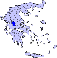
periph =Central Greece
capital =Karpenisi
population = 34,855
population_as_of = 2005
pop_rank = 53rd
pop_dens = 18.6
popdens_rank = 53rd
area = 1,868.911
area_rank = 35th
postal_code = 36x xx
area_code = 22370
licence = ΚΗ
provinces =
municip = 11
commun =
ISO = GR-05
website = [http://www.evritania.gr/ www.evritania.gr]Evrytania (Greek: Ευρυτανία, alternative romanization "Evritania",
Latin : "Eurytania") is one of theprefectures of Greece . It is within the periphery ofCentral Greece and its capital isKarpenisi (approx. 8,200 inhabitants). The prefecture was created in 1947 out of the Aitolia-Acarnania prefecture. It is almost entirely formed of mountains , including theTymfristos and thePanaitoliko in the south, rivers including the Acheloos in the west,Agrafiotis to the east, andMegdova in the east flowing down to theIonian Sea . It is one of the least populated prefectures in Greece, and also one of the few prefectures to use only one area code. The area bordersAetolia-Acarnania to the west, southwest and south (west over theAcheloos river), Karditsa to the north, andPhthiotis to the east. Evyrtania also features a famous skiing resort located near Karpenisi on the Tymfristos mountain ; since 2004, the 1.4 km-longTymfristos Tunnel lies to the east.Transport
*GR-38, W, Cen., E
Municipalities
ee also
*
List of settlements in the Evrytania prefecture Climate
Its climate is a mixture of Mediterreanean and mountainous in the western portion, much of the area receive winter with snow and warm during the summer months.
History
Evrytania dates to ancient times, the area was first settled around 6000 to 5000 BC. The
Eurytans or Evrytans were the first settlers of the area It fell into the Roman hands, and was later incorporated into theByzantine Empire , and later did not entirely rule by the Franks but under autonomy and later into theDespotate of Epirus and lastly the Ottomans. Unlike other parts of Greece at the time, while the eastern and the southern parts were definitively ruled by the Ottomans, the area aroundAgrafa managed to sustain complete autonomy with the difficuties experienced in conquest of the region. After 400 years, Evrytania finally became part ofGreece following theGreek War of Independence , the economy boomed with agriculture, whle its village economy has been poor. The areas was affected byWorld War II , and later theGreek Civil War , peace finally returned to Evrytania at the end of the 1940s and its economy expanded, though the village population began to decline and the city population to bloom. It received electricity, radio communications, motor transport and fuller roads in the 1950s, the GR-38 became paved, and the prefecture's only ski resort opened. Computer and Internet connections were put in place in the 1990s.Persons
*
Pavlos Bakoyannis
*Markos Giolias , artist
*Demosthenis Goulas , artist
*Stefanos Granitsas , artist
*Christos Kagaras , painter
*Spyros Paliouras , a Greek artist
*Zacharias Papantoniou , artist
*Michael Stafylas , artist
*Lefteris Theodorou , painterBibliography
*"Evrytania and the History of Agios Nikolaos"
*"Evrytanes Istories" ("Evrytanian Tales")External links
* [http://www.evrytan.gr Evrytania]
Wikimedia Foundation. 2010.