- Levice District
-
Levice District — District — 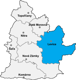
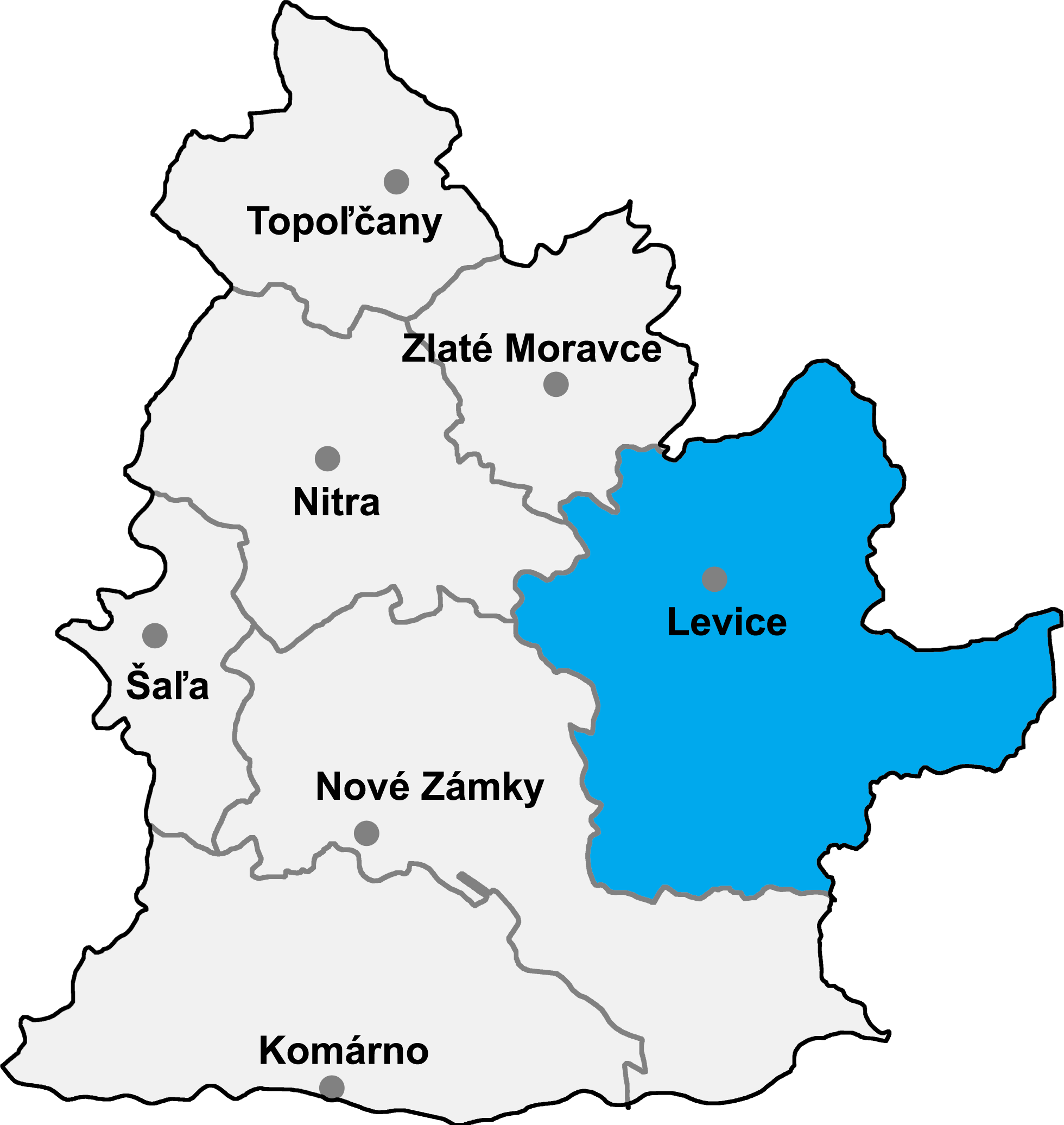
Country Slovakia Region (kraj) Nitra Region Area – Total 1,551 km2 (598.8 sq mi) Population (2001) – Total 120,021 – Density 77.4/km2 (200.4/sq mi) Time zone CET (UTC+1) – Summer (DST) CEST (UTC+2) Telephone prefix 36 Levice District (okres Levice) is a district in the Nitra Region of western Slovakia. It is the largest of Slovakia's 79 districts. The west of the district was in the Hungarian county of Tekov until 1918, while the east of the district was in Hont County: Farná in the south was in the county of Esztergom (Ostrihom).
Municipalities
- Bajka
- Bátovce
- Beša
- Bielovce
- Bohunice
- Bory
- Brhlovce
- Čajkov
- Čaka
- Čata
- Demandice
- Devičany
- Dolná Seč
- Dolné Semerovce
- Dolný Pial
- Domadice
- Drženice
- Farná
- Hokovce
- Hontianska Vrbica
- Hontianske Trsťany
- Horná Seč
- Horné Semerovce
- Horné Turovce
- Horný Pial
- Hrkovce
- Hronovce
- Hronské Kľačany
- Hronské Kosihy
- Iňa
- Ipeľské Úľany
- Ipeľský Sokolec
- Jabloňovce
- Jesenské
- Jur nad Hronom
- Kalná nad Hronom
- Keť
- Kozárovce
- Krškany
- Kubáňovo
- Kukučínov
- Kuraľany
- Levice
- Lok
- Lontov
- Lula
- Málaš
- Malé Kozmálovce
- Malé Ludince
- Mýtne Ludany
- Nová Dedina
- Nový Tekov
- Nýrovce
- Ondrejovce
- Pastovce
- Pečenice
- Plášťovce
- Plavé Vozokany
- Podlužany
- Pohronský Ruskov
- Pukanec
- Rybník
- Santovka
- Sazdice
- Sikenica
- Slatina
- Starý Hrádok
- Starý Tekov
- Šahy
- Šalov
- Šarovce
- Tehla
- Tekovské Lužany
- Tekovský Hrádok
- Tlmače
- Tupá
- Turá
- Uhliská
- Veľké Kozmálovce
- Veľké Ludince
- Veľké Turovce
- Veľký Ďur
- Vyškovce nad Ipľom
- Vyšné nad Hronom
- Zalaba
- Zbrojníky
- Želiezovce
- Žemberovce
- Žemliare
Source: Lacika, Ján (2005). Slovaquie en bref. Priroda. ISBN 80-07-01377-6.
Komárno · Levice · Nitra · Nové Zámky · Šaľa · Topoľčany · Zlaté Moravce
 Categories:
- Levice District
- Districts of Nitra Region
- Districts of Slovakia
- Nitra Region geography stubs
Wikimedia Foundation. 2010.