- Mimata, Miyazaki
-
Mimata
三股町— Town — Location of Mimata in Miyazaki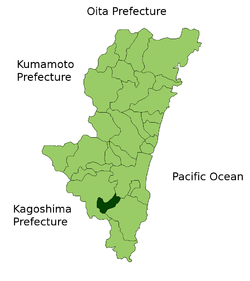

 Mimata
Coordinates: 31°42′54″N 131°9′31″E / 31.715°N 131.15861°ECoordinates: 31°42′54″N 131°9′31″E / 31.715°N 131.15861°E Country Japan Region Kyūshū Prefecture Miyazaki District Kitamorokata Area – Total 110.01 km2 (42.5 sq mi) Population (2003) – Total 26,752 – Density 243/km2 (629.4/sq mi) Time zone Japan Standard Time (UTC+9) City symbols - Tree Ginko Biloba - Flower Azalea - Bird Bunting Website Town of Mimata Mimata (三股町 Mimata-chō) is a town located in Kitamorokata District, Miyazaki, Japan.
Contents
Transportation
The primary form of transportation in Mimata is the car. There is one train station in Mimata and it is on the Nippō Main Line of Kyushu Railway Company (JR Kyushu).
Attractions
- Shiibae Park (椎八重公園) is famous for its Azalea Festival. This happens in April of every year during the Hanami season. Shiibae is located only 12km from the JR Mimata Station.
- Nagata Gorge (長田峡) is located only 8km from the JR Mimata Station. It is approximately 10 minutes by car.
- Kajiyama Bridge (梶山橋) is located in the center of a local park. It was built in 1942. It is located 4km from the JR Mimata Station. It is nicknamed Megane Bridge (メガネ橋) which means "glasses bridge". This is because it looks like a pair of eyeglasses when it is reflected in the water.
Education
- Primary:
- Mimata Elementary School
- Mimata West Elementary School
- Katsuoka Elementary School
- Kajiyama Elementary School
- Miyamura Elementary School
- Nagata Elementary School
- Secondary:
- Mimata Junior High School
- East Miyakonojo High School
Mimata Junior High School
This is currently the largest junior high in all of Miyazaki Prefecture and in 2006 was the 3rd largest school Secondary Education School in the prefecture.
East Miyakonojō High School
Mimata does not have any public high schools. Within its boundaries is East Miyakonojō High School which is a privately run. It is called East Miyakonojō High School because the private funding comes from Miyakonojō.
Because of the sheer size of Mimata Junior High School, many students do not get admitted to East Miyakonojō High School. They take a train from Mimata Station or bike to other nearby high schools either in Miyakonojō proper or other neighboring towns.
External links
 Media related to Mimata, Miyazaki at Wikimedia Commons
- Official website (Japanese)
Categories:- Towns in Miyazaki Prefecture
- Miyazaki geography stubs


Wikimedia Foundation. 2010.