- Mbombela Local Municipality
-
Mbombela Local Municipality — Local municipality — Location in Mpumalanga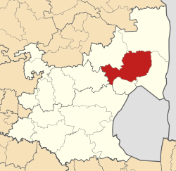
Coordinates: 25°25′S 30°55′E / 25.417°S 30.917°ECoordinates: 25°25′S 30°55′E / 25.417°S 30.917°E Country South Africa Province Mpumalanga District Ehlanzeni District Seat Nelspruit Area - Total 3,331 km2 (1,286.1 sq mi) Population (2007)[1] - Total 527,203 - Density 158.3/km2 (409.9/sq mi) - Households 137,353 Racial makeup[2] (2007) - Black African 89.72% - White 9.12% - Coloured 0.77% - Indian or Asian 0.39% Time zone SAST (UTC+2) Municipal code MP322 Mbombela Local Municipality is an administrative area in the Ehlanzeni District of Mpumalanga in South Africa. Mbombela is a siSwati name meaning "a lot of people in a small space".[3]
Towns
- Daantjie
- Kaapsehoop
- Kabowkeni
- Kanyamazane
- Hazyview
- Matsulu
- Mbombela (Nelspruit)
- Mpakeni
- Msogwaba
- Ngodwana
- Nsikazi
- Rocky’s Drift
- Tekwane
- White River
References
- ^ "Community Survey, 2007: Basic Results Municipalities" (PDF). Statistics South Africa. http://www.statssa.gov.za/Publications/P03011/P030112007.pdf. Retrieved 2009-10-20.
- ^ "Community Survey 2007 interactive data". Statistics South Africa. http://www.statssa.gov.za/community_new/content.asp?link=interactivedata.asp. Retrieved 19 October 2009.
- ^ South African Languages - Place names

Mbombela • Nkomazi • Thaba Chweu • Umjindi • Bushbuckridge
Cities and towns Nelspruit • Kaapsehoop • Kanyamazane • Hazyview • Matsulu • Mpakeni • Ngodwana • Tekwane • White River
Province of Mpumalanga, South Africa Provincial Capital: Nelspruit District
and Local
MunicipalitiesThaba Chweu · Mbombela · Umjindi · Nkomazi · BushbuckridgeCategories:- 2000 establishments in South Africa
- Local municipalities of Ehlanzeni


Wikimedia Foundation. 2010.