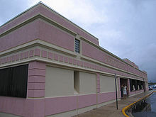
- Diego Jiménez Torres Airport
-
Diego Jiménez Torres Airport
Fajardo Airport
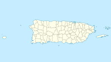
IATA: FAJ – ICAO: TJFA – FAA LID: X95 Summary Airport type Public Owner Puerto Rico Ports Authority Serves Fajardo, Puerto Rico Elevation AMSL 64 ft / 20 m Coordinates 18°18′29″N 065°39′43″W / 18.30806°N 65.66194°WCoordinates: 18°18′29″N 065°39′43″W / 18.30806°N 65.66194°W Map Location in Puerto Rico Runways Direction Length Surface ft m 8/26 3,600 1,097 Asphalt Statistics (1998) Aircraft operations 14,314 Based aircraft 14 Source: Federal Aviation Administration[1] Diego Jiménez Torres Airport (IATA: FAJ, ICAO: TJFA, FAA LID: X95) is a public use airport owned by the Puerto Rico Ports Authority and located one nautical mile (1.85 km) southwest of the central business district of Fajardo, a city in Puerto Rico.[1] It is also known as Fajardo Airport.
Airport operations were shut down in November 2008 and transferred to the newly-opened José Aponte de la Torre Airport in Ceiba.[citation needed] However, as of July 2009, Diego Jiménez Torres Airport is still listed as an active airport by the Federal Aviation Administration.[1]
Contents
Facilities and aircraft
Diego Jiménez Torres Airport covers an area of 95 acres (38 ha) at an elevation of 64 feet (20 m) above mean sea level. It has one asphalt paved runway designated 8/26 which measures 3,600 by 75 feet (1,097 x 23 m).[1]
For the 12-month period ending March 16, 1998, the airport had 14,314 aircraft operations, an average of 39 per day: 90% air taxi and 10% general aviation. At that time there were 14 aircraft based at this airport: 71% single-engine, 21% multi-engine and 7% ultralight.[1]
Airlines
At the time of closing, air taxi service was provided by the following airlines[2]:
- Air Flamenco
- Isla Nena Air [3]
- M&N Aviation
- Vieques Air Link
See also
References
- ^ a b c d e FAA Airport Master Record for X95 (Form 5010 PDF), effective 2 July 2009.
- ^ "Airlines serving Puerto Rico". Travel and Sports, Inc.. http://travelandsports.com/al.htm.
- ^ Isla Nena Air Services, Inc., official site
External links
- Resources for this airport:
- AirNav airport information for TJFA
- ASN accident history for FAJ
- FlightAware airport information and live flight tracker for TJFA
- NOAA/NWS latest weather observations for TJFA
- SkyVector aeronautical chart for X95
Airports in Puerto Rico International Luis Muñoz Marín International Airport (SJU) · Mercedita Airport (PSE) · Rafael Hernández Airport (BQN)

Regional Antonio (Nery) Juarbe Pol Airport (ABO) · Antonio Rivera Rodríguez Airport (VQS) · Benjamín Rivera Noriega Airport (CPX) · Eugenio María de Hostos Airport (MAZ) · Fernando Luis Ribas Dominicci Airport (SIG) · José Aponte de la Torre Airport (RVR)
Closed Diego Jiménez Torres Airport (X95) · Dorado Airport · Humacao Airport (X63)
Categories:- Airports in Puerto Rico
- Defunct airports in Puerto Rico
- Fajardo, Puerto Rico
Wikimedia Foundation. 2010.

