- Mona Airport
-
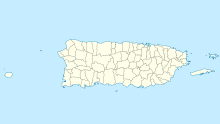
Mona Airport IATA: none – ICAO: none Summary Airport type Permit required Owner Department of Natural and Environmental Resources Location Mona, Mayagüez, Puerto Rico Elevation AMSL 1 ft / 0 m Coordinates 18°04′38″N 067°55′57″W / 18.07722°N 67.9325°WCoordinates: 18°04′38″N 067°55′57″W / 18.07722°N 67.9325°W Map Location in Puerto Rico Runways Direction Length Surface ft m 3,000 914 Grass Source: ourairports.com[1] Mona Airport is an airstrip on Mona Island (Spanish: Isla de la Mona), the third largest island of Puerto Rico. Private and commercial flights require a permit for use of the landing strip. The permit can only be acquired through the Puerto Rico Department of Natural and Environmental Resources. The airport is available to light aircraft for emergency purposes.
Mona Island is a natural reserve and there are no native inhabitants. Rangers from the Department of Natural and Environmental Resources reside on the island to manage visitors and take part in research projects.
References
Airports in Puerto Rico International Luis Muñoz Marín International Airport (SJU) · Mercedita Airport (PSE) · Rafael Hernández Airport (BQN)

Regional Antonio (Nery) Juarbe Pol Airport (ABO) · Antonio Rivera Rodríguez Airport (VQS) · Benjamín Rivera Noriega Airport (CPX) · Eugenio María de Hostos Airport (MAZ) · Fernando Luis Ribas Dominicci Airport (SIG) · José Aponte de la Torre Airport (RVR)
Closed Diego Jiménez Torres Airport (X95) · Dorado Airport · Humacao Airport (X63)
Categories:- Airports in Puerto Rico
- Mayagüez, Puerto Rico
Wikimedia Foundation. 2010.

