- Madulain
-
Madulain 
Country Switzerland 
Canton Graubünden District Maloja 46°35′N 9°56′E / 46.583°N 9.933°ECoordinates: 46°35′N 9°56′E / 46.583°N 9.933°E Population 202 (Dec 2009)[1] - Density 12 /km2 (32 /sq mi) Area 16.35 km2 (6.31 sq mi) Elevation 1,697 m (5,568 ft) Postal code 7523 SFOS number 3783 Surrounded by Bever, La Punt-Chamues-ch, Pontresina, S-chanf, Zuoz Website www.madulain.ch
SFSO statistics
 Madulain
View map of Madulain Madulain is a municipality in the district of Maloja in the Swiss canton of Graubünden.
Contents
History
Madulain is first mentioned around 1137-39 as Madulene.[2]
Geography
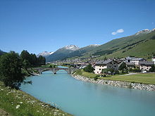 S-chanf in the foreground, Madulain in the background
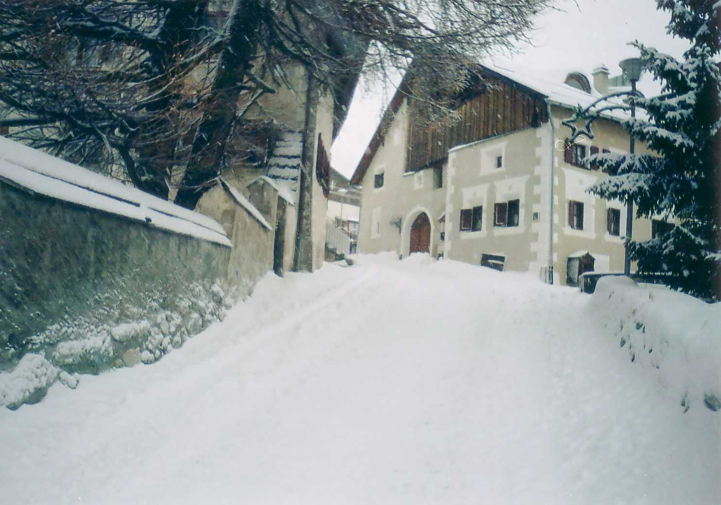
 Madulain in the winter
Madulain has an area, as of 2006[update], of 16.4 km2 (6.3 sq mi). Of this area, 33.9% is used for agricultural purposes, while 14.6% is forested. Of the rest of the land, 1.5% is settled (buildings or roads) and the remainder (49.9%) is non-productive (rivers, glaciers or mountains).[3]
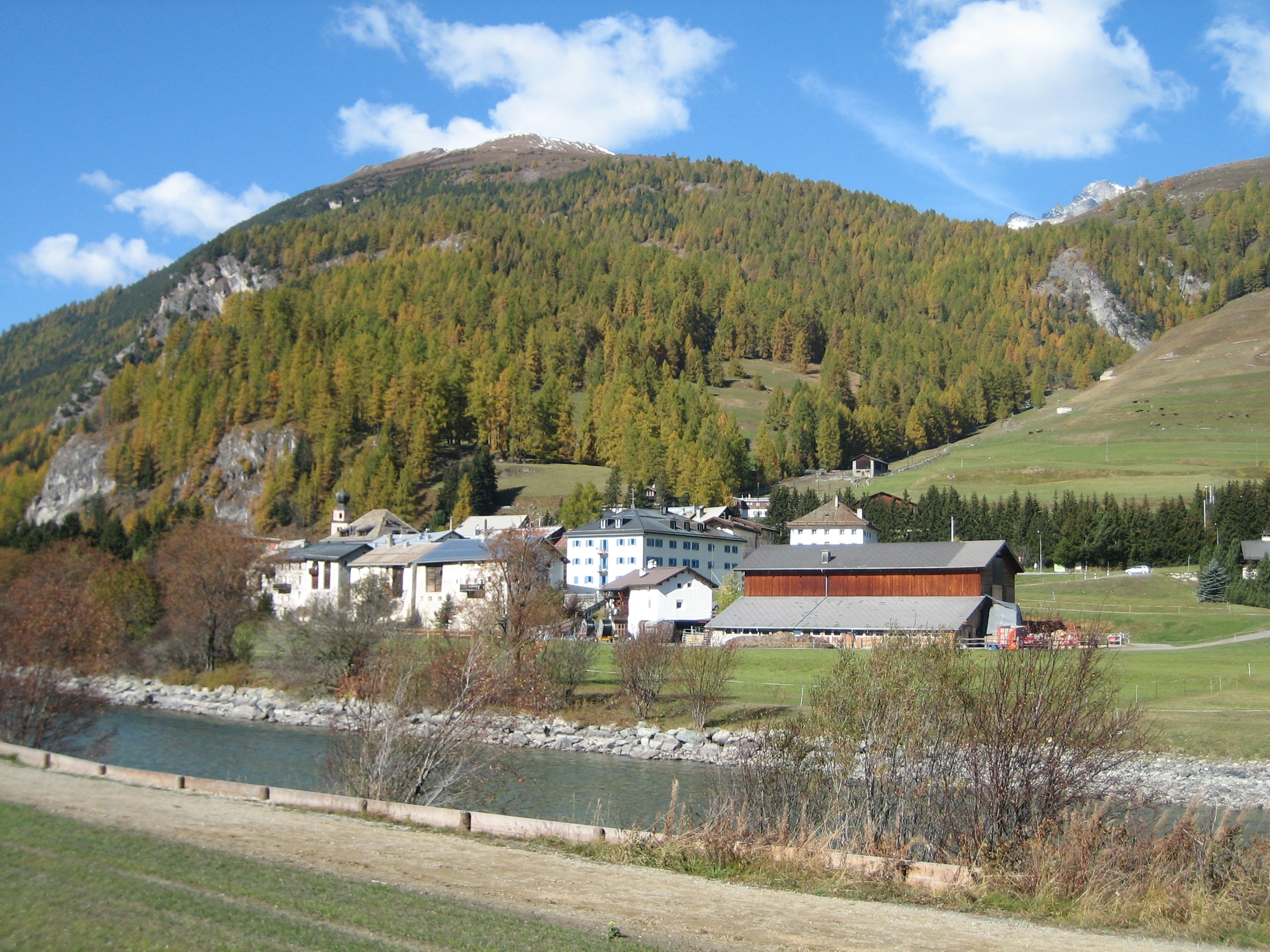
The municipality is located in the Oberengadin sub-district of the Maloja district. It is the smallest of the eleven municipalities in the district. It is located in the upper Engadin valley between La Punt-Chamues-ch and Zuoz about 15 minutes from St. Moritz on the Inn River. It consists of the haufendorf village (an irregular, unplanned and quite closely packed village, built around a central square)of Madulain on the Inn at an elevation of 1,684 m (5,525 ft). Until 1943 Madulain was known as Madulein.[4]
Demographics
Madulain has a population (as of 31 December 2009) of 202.[1] As of 2008[update], 24.8% of the population was made up of foreign nationals.[5] Over the last 10 years the population has grown at a rate of 9.6%.[3]
As of 2000[update], the gender distribution of the population was 49.2% male and 50.8% female.[6] The age distribution, as of 2000[update], in Madulain is; 22 children or 12.2% of the population are between 0 to 9 years old. 11 teenagers or 6.1% are 10 to 14, and 8 teenagers or 4.4% are 15 to 19. Of the adult population, 29 people or 16.1% of the population are between 20 to 29 years old. 30 people or 16.7% are 30 to 39, 27 people or 15.0% are 40 to 49, and 22 people or 12.2% are 50 to 59. The senior population distribution is 19 people or 10.6% of the population are between 60 to 69 years old, 10 people or 5.6% are 70 to 79, there are 2 people or 1.1% who are 80 to 89.[5]
In the 2007 federal election the most popular party was the SVP which received 38.2% of the vote. The next three most popular parties were the SP (37%), the FDP (12.2%) and the CVP (10.2%).[3]
The entire Swiss population is generally well educated. In Madulain about 71.2% of the population (between age 25-64) have completed either non-mandatory upper secondary education or additional higher education (either university or a Fachhochschule).[3]
Madulain has an unemployment rate of 1.04%. As of 2005[update], there were 23 people employed in the primary economic sector and about 7 businesses involved in this sector. 37 people are employed in the secondary sector and there are 3 businesses in this sector. 19 people are employed in the tertiary sector, with 7 businesses in this sector.[3]
The historical population is given in the following table:[2]
year population 1806 93 1850 63 1900 54 1950 77 1980 94 2000 180 Languages
Most of the population (as of 2000[update]) speaks German (53.9%), with Romansh being second most common (22.2%) and Italian being third (17.2%).[3] Currently, a minority of the population spokes the Upper-Engadin Romansh dialect of Puter, though until the early 19th Century the entire village spoke it. Due to increasing trade with the outside world, Romansh usage began to decline. In 1880 about 69% spoke Romansh as a first language, while in 1900 it was only 55% and by 1910 there were 36 Romansh native speakers and 47 German native speakers. However, during World War II the majority language switched several times. In 1941 the village was 50% Romansh speaking. By 1970 German was again the majority. In 1990 there were 50.8% of the population that could understand Romansh and in Jahr 2000 a total of 43% could understand it.
Languages in Madulain Languages Census 1980 Census 1990 Census 2000 Number Percent Number Percent Number Percent German 42 44.68 % 48 40.00 % 97 53.89 % Romansh 35 37.23 % 33 27.50 % 40 22.22 % Italian 15 15.96 % 28 23.33 % 31 17.22 % Population 94 100 % 120 100 % 180 100 % References
- ^ a b Swiss Federal Statistical Office, MS Excel document – Bilanz der ständigen Wohnbevölkerung nach Kantonen, Bezirken und Gemeinden (German) accessed 25 August 2010
- ^ a b Madulain in German, French and Italian in the online Historical Dictionary of Switzerland.
- ^ a b c d e f Swiss Federal Statistical Office accessed 20-Oct-2009
- ^ Amtliches Gemeindeverzeichnis der Schweiz published by the Swiss Federal Statistical Office (German) accessed 23 September 2009
- ^ a b Graubunden Population Statistics (German) accessed 21 September 2009
- ^ Graubunden in Numbers (German) accessed 21 September 2009
- This article incorporates information from the equivalent article on the German Wikipedia.
External links
- Official Website of Madulain
 Media related to Madulain at Wikimedia Commons
- Madulain in German, French and Italian in the online Historical Dictionary of Switzerland.
Bever | Bregaglia | Celerina/Schlarigna | Madulain | Pontresina | La Punt-Chamues-ch | Samedan | St. Moritz | S-chanf | Sils im Engadin/Segl | Silvaplana | Zuoz Maloja • Sils/Segl • Silvaplana • Champfèr • St. Moritz • Celerina/Schlarigna • Pontresina • Samedan • Bever • La Punt • Chamues-ch • Madulain • Zuoz • S-chanf • Zernez • Susch • Lavin • Guarda • Ardez • Tarasp-Vulpera • Ftan • Scuol • Sent • Ramosch • Tschlin • MartinaCategories:
- Municipalities of Graubünden
- Municipalities of Switzerland
- Engadin


Wikimedia Foundation. 2010.