- China National Highway 219
-
China National Highway 219
Route information Length: 2,743 km (1,704 mi) Major junctions From: Kargilik To: Lhazê Highway system China National Highway 219 (G219) runs along the southwestern border of the People's Republic of China, from Kargilik in the Xinjiang Uyghur Autonomous Region to Lhazê in the Tibet Autonomous Region. It is 2,743 kilometres in length.[1] Construction of this road was started in 1951.[2] It was completed in 1957.[3] The road passes through disputed area of Aksai Chin, an area administered by the People's Republic of China but also claimed by India, and its construction was one of the triggers for the Sino-Indian War of 1962.
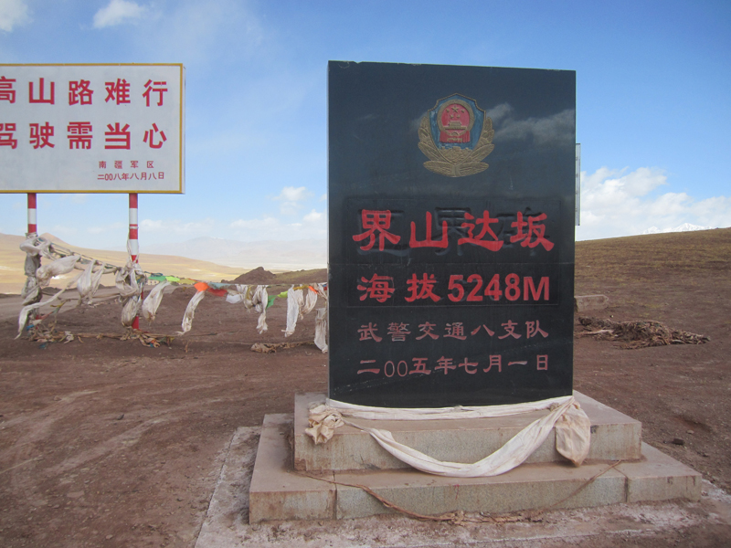
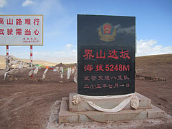 Marker at a mountain pass on G219 in Rutog County.
The construction of the road was not known to India government until the completion of the construction was announced in Chinese official newspaper in 1957. Part of the reason that India was not aware of the road is that Indian border patrol never successfully entered the area before. After the India Embassy in Beijing reported this to New Dehli in September 1957, India decided to send 2 troops of patrol to locate the exact location of the road. However due to the cold winter in the area, the patrol only started leaving from Leh district in July 1958. The patrol sent to locate the south part of the road reported the location of road in October 1958 but the patrol sent to the north part of the road went missing.
As one of the highest motorable roads in the world, the breathtaking scenery of Rutok county also ranks as some of the most inhospitable terrain on the planet. Domar township—a town of concrete blocks and nomad tents—is one of the bleakest and most remote outposts of the People's Liberation Army at the edge of the Aksai Chin. Near the town of Mazar many trekkers turn off for both the Karakorum range and K2 base camp. Approaching the Xinjiang border, past the final Tibetan settlement of Tserang Daban is a dangerous 5,050-meter-high pass. Tibetan nomads in the area herd both yaks and two-humped camels. Descending through the western Kunlun Shan, the road crosses additional passes of 4,000 and 3,000 meters, and the final pass offers brilliant views of the Taklamakan Desert far below before descending into the Karakax River basin.
The road passes near Mount Kailash and Lake Manasarovar and Pangong Tso.
Contents
Route and distance
Route and distance City Distance (km) Kargilik, Xinjiang 0 Rutog, Tibet 994 Gar County, Tibet 1111 Tingkye, Tibet 1829 Saga County, Tibet 2035 Ngamring, Tibet 2282 Lhaze, Tibet 2342 See also
References
- ^ Xinjiang-Tibet Highway (Yecheng-Burang)
- ^ MemCons of Final sessions with the Chinese, White House, 1971-08-12
- ^ 50th anniversary of Xinjiang-Tibet Highway marked, China Tibet Information Center, 2007-11-01
- Dorje, Gyurme. (2009). Footprint Tibet Handbook. (4th Ed.) Footprint Handbooks, Bath, England. ISBN 978 1 906098 32 2.
External links
- The Highway 219 from Yecheng over Western Tibet to Kathmandu Description and profile of the route.
- Going round in circles on the road to Nirvana describes a journey along part of the route
- Some photos along the Highway 219
- A detailed description of a bicycle ride along highway 219 with lots of photos
China National Highways Radial 
North-south East-west Note China National Highway 112 runs around Beijing; China National Highway 228 in Taiwan is unilaterally planned by People's Republic of China.Categories:- National Highways in China
- Tibet Autonomous Region
- Transport in Xinjiang
- Roads in Xinjiang
- Roads in Tibet
- Tibet geography stubs
- Xinjiang geography stubs

Wikimedia Foundation. 2010.