- Region of Republican Subordination
Geobox Region
name = Region of Republican Subordination
native_name =
other_name =
other_name1 =
category =
image_size =
image_caption =
flag_size =
symbol =
symbol_size =
country = Tajikistan
state =
region =
district =
capital =Dushanbe
capital_type = Capital
capital_lat_d =
capital_lat_m =
capital_lat_s =
capital_lat_NS =
capital_long_d =
capital_long_m =
capital_long_s =
capital_long_E =
capital_elevation =
city_type =
city =
part_type =
part_count =
part =
part1 =
area = 28600
highest =
highest location =
highest_lat_d =
highest_lat_m =
highest_lat_s =
highest_lat_NS =
highest_long_d =
highest_long_m =
highest_long_s =
highest_long_EW =
highest_elevation =
lowest =
lowest_location =
lowest_lat_d =
lowest_lat_m =
lowest_lat_s =
lowest_lat_NS =
lowest_long_d =
lowest_long_m =
lowest_long_s =
lowest_long_EW =
lowest_elevation =
population_as_of = 2008
population = 1606900
population_density = 56.2
established_type =
established =
leader_type =
leader =
timezone =
utc_offset =
timezone_DST =
utc_offset_DST =
code_type =ISO 3166-2
code = TJ-RR
code1_type =
code1 =
free_type =
free =
free1_type =
free1 =
map_size = 200
map_caption =
map_locator =
map_locator_x =
map_locator_y =
map_first = 1
website =
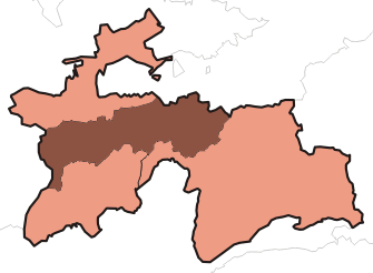
footnotes =Region of Republican Subordination ( _tg. Ноҳияҳои тобеи ҷумҳурӣ, _ru. Районы республиканского подчинения, "Raiony respublikanskogo podchineniya", abbrev. RRP), formerly known as Karotegin Province, is a region in
Tajikistan , consisting of 13 districts which are directly under central rule. Karotegin is the historic name of theRasht Valley and a historic political region in pre-Soviet Central Asia that is today part ofTajikistan . The Karotegin region was also namedGarm , though Garm is also the name of a city and theGarmi ethnic group. Karotegin frequently appears in its alternative spellings Karategin and Karateghin in literature from the 1990s and earlier.History
Karotegin was an independent region in
Central Asia for many centuries. The native princes, who claimed to be descended fromAlexander the Great , were independent until1868 , although their allegiance was claimed in an ineffective way byKokand . TheEmirate of Bukhara took advantage of internal political feuds and conquered the region, along withDarvaz , in 1877.Encyclopædia Britannica Eleventh Edition ]The Karotegin consisted of a highland district bounded on the north by
Samarkand andKhokand , on the east byFerghana , on the south byDarvaz , and on the west byHissar and other Bokharian provinces. Traditionally rough woolen cloth and mohair were woven by the natives, who also made excellent firearms and other weapons. Gold was mined in various places and there were salt-pits in the mountains. The chief town, Garm, situated on a hill on the right bank of theVakhsh River , was a place of some 2,000 inhabitants, as of|1911|lc=on. The population was about 60,000 (1911); five-sixths Tajik, the restKyrgyz , who reside in what is today theJirgatol district of Tajikistan. Historically it was difficult for the people of the Karotegin to communicate with neighboring lands except during the summer, from May to September.Districts
The 13 districts are listed below roughly in their order of occurrence from west to east within the band forming the Region of Republican Subordination. The order of the districts and the district names are based on two consistent sources: an administrative map of Tajikistan ["Republic of Tajikistan", map showing administrative division as of January 1, 2004, "Tojikkoinot" Cartographic Press, Dushanbe] and a statistical yearbook showing the breakdown of RRP into districts [Agriculture of Tajikistan, Statistical Yearbook, State Statistical Committee of Tajikistan, Dushanbe, 2007] .
*
Tursunzoda district (formerly Regar district)
*Shahrinaw district
*Hisor district
*Rudaki district (formerly Leninskiy district)
*Varzob district
*Vahdat district (formerly Kofarnihon district)
*Faizobod district
*Roghun district
*Nurobod district (formerly Darband district)
*Rasht district (formerly Gharm district)
*Tavildara district
*Tojikobod district
*Jirgatol district Geography
The plateau is traversed by the
Vakhsh River , a right-hand tributary of theAmu Darya . On the northern border run the Gissar and Zeravshan mountains, and on the southern border theDarvaz range m to ft|7600|precision=-2|wiki=yes . The area is km2 to mi2|28400|precision=0|wiki=yes. The winter climate is extremely severe; snow begins to fall in October and it is May before it disappears. During the warmer months, however, the mountainsides are richly clothed with the foliage ofmaple ,mountain ash , apple,pear andwalnut trees; theorchards furnish, not only apples and pears, butpeaches ,cherries ,mulberries andapricots . Both cattle and horses are of a small and hardy breed.References
Wikimedia Foundation. 2010.