- Stonewall, Manitoba
Infobox Settlement
official_name = Stonewall, Manitoba
other_name =
native_name =
nickname =
settlement_type = Town
motto =
imagesize =
image_caption =
flag_size =
image_
seal_size =
image_shield =
shield_size =
image_blank_emblem = Stonewall_MB_logo.jpg
blank_emblem_size =
mapsize =
map_caption =
mapsize1 =
map_caption1 =
image_dot_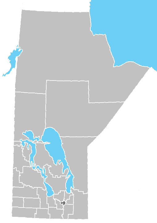
dot_mapsize = 200px
dot_map_caption = Location of Stonewall inManitoba
dot_x = 72 |dot_y = 245
pushpin_
pushpin_label_position =
pushpin_map_caption =
pushpin_mapsize =
subdivision_type = Country
subdivision_name =Canada
subdivision_type1 = Province
subdivision_name1 =Manitoba
subdivision_type2 = Region
subdivision_name2 =Winnipeg Capital Region
subdivision_type3 = Rural Municipality
subdivision_name3 = Rockwood
subdivision_type4 =
subdivision_name4 =
government_footnotes =
government_type =
leader_title = Mayor
leader_name = Ross Thompson
leader_title1 =
leader_name1 =
leader_title2 =
leader_name2 =
leader_title3 =
leader_name3 =
leader_title4 =
leader_name4 =
established_title = Established
established_date = 1878cite web| author= Town of Stonewall | title = Town Founder | url = http://www.stonewall.ca/dyk.asp?ID=25 | year = 2004 | accessdate = 2007-07-30 | publisher = stonewall.ca ]
established_title2 = Incorporated (Village)
established_date2 = 1906cite web| author= Rural Municipality of Rockwood | title = History of Rockwood | url = http://www.rockwood.ca/history_of_rockwood.asp | accessdate = 2007-07-30 | publisher = rockwood.ca ]
established_title3 = Incorporated (Town)
established_date3 = 1908
area_magnitude =
unit_pref =
area_footnotes =
area_total_km2 = 6.02
area_land_km2 =
area_water_km2 =
area_total_sq_mi =
area_land_sq_mi =
area_water_sq_mi =
area_water_percent =
area_urban_km2 =
area_urban_sq_mi =
area_metro_km2 =
area_metro_sq_mi =
area_blank1_title =
area_blank1_km2 =
area_blank1_sq_mi =
population_as_of = 2006 Census
population_footnotes =
population_note =
population_total = 4376
population_density_km2 = 727.1
population_density_sq_mi =
population_metro =
population_density_metro_km2 =
population_density_metro_sq_mi =
population_urban =
population_density_urban_km2 =
population_density_urban_sq_mi =
population_blank1_title =
population_blank1 =
population_density_blank1_km2 =
population_density_blank1_sq_mi =
timezone = CST
utc_offset = -6
timezone_DST = CDT
utc_offset_DST = -5
latd=50 |latm=08 |lats=12.65 |latNS=N
longd=97 |longm=19 |longs=31.18 |longEW=W
elevation_footnotes =
elevation_m =
elevation_ft =
postal_code_type = Postal Code
postal_code = R0C 2Z0
area_code = 204
blank_name =
blank_info =
blank1_name =
blank1_info =
website = http://www.stonewall.ca
footnotes =Stonewall is a
town in the Canadianprovince ofManitoba with a population of 4376 as of the 2006 census. [cite web| author=Statistics Canada | title = 2006 Census | url = http://www12.statcan.ca/english/census06/data/profiles/community/Details/Page.cfm?Lang=E&Geo1=CSD&Code1=4614039&Geo2=PR&Code2=46&Data=Count&SearchText=Stonewall&SearchType=Begins&SearchPR=46&B1=All&Custom= | year = 2007 | accessdate = 2007-07-31 | publisher = statcan.ca ] The town is situated approximately 25 kilometres (15.5 miles) north ofWinnipeg on Provincial TrunkHighway 67. It is known for itslimestone quarries. The local festival is the Quarry Days which is usually held over three days in August at the Stonewall Quarry Park.History
When the last
ice age retreated, as well as theprairie s,escarpment s such as Riding Mountain were left behind. In addition to these, smaller elevations were left behind such as Stony Mountain and Stonewall. It is believed that these escarpments were used as look-outs by early hunters approximately 4,000 to 5,000 years ago. These formations were later used asbuffalo jump s by the indigenous populations.cite web| author= Robert Coutts | title = The Quarry Park at Stonewall, Manitoba | url = http://www.mhs.mb.ca/docs/mb_history/10/quarrypark.shtml | year = 1985 | accessdate = 2007-07-31 | publisher = Manitoba Historical Society ]Stonewall was founded by Samuel Jacob Jackson in 1878 after he acquired the land the town is built upon in 1875. However, Mr Jackson did not move to Stonewall himself until 1881.
In the early 1880s the quarry opened with the focus of their operation being the production of quicklime. [cite web| author= Town of Stonewall | title = The Quarries | url = http://www.stonewall.ca/dyk.asp?ID=35 | year = 2004 | accessdate = 2007-07-31 | publisher = stonewall.ca ] During the peak times of the quarry, large amounts of
dynamite was used for blasting the rock. The dynamite was kept in the powder magazine which has since be rebuilt near the entrance to Stonewall Quarry Park. [cite web| author= Town of Stonewall | title = The Powder Magazine | url = http://www.stonewall.ca/dyk.asp?ID=36 | year = 2004 | accessdate = 2007-07-31 | publisher = stonewall.ca ]On
30 June 1880 , the railway line between Winnipeg and Victoria Junction, 3 miles east of Stonewall, was completed. The construction of the line continued west passing through Stonewall, Hanlan and Meadow Lea before turning south-west towards Portage La Prairie during the summer of 1880. The transcontinental line was originally planned to pass through Selkirk, but was actually built through Winnipeg following heavy lobbying from the city. The line west of Stonewall was therefore rebuilt through Rosser. The line north-west from Stonewall was subsequently extended through Teulon, Komarno before eventually reaching Arborg in 1910. [cite web| author= Town of Stonewall | title = The Railroad | url = http://www.stonewall.ca/dyk.asp?ID=30 | year = 2004 | accessdate = 2007-07-31 | publisher = stonewall.ca ]The present town hall was built in 1912 using local limestone. [cite web| author= Town of Stonewall | title = The Town Hall | url = http://www.stonewall.ca/dyk.asp?ID=34 | year = 2004 | accessdate = 2007-07-31 | publisher = stonewall.ca ]
Following the closure of the quarry, Kinsmen Lake was developed on the site and opened to the public on
10 August 1956 . The lake has become a popular location for locals and visitors to the town. [cite web| author= Town of Stonewall | title = Kinsmen Lake | url = http://www.stonewall.ca/dyk.asp?ID=23 | year = 2004 | accessdate = 2007-07-31 | publisher = stonewall.ca ] In 1983 the town council initiated a project to develop the former quarry site around Kinsmen Lake into a historical site and natural area.Education
Stonewall is situated in the Interlake school division and is served by three schools:
* [http://www.isd21.mb.ca/rwbb/ R. W. Bobby Bend School] caters forkindergarten to year 4 pupils;
* [http://www.isd21.mb.ca/centennial/ Stonewall Centennial School] caters for year 5 to year 8 pupils; and
* [http://www.isd21.mb.ca/SCI/ Stonewall Collegiate Institute] caters for year 9 to year 12 pupils.Government
Municipal
Stonewall is represented by a Head of Council (
Mayor ), a Deputy Mayor and three councillors. The current incumbents of the positions are:
*Ross Thompson – Mayor
*Pat Corbin – Deputy Mayor, Councillor
*John Ploszny – Councillor
*Lockie McLean – Councillor
*Walter Badger – CouncillorProvincial
Stonewall is located in the Riding of Lakeside of
Legislative Assembly of Manitoba and is currently represented by Ralph Eichler of theProgressive Conservative Party of Manitoba .Federal
Stonwall is located in the
Selkirk—Interlake electoral district which returns one Member of Parliament who currently isJames Bezan of theConservative Party of Canada .The Winnipeg-Interlake division of the Senate is represented by
Janis Johnson who was appointed byBrian Mulroney and who is a member of the Conservative Party of Canada.Attractions
tonewall Quarry Park
"(for a history of Stonewall Quarry Park see History above)"
The Stonewall Quarry Park has been maintained as a natural area on the edge of town and provides picnic facilities and walking trails for visitors and residents alike. The nine baseball diamonds are available for hire and have been used for the Blue Jays Cups in 1997 and 1998, the Pan Am Games in 1999 and the Western Canada Summer Games in 2003. There is also a
campsite and swimming available in Kinsmen Lake. Stonewall Quarry Park also displays the many aspects of limestone production. There was a museum and visitor centre, however these were destroyed by fire in November 2007. [cite web | title = Fire destroys Stonewall landmark, artifacts | url = http://www.cbc.ca/canada/manitoba/story/2007/11/12/stonewall-fire.html | publisher = CBC | date =12 November 2007 | accessdate = 2008-06-14 ]Oak Hammock Marsh Interpretive Centre
Oak Hammock Marsh Interpretive Centre is a 36 km2 (8.9 sq mi) restored prairiemarsh featuring artesian springs,aspen -oak bluff,waterfowl lure crop, tall-grass prairie and 30 kilometres (18.6 miles) oftrail s. The marsh is home tomammal s,bird s,amphibians ,reptiles ,fish andinvertebrate s. During the migration season, the number of waterfowl using the marsh can exceed 400,000 a day. [cite web| author= Oak Hammock Marsh Interpretive Centre | title = About Oak Hammock Marsh Interpretive Centre | url = http://www.oakhammockmarsh.ca/about-us/index.html | year = 2007 | accessdate = 2007-07-31 | publisher = oakhammockmarsh.ca ]The Stonewall Postoffice
The Stonewall Postoffice is an example of the prairie style of
architecture which was popular between late 19th and early 20th century. It was built in 1914 using local limestone and used as a post office until 1979. [cite web| author= Travel Manitoba | title = Stonewall Post Office (PHS) | url = http://www.travelmanitoba.com/default.asp?page=500&pid=12&opid=27570&detail=yes | year = 2007 | accessdate = 2007-07-31 | publisher = travelmanitoba.com ]Notes
External links
* [http://www.stonewall.ca/ Town of Stonewall]
* [http://www.rockwood.ca/ Rural Municipality of Rockwood]
* [http://www.oakhammockmarsh.ca/ Oakhammock Marsh Interpretive Centre]
Wikimedia Foundation. 2010.