- Chester Canal
-
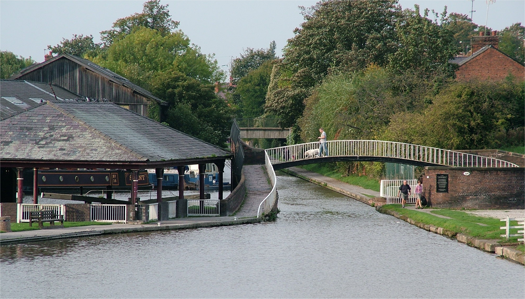
Chester Canal Chester Canal basin, on the Wirral Line of the Ellesmere Canal, at Raymond Street, near the junction with the Chester Canal and the River Dee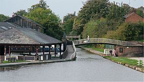
Original owner Chester Canal Company Date of act 1772 Date of first use 1779 Maximum boat length 72 ft 0 in (21.95 m) (originally 80 ft 0 in (24.38 m))
Maximum boat beam 9 ft 0 in (2.74 m) (originally 14 ft 9 in (4.496 m))
Start point Nantwich
53°03′50″N 2°31′12″W / 53.064°N 2.520°WEnd point Chester
53°11′28″N 2°53′42″W / 53.191°N 2.895°WBranch of Now part of Shropshire Union Locks 14 Status Navigable Navigation authority British Waterways The Chester Canal was a canal linking the south Cheshire town of Nantwich with the River Dee at Chester, providing a route for produce (including salt) from Nantwich to reach Chester and, beyond it, the sea via the Dee estuary.
Contents
History
The canal was instigated by an Act of Parliament in 1772, which authorised the construction of a canal to run "from the River Dee, within the liberties of the city of Chester, to or near Middlewich and Nantwich".[1] At Middlewich the Trent and Mersey Canal was under construction. The canal was an attempt to reduce the perceived threat of the Trent and Mersey Canal from damaging the profitability of the Port of Chester and River Dee Navigation. The canal was a broad canal, designed with locks which were 80 feet (24 m) by 14 feet 9 inches (4.50 m) suitable for broad-beam barges.[2]
Work started immediately, but was hampered by financial and engineering problems, and so progress was slow. The plans were changed, with the main line going to Nantwich, and the Middlewich section becoming a branch. Construction of the main line was completed in 1779, but the branch to Middlewich was not built, and there were difficulties at the Chester end, with a failure to reach an agreement with the Dee River Company resulting in delays to the building of the lock into the river. The canal was uneconomic, with limited outlets, and the company collapsed in 1787.[2]
The impact of the Ellesmere Canal
In 1790 the plans for the Ellesmere Canal were published, and the directors of the Chester canal saw this as a chance to make the canal profitable again, and to build the Middlewich branch. The canal was repaired and revived.[2] In 1805 the Wirral section of the Ellesmere Canal was completed, which linked the Chester canal with the River Mersey at Netherpool (later renamed Ellesmere Port). The Northgate Locks within Chester had previously been a five chamber staircase lock, but in order to connect to the Ellesmere Canal's Wirral section, they were modified to a three chamber staircase, with a canal basin at the junction. With a proper outlet to the north, the joint canals were more successful, and the two companies merged in 1813, to become the Ellesmere and Chester Canal Company.
A new route to the south
In 1825, the Birmingham and Liverpool Junction Canal was authorised by an Act of Parliament, to construct a canal from Nantwich to a junction with the Staffordshire and Worcestershire Canal at Autherley in the Midlands. With the prospect of being part of a link between Liverpool and the Midlands, the joint company pressed on with the construction of the Middlewich branch, which would give an outlet to Manchester and the Potteries industrial centre around Stoke on Trent. This was opened in 1833, and the new Birmingham and Liverpool Junction Canal finally opened in 1835, having suffered from engineering problems during construction.[2] It was a narrow canal, suitable for boats which were 7 ft (2.1m) wide.
The two canal companies worked together from the start, in a bid to ensure that both remained profitable despite competition from the railways. A merger with the Birmingham and Liverpool Junction Canal in 1845 was followed in 1846 by the formation of the Shropshire Union Railways and Canal Company,[2] making the Chester Canal the oldest part of the Shropshire Union Canal network. Profitability was maintained, with the result then when most of the Shropshire Union network of canals were abandoned in 1944, the sections which had originally been the Chester Canal, the Ellesmere Canal, the Birmingham and Liverpool Junction Canal and the Middlewich Branch were all retained. The only other section which was not abandoned was the Llangollen branch, which was used as a water supply channel, rather than for navigation.[2]
Today
Chester Canal Legend

Manchester Ship Canal 
Whitby Locks (4) 
M53 motorway 
railway M53 motorway 
A5117 road M56 motorway A41 road railway 
A5480 Deva aqueduct 


Chester 

Dee locks 
River Dee railway 
Northgate staircase 
Hoole Lane lock Chemistry lock Tarvin lock A41 road Greenfield lock Christleton Lock A55 road Wharton's Lock 
A49 road Beeston Iron Lock Beeston Stone Lock Tilstone Lock railway Bunbury Staircase Trent and Mersey Canal Wardle Lock 
Middlewich A530 aqueduct Stanthorne Lock railway 
aqueduct Minshall Lock railway 
Venetian Marina Cholmondeston Lock A511(T) road 

Barbridge Junction 

--Hurleston Junction 
Llangollen Canal 
End of Chester Canal 

Nantwich Basin The canal is popular with pleasure boaters. The Chester Canal Heritage Trust was started in 1997 to promote the canal.
Route
The canal passes through Christleton, Waverton, Hargrave and Tiverton before passing Barbridge Junction, where the branch to Middlewich begins, and Hurleston Junction, which has given access to the Llangollen Canal since 1806. There is a junction with the line to Autherley just before the canal reaches the original terminus at Nantwich basin. In Chester the canal passes through a deep cutting alongside the city's Roman walls.
See also
- Canals of Great Britain
References
- ^ Priestly, J: "Historical Account of the Navigable Rivers, Canals and Railways of Great Britain", page 236. 1831
- ^ a b c d e f Nicholson Waterways Guide Volume 4, 2006, Harper Collins Publishers Ltd, ISBN 0-00-721112-0
- Gordon Emery - The Old Chester Canal (2005) ISBN 1-872265-88-X
External links
Categories:- Chester
- History of Cheshire
- Canals in England
Wikimedia Foundation. 2010.