- Badin District
Infobox Pakistan district
district = Badin District
area = 6726
population = 1136636
pop_year = 1998
density =
established =
nazim =Ali Anwar Halepoto
naib_nazim =Azizullah Dero
tehsils=6
languages =
website = www.badin.gov.pk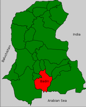
region=Sindh
caption= Badin is located in the south of SindhBadin District ( _ur. بدین) is a district in the
Sindh province ofPakistan . The total area of the district is 6,726 square kilometres, according to the 1998 census of Pakistan, it had a population of 1,136,636 of which 16.42% were urban [ [http://www.badin.gov.pk/population.htm Urban Resource Centre] ] .Headquartered at the city of
Badin the district is situated between 24º-5` to 25º-25` north latitude and 68 21’ to 69 20’ east longitude and is bounded on the north by Hyderabad District on the east by Mirpurkhas and Tharparker districts, on the south the Arabian Sea and Rann of Kutch, which also forms the international boundary with India, and on the west it is bounded by Thatta and Hyderabad districts.Administration
The district is administratively subdivided into the following talukhas: : [ [http://www.lgdsindh.com.pk/badin2.htm Local Govt. Department of Sindh - District of Badin] ]
*
Badin
*Matli
*Shaheed Fazil Rahu
*Talhar
*Tando Bago With the introduction of the devolution System the talukas have been sub-divided into the Union Councils numbering 49, Tapas 109 and Dehs 511.
Religion
The population of the district is predominantly Muslims which constitutes 79.43 percent of the total population, more in urban at 82.17 percent as compared to 78.89 percent in rural areas. However Hindus form an important minority at 19.93 percent in the district with larger concentration at 20.67 percent in rural areas compared to 16.16 percent in urban areas. Presence of other minorities in the district (Christians at 0.25% and Qadianis at 0.24%)as well as in rural and urban areas is quite insignificant.
Mother Tongue
Sindhi is the major mother tongue which is spoken by 89.82 percent of the total population in the district. It is more predominant in rural areas at 92.20 percent as compared to 77.69 percent in urban areas. The next prominent percentage is of Punjabi speaking at 5.62 who, more than double, in urban areas at 11.30 percent as compared to 4.50 percent in rural areas. Urdu speaking are only 1.21 percent in the district almost concentrated in urban areas at 4.65 percents compared to only 0.53 percent in rural areas. Pashto (0.73 percent), Seraiki (0.59 percent) and Balochi (0.21 percent) are other communities in the district
References
External links
* [http://www.lgdsindh.com.pk/badin2.htm Local Govt. Department of Sindh - District of Badin]

Wikimedia Foundation. 2010.