- Cuajimalpa
-
Cuajimalpa de Morelos — Delegación — Cuajimalpa de Morelos within the Federal District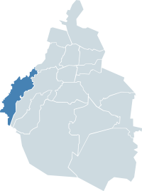
Country Mexico Federal entity D.F. Established 1928 Named for Pre-Columbian city Seat San Pedro Cuajimalpa Government - Jefe delegacional Carlos Orvañanos (PAN) Area[1] - Delegación 80.95 km2 (31.3 sq mi) - Urban 16.22 km2 (6.3 sq mi) Elevation[1] 2,623 m (8,606 ft) Highest elevation 3,800 m (12,467 ft) Lowest elevation 2,420 m (7,940 ft) Population [2] - Delegación 186,391 - Density 2,302.5/km2 (5,963.6/sq mi) Time zone Central Standard Time (UTC-6) - Summer (DST) Central Daylight Time (UTC-5) Postal codes 05000 – 05780 Area code(s) 55 Website http://www.cuajimalpa.df.gob.mx Cuajimalpa de Morelos (more commonly known simply as Cuajimalpa) is one of the 16 boroughs of Mexico City. Its name comes from the indigenous expression "over sticks of wood". At the 2010 census, it had a population of 186,391 inhabitants, the second-least populous of Mexico City's boroughs (after Milpa Alta).
The historic center of this borough was designated as a "Barrio Mágico" by the city in 2011.[3]
Contents
Etymology
Cuajimalpa's name comes from the Nahuatl word Cuauhximalpan that is composed of "cuauh"(itl) (tree, wood), with the transitive verb "xima", (carpentering, to work, or to polish), followed by a "I" formative and of the preposition "pan" (above, have more than enough, in). The first two elements form "cuauhximal-li" (small chip) that without the formulative suffix "li" (tli aphaeresis, lost the t to be eles between two) and with the posposition it comes to mean "on the wooden chips" and it designates a place where wooden chips are worked.
History
Early years
Although Cuajimalpa's history certainly extends to the pre-Columbian city of Tenochtitlan, still much is unknown about its history prior to the arrival of the Spanish.
Founded as a municipality on February 8, 1862, Cuajimalpa belonged to the Town of Santa Fe, separated from the neighboring towns of San Pedro Cuajimalpa, San Pablo Chimalpa, San Lorenzo Acopilco and San Mateo Tlaltenango, this San Pedro Cuajimalpa considered as head of the municipality due to its proximity to the El Camino Real route between the cities of Toluca and Mexico City.
San Pedro Cuajimalpa existed in the place that occupies its modern-day market, an old inn refuge of travelers, which during the Mexican War of Independence was used by Realistas ( Spaniard Viceroy army), during the dates that surround the battle of the Battle of Monte de las Cruces, and in the later retreat of the Insurgentes (Insurgentes) (It means a Civil Native Mexican and Spaniard Creole little army).
The house was destroyed in the 1970s and the site is today is a center of psychological support and the offices of civil protection.
In 1862, Cuajimalpa was made a municipality which today represents an important residential area of Greater Mexico City.
20th Century
During the 20th century, two railroad lines were built through Cuajimalpa, one leaving San Lázaro station in Mexico City which goes to Toluca, and the one between the manufacturing areas of Loreto and Peña Pobre, in San Angel, to take advantage of the wood in the area. The train was retired in 1953 after an accident at Arteaga y Salazar streets.
In 1898, the first water aqueduct system was introduced to San Pedro Cuajimalpa. Until 1916, the public illumination was by gas lamps. The nearby modern real estate development of Santa Fe is settled upon the site of several old mines. Ancient pottery and prehispanic statuettes have also been found in the red mud of the area.
In 1917, Desierto de los Leones National Park was created, within which is a convent erected by the order of the Barefoot Carmelite.
During the revolutionary period, the mountains and valleys of the delegation were the site of many fights between Zapatistas and Carrancistas. It is said that the Zapatistas amputated the ears of the males of the town, to be able to distinguish them from the Carrancistas.
During the government of Lázaro Cárdenas, Cuajimalpa experienced an expansion of the residential developments that already denominated the Delegacion with new construction that characterizes Cuajimalpa's appearance today. The growth was promoted by the president's family member Avila Camacho, which bought large plots of land in the areas near Herradura, Interlomas, Bosques de las Lomas, Lomas de Chapultepec and Lindavista.
In this period, Mexican personalities such as Emilio Azcárraga Milmo, Mario Moreno "Cantinflas", Pedro Infante, and several Presidents began to arrive to Cuajimalpa and specifically to the Contadero. Among them were the wife of Miguel de la Madrid, who occupied the Exhacienda Stands out the Doves, and the brother of Carlos Salinas, with his country residence "El Encanto", and several houses of José López Wicket, the celebrated "Colina del Perro".
Since the 1980s, large urban centers have been developed in Cuajimalpa, such as upscale Santa Fe and Parque de la Colina, which were built on lands used previously for mining and trash disposal.
In the 1970s, a series of industrial parks was developed in Santa Fe that included a Center of Social Readaptation (CERESO), built on a landfill that expels gases nightly, causing unpleasant scents. In Parque de la Colina, a golf course and private residential area were created.
Development in the area has been at the expense of the forests that have served as part of the ecology of the Valley of Mexico, and were one of the main sources feeding the aquifers of the Valley. The development of a unit of the Metropolitan Autonomous University has been impeded by the action of local residents and national environmentalists.
Geography & Climate
Cuajimalpa de Morelos is located in the southwest of the Federal District. It borders Miguel Hidalgo and Álvaro Obregón boroughs and the municipalities of Ocoyoacac, Huixquilucan and Xalatlaco in the state of Mexico. It has a median altitude of 2,760 meters above sea level (9,055 ft), and has an area of 8,095 hectares, of which 6,473 are wildlands and 1,622 hectares are urbanised, organised in 47 "colonias" (neighborhoods) and 4 towns, with a regional seat. In terms of percentages the territory of Cuajimalpa represents 5.1% of the Federal District area.
Cuajimalpa is an important provider of oxygen and filter of atmospheric pollutants, given its large forested zone. It receives the highest precipitation of the Federal District and has a system of ravines, gullies and superficial streams of water, that are important in the recharge of groundwater and the climate control.
Also, it bestows topographical characteristic favorable to the conservation of flora and fauna native to the Valley of Mexico.
Orography
The borough has two important elevations:
- Volcan La Palma, 3,800 meters above sea level (12,467 ft, its highest point).
- Cerro San Miguel 3,780 meters above sea level (12,401 ft)
Other important altitude facts are:
- 2,760 meters above sea level at the borough's city hall. (9,055 ft)
- 2,460 meters above sea level at its lowest part. (8,070 ft)
Hidrography
The borough belongs to the basin of Rio Moctezuma and the sub-basin of Lago Texcoco-Zumpango.The main streams are: Rio Santo Desierto, Arroyo Agua de Leones, Río Borracho, Arroyo Agua Azul and Río Atitla
Climate
Cuajimalpa Climate chart (explanation) J F M A M J J A S O N D 11185719512217282288622922520927718826619821218879187111866185Average max. and min. temperatures in °C Precipitation totals in mm Source: [1] Imperial conversion J F M A M J J A S O N D 0.464410.366410.570451.172463.472488.968481164461066468.364463.164450.464430.26441Average max. and min. temperatures in °F Precipitation totals in inches The climate is primarily semi cold with a high degree of humidity. The yearly median temperature ranges mostly between 10 °C to 12 °C (50°F to 54°F). Total rainfall averages between 1,200 to 1,500 mm (47 to 59 in). The following chart illustrates the rhythm of the weather year-through for Cuajimalpa according to the National Weather Service of Mexico (Servicio Meteorológico Nacional)
Government
Mayors, without trustworthy data
- 1861 - ????: Ángel Gonzalez
- ???? - ????: Juan de Mata González
- ???? - 1883: Lucio Cortés
- 1903 - ????: Enrique Rivera, as Prefect
- 1883 - 1910: Pedro Segura
Revolutionary Prefectures
- 1910 - 1912: Rómulo Luna
- 1912 - 1913: José María Leyva, appointed by Francisco I. Madero
- 1913 - 1914: Marcelino Nava, appointed by Victoriano Huerta
- 1914 - 1915: Pedro Muciño, elected
- 1915 - 1919: Maurilio Sánchez, appointed by Venustiano Carranza
- 1920 - 1920: Margarito Vázquez, elected
- 1921 - 1923: Enrique Segura, elected
- 1923 - 1925: Jacinto Ortiz, elected
- 1925 - 1929: Teófilo Sánchez, elected
Delegates appointed by the President
- 1929: Fermín López Urbina
- 1929 - 1935: José E. Ancona
- 1935 - 1942: Erasmo Reséndiz Sánchez
- 1942 - 1947: Eulalio Cabañas
- 1947 - 1964: J. Ascensión Almaraz Espinoza, AKA "Don Chon Almaraz"
- 1964 - 1970: Mario Ruíz M.
- 1970 - 1976: Ramón Osorio
- 1976 - 1980: Margarita García F.
- 1980 - 1982: Máximo Evia
- 1982 - 1988: María Inés Solís G.
- 1988 - 1993: Margarita Peimber Sierra
- 1993 - 1994: Jaime del Río
- 1994 - 1997:
- 1997 - 2000: Yenny Saltiel Cohen
Mayors chosen by direct vote
They are known as Borough Chiefs (Spanish: Jefes Delegacionales)
- 2000 - 2003: Francisco de Souza
- 2003 - 2006: Ignacio Ruíz López
- 2006 - 2009: Remedios Ledesma García
- 2009 - 2012: Carlos Orvañanos Rea
See also
- Mexico D.F.
References
- ^ a b "Situación Geográfica" (in Spanish). http://www.cuajimalpa.df.gob.mx/geografia/situacion.html. Retrieved 2008-09-18.
- ^ 2010 census tables: INEGI
- ^ Quintanar Hinojosa, Beatriz, ed (November 2011). "Mexico Desconocido Guia Especial:Barrios Mágicos [Mexico Desconocido Special Guide:Magical Neighborhoods]" (in Spanish). Mexico Desconocido (Mexico City: Impresiones Aereas SA de CV): 5–6. ISSN 1870-9400.
External links
- (Spanish) Delegación Cuajimalpa Official site
Boroughs (Delegaciones) of the Mexican Federal District Álvaro Obregón · Azcapotzalco · Benito Juárez · Coyoacán · Cuajimalpa de Morelos · Cuauhtémoc · Gustavo A. Madero · Iztacalco · Iztapalapa · Magdalena Contreras · Miguel Hidalgo · Milpa Alta · Tláhuac · Tlalpan · Venustiano Carranza · Xochimilco
Coordinates: 19°22′28″N 99°17′05″W / 19.37444°N 99.28472°W
Categories:

Wikimedia Foundation. 2010.