Sandycove and Glasthule railway station
- Sandycove and Glasthule railway station
-
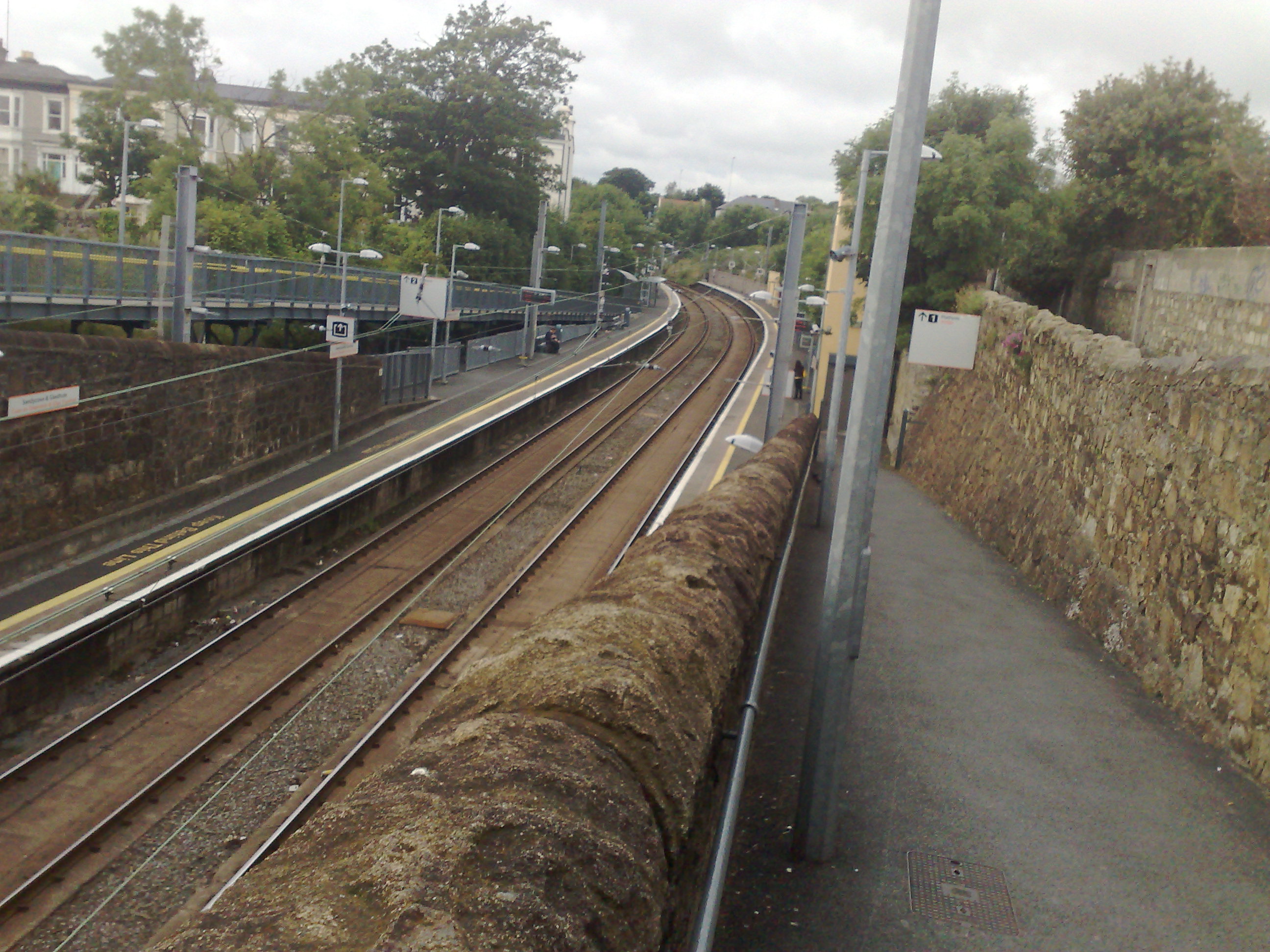
Sandycove and Glasthule railway station (Irish: Stáisiún Chuas an Ghainimh agus Glas Tuathail) serves the suburban areas of Sandycove (on the coast) and Glasthule (just inland) south of Dun Laoghaire in County Dublin, Ireland. The building is on a bridge as the rail line is in a cutting. Because of the station's altitude at sea level and the subsequent moisture of the earth, the track at and surrounding this station is laid on solid concrete rather than wooden sleepers.
The station opened on 11 October 1855.[1]

The platforms at Sandycove and Glasthule railway station.
External links
References
Coordinates: 53°17′15″N 6°7′39″W / 53.2875°N 6.1275°W / 53.2875; -6.1275
Categories:
- Iarnród Éireann stations in County Dublin
- Railway stations opened in 1855
Wikimedia Foundation.
2010.
Look at other dictionaries:
Sandycove — Infobox Irish Place name = Sandycove gaeilge = Cuas an Ghainimh | crest motto = map pin coords = left: 78px; top: 100px north coord = 53.286 west coord = 6.116 irish grid = area = elevation = province = Leinster county = Dún Laoghaire Rathdown… … Wikipedia
Glasthule — Infobox Irish Place name = Glasthule gaeilge = Glas Tuathail crest motto = map pin coords = left: 78px; top: 110px north coord = 53.2871 west coord = 6.1235 irish grid = area = elevation = province = Leinster county = Dún Laoghaire Rathdown town… … Wikipedia
Dublin Pearse railway station — Coordinates: 53°20′36″N 6°14′54″W / 53.3433°N 6.2483°W / 53.3433; 6.2483 … Wikipedia
Dún Laoghaire railway station — Coordinates: 53°17′41″N 6°8′4″W / 53.29472°N 6.13444°W / 53.29472; 6.13444 … Wikipedia
Dublin–Rosslare railway line — Dublin to Rosslare line Rock protection from flooding at Kilcoole Overview Type Commuter rail, InterCity, Regional rail … Wikipedia
Padraic Colum — Photographed by Carl Van Vechten, 1959. Born Patrick Collumb December 8, 1881(1881 12 08) Columbkille, County Longford … Wikipedia
Dún Laoghaire — This article is about the town of Dún Laoghaire. For the parliamentary constituency, see Dún Laoghaire (Dáil Éireann constituency). For the song D.U.N L.A.O.G.H.A.I.R.E, see Like Clockwork. Dún Laoghaire Town … Wikipedia
Dublin Area Rapid Transit — DART Info Transit type Rapid transit, Heavy Rail Number of lines 1 … Wikipedia
Transport in Dublin — Dublin Region Railway Network DART and Commuter lines in red Luas lines in blue (extensions under construction are in light blue) Legend … Wikipedia
Dublin Suburban Rail — Map of the intended Greater Dublin Rail Network showing Suburban Rail, Luas and proposed extension with planned Metro and Commuter lines. The Dublin Suburban Rail (Irish: Iarnród Bruachbhailteach Baile Átha Cliath) network, (now branded… … Wikipedia

 Iarnród Éireann