- Drohiczyn
-
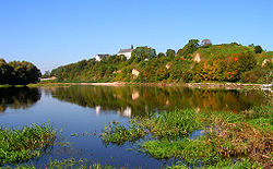
Drohiczyn Castle hill in Drohiczyn 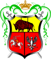
Coat of armsCoordinates: 52°24′N 22°39′E / 52.4°N 22.65°E Country  Poland
Voivodeship Podlaskie County Siemiatycze Gmina Drohiczyn Area – Total 15.68 km2 (6.1 sq mi) Population (2006) – Total 2,086 – Density 133/km2 (344.6/sq mi) Postal code 17-312 Website http://www.drohiczyn.pl Drohiczyn ([drɔˈxit͡ʂɨn]; Ukrainian: Дорогочин, Dorohochyn) is a small historic town in Siemiatycze County, Podlaskie Voivodeship, Poland. The town with population 2,110 is situated on a bank of the Bug River.
History
A Neolithic settlement, La Tène culture crematoria, and ancient graves have been uncovered at Drohiczyn.
Drohiczyn lay astride a trade route between Ukraine and Poland, and in the 13th century was a part of Berestia Land of the principality of the Kingdom of Galicia–Volhynia. It was annexed by Mazovia in 1238. In 1253, prince Daniel of Halych was crowned by a papal archbishop in Drohiczyn as the first King of all Rus' (Latin: Rex Rusiae).
From 1443 it was a Lithuanian domain. After the 1569 Union of Lublin it was ceded to Poland.
City rights were granted to Drohiczyn by Alexander Jagiellon in 1498. From 1520 to 1795 it served as the capital of Podlaskie Voivodeship. In 1795 annexed by Prussia. From 1807 to 1916 the town was part of the Russian Empire. In 1916 occupied by the Germans. In 1918 Drohiczyn returned to the Second Polish Republic.
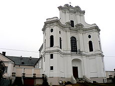
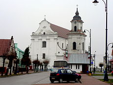
In 1939-1940, when Poland was occupied by Nazi Germany and the Soviet Union, Drohiczyn became a border town between both countries. The Soviets plundered the town, destroyed the rich interior of both Roman Catholic and Orthodox churches and deported a number of the town inhabitants to Siberia. In spring of 1940, Soviet authorities ordered the destruction of all buildings within 800 meters from the river Bug.
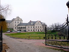
In 1991, the city was made the seat of the Roman Catholic Diocese of Drohiczyn as part of the newly created Roman Catholic Archdiocese of Białystok.
References
- Encyclopedia of Ukraine (online)
- http://www.drohiczyn.opoka.org.pl/1/1.htm (Polish)
- http://www.jewishgen.org/yizkor/Drohiczyn/Drohiczyn.html
- http://kacper854.cba.pl/index_pliki/Page577.htm photos from Drohiczyn
Coordinates: 52°24′N 22°39′E / 52.4°N 22.65°E
Gmina Drohiczyn Town and seat Drohiczyn
Villages Arbasy Duże • Arbasy Małe • Bryki • Bujaki • Bużyski • Chechłowo • Chrołowice • Chutkowice • Klepacze • Kłyzówka • Koczery • Lisowo • Lisowo-Janówek • Łopusze • Milewo • Miłkowice-Janki • Miłkowice-Maćki • Miłkowice-Paszki • Miłkowice-Stawki • Minczewo • Narojki • Obniże • Ostrożany • Przesieka • Putkowice Nagórne • Rotki • Runice • Sady • Siekierki • Sieniewice • Skierwiny • Śledzianów • Smarklice • Smorczewo • Sytki • Tonkiele • Wierzchuca Nadbużna • Wierzchuca Nagórna • Wólka Zamkowa • ZajęcznikiCategories:- Cities and towns in Podlaskie Voivodeship
- Siemiatycze County
- Podlasie geography stubs
Wikimedia Foundation. 2010.

